Historic Rains Continue Across Eastern Oklahoma; Temps Drop
<p>Widespread and historic December rains continued Sunday and flooding is becoming dangerous across much of Green Country. Another round of wet and cold weather is expected on Monday, the WARN Team says.</p>Sunday, December 27th 2015, 8:56 am


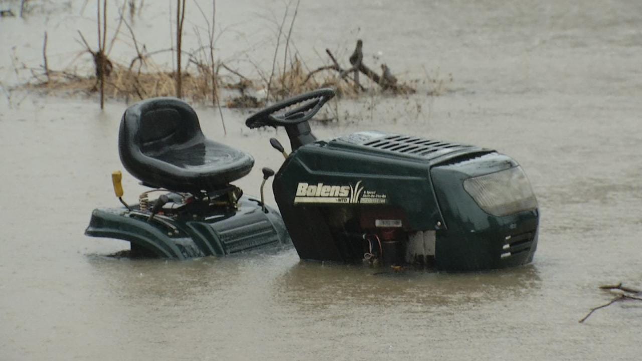
Widespread and historic December rains continued Sunday and flooding is becoming dangerous across much of Green Country. Another round of wet and cold weather is expected on Monday, the WARN Team says.
There have been multiple water rescues throughout the area, and as the day went on, many roads were difficult to navigate due to the excessive water.
The Pittsburg County sheriff told News On 6 this morning that the search and rescue mission for a 35-year-old man has turned into a recovery effort. The man was in a vehicle and abandoned it, but returned to it and was swept away by floodwaters, the sheriff said.
River flooding still is of high concern as area rivers rise have been rising rapidly over the next 24 hours. Creeks, streams and low-water crossings across the area will be susceptible to the dangers of flooding, especially south and east of Tulsa, according to the National Weather Service.
A flood warning remains in effect for most of eastern Oklahoma through Monday.
The WARN Team is urging drivers not to take the conditions lightly, because flooding will continue to be dangerous. If you come into water across the roadway, turn around, don’t drown.
12/27/2015 Related Story: Winter, Severe Weather Causes Flooding And Road Closures In OK
Temperatures remained in the 30s all day across most of Green Country, with the wind chill making it seem even colder. Temps could dip near 32 degrees in parts of Osage and Pawnee Counties and back into Ponca City as well, so some freezing rain and slick spots could develop in those areas overnight Sunday into Monday.
On Monday, expect a break in the rain in the early morning hours, but another round will be right behind it, meteorologist Stacia Knight says. The freezing line, however, has moved further east, closer to the Tulsa-metro area, she says.
A wintery mix and even snowflakes are possible in the northern portion of our viewing area by noon-early afternoon.
Weather Alerts
WARN Interactive Radar
The National Weather Service has issued a blizzard warning is in effect in the far western counties of the state, and an ice storm warning for counties along Interstate 35, which could creep into the far eastern parts of our viewing area.
To find out about road conditions across the state, check ODOT's real-time interactive map by clicking here or call 877-403-7623.
If you are traveling across the region and need information on road conditions in neighboring states:
Arkansas 800-245-1672 www.idrivearkansas.com
Colorado 303-639-1111 www.cotrip.org
Kansas 866-511-5368 511.ksdot.org
Missouri 888-275-6636 www.modot.org
New Mexico 800-432-4269 www.nmroads.com
Texas 800-452-9292 www.drivetexas.org

Get The Daily Update!
Be among the first to get breaking news, weather, and general news updates from News on 6 delivered right to your inbox!
More Like This

December 27th, 2015

April 15th, 2024

April 12th, 2024

March 14th, 2024
Top Headlines

April 18th, 2024

April 18th, 2024

April 18th, 2024

