One More Cold Day Oklahoma, Before Major Warm-Up
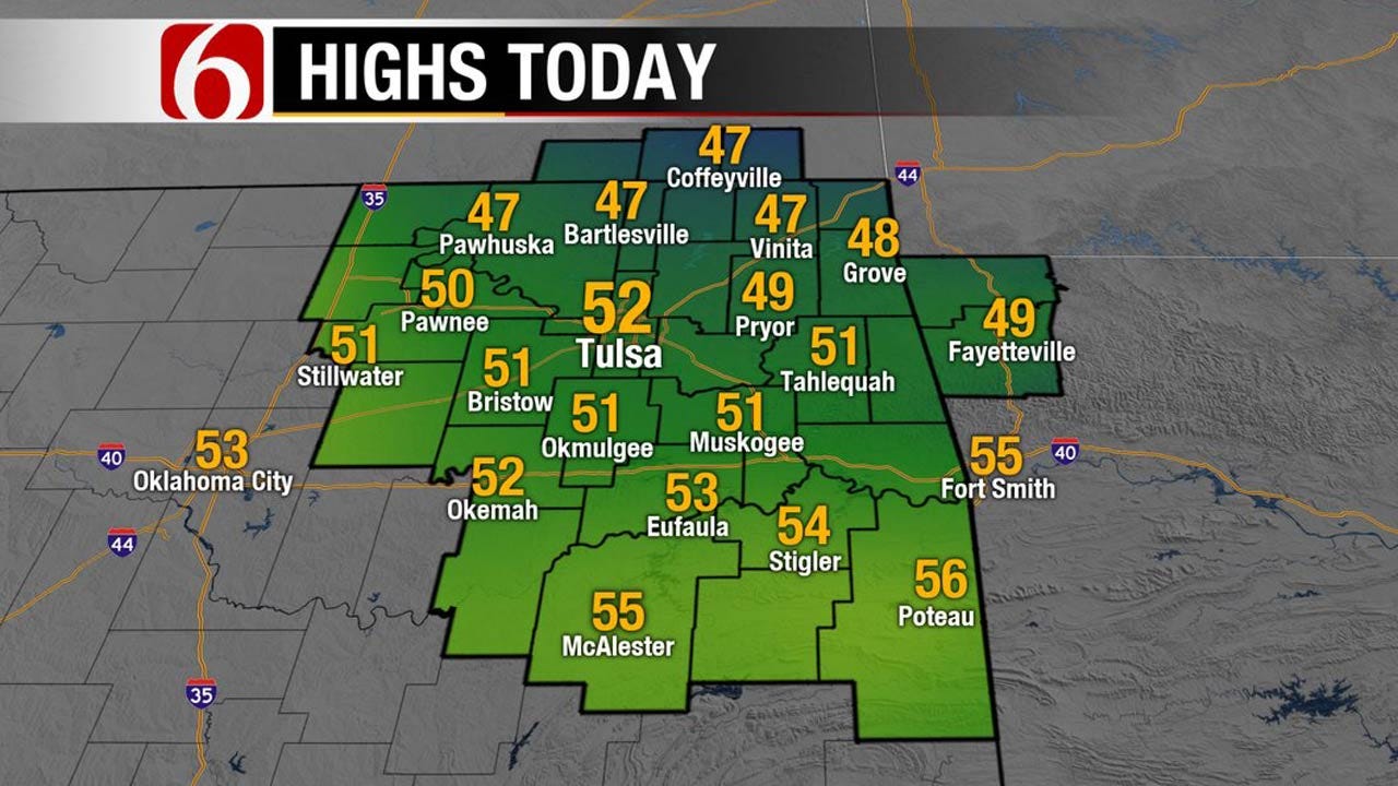
<p>A very cold start is underway across northern OK this morning with some locations in the upper teens to lower 20's, including the Tulsa metro in the mid-20's. Highs today will stay in the upper 40's and lower 50's before the major warm-up occurs Friday into Saturday. </p>Thursday, February 9th 2017, 4:04 am


A very cold start is underway across northern OK this morning with some locations in the upper teens to lower 20's, including the Tulsa metro in the mid-20's. Highs today will stay in the upper 40's and lower 50's before the major warm-up occurs Friday into Saturday. The fire danger will increase to critically high levels early this weekend before a front arrives with a low chance for some showers.
Our main forecast scenario hasn’t changed much over the past few days, at least concerning the short term into the weekend. This means a major warm-up is likely to occur Friday into Saturday with strong thermal advection from the southwestern U.S. into the state. Temps around the 5,000 ft level are anticipated to be extremely high for February and will result in many locations shattering record highs across Oklahoma and Texas. While our highs Friday will be in the lower to mid-70s and Saturday into the lower to mid-80's, our friends and neighbors across Texas will see highs in the 90's.
Stay Connected With The News On 6
By Sunday, most data support another weak front sliding into the state Sunday morning to midday. The latest and greatest data is supporting a slightly higher QPF signal but I’m continuing to remain hesitant regarding this signal for the metro. The higher chances will occur across southern OK into north TX, but we’ll keep a mention for the metro Sunday morning to afternoon. This would be post-frontal.
Next week: This is where the data continue to diverge with different signals regarding the evolution and direction of a strong upper level storm system. EURO data (the last run) has now taken the main upper level system directly across Oklahoma Monday night into Tuesday while the GFS has now shifted to the south across Texas. A few days back these solutions where opposite regarding the model support. The Canadian also has the main support south. Our current forecast has low chances for precip Monday into Tuesday, and I’m leaning toward keeping this configuration in place, at least for another day, before making any big changes. In summary, our pops will remain Sunday into Tuesday, but will keep them on a very low and conservative track for now.
Thanks for reading the Thursday morning weather discussion and blog.
Have a super great day!
Alan Crone

Get The Daily Update!
Be among the first to get breaking news, weather, and general news updates from News on 6 delivered right to your inbox!
More Like This
February 9th, 2017

April 15th, 2024

April 12th, 2024

March 14th, 2024
Top Headlines

April 19th, 2024

April 19th, 2024

April 19th, 2024

April 19th, 2024
