New Satellite Mapping System Aids Firefighters During Wildfires
<p>The fire-mapping system so far has proven to be most helpful in rural areas where wildfires popped up recently.</p>Tuesday, February 14th 2017, 6:59 pm

Climate scientists credit a new satellite mapping system with helping firefighters battle wildfires, and they say the new system helps better connect fire agencies across the state.
A lot of the fire-spotting happens at the National Weather Service.
The fire-mapping system has proven to be most helpful in rural areas where wildfires popped up recently.
Oklahoma wildfires can consume hundreds of acres in minutes. Firefighters have gotten used to it, but it doesn't make their jobs easier.
The National Weather Service's satellite fire mapping system does help.
"It looks like we may have stopped maybe two or three of them in the last year so that folks are really sure they would have become one of the really big news stories that would have really burned a lot of areas and got into a lot of homes," said Steve Piltz, Chief Meteorologist with the National Weather Service.
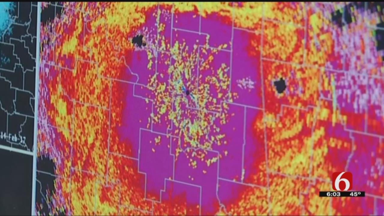
It's called the Watch Officer Map.
It uses satellites and radars to pinpoint if an area is getting hotter due to fire or smoke, and then local emergency managers are alerted.
"There are times we get detect fires using satellite and radar data before they get reports of it," Piltz said.
In dry weather, his team monitors wildfires just like they would severe weather.
When wildfires broke out Sunday in southeast Oklahoma and Okmulgee County, threatening homes...Piltz said things could have been worse if not for this system.
"Had we not made the initial call, they would have been behind just a few minutes and maybe those few minutes would have made a difference," Piltz said.
The system came about a year ago, during a big fire day.
So many different groups trying to communicate through different systems became a problem.
Now, the information is easily shared with emergency operations, state forestry and local fire departments.
"That's been the great part of this. It puts us all on the same page," Piltz said.
The next plan for the mapping system is to better coordinate with the helicopters that drop water on wildfires.

Get The Daily Update!
Be among the first to get breaking news, weather, and general news updates from News on 6 delivered right to your inbox!
More Like This

February 14th, 2017

April 15th, 2024

April 12th, 2024

March 14th, 2024
Top Headlines


April 24th, 2024

April 24th, 2024

