More Storms Likely In NE Oklahoma Into The Weekend
<p>We’re in the middle of our current severe weather pattern that will bring another round (or two) of thunderstorm activity across the area today and tonight before exiting the region early Saturday morning to midday. </p>Friday, May 19th 2017, 4:11 am


We’re in the middle of our current severe weather pattern that will bring another round ( or two) of thunderstorm activity across the area today and tonight before exiting the region early Saturday morning to midday.
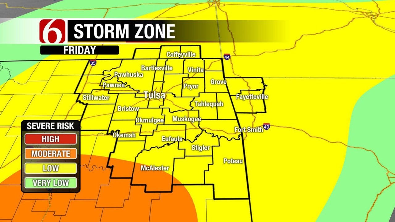
Highs today will be in the upper 70s to lower 80s along with a high likelihood of thunderstorms. Some of the storms may be strong to severe with all modes of severe weather possible but our main threats will be damaging winds and some hail. Additionally, heavy rainfall may result in some localized flooding issues and a flood watch is posted for part of the area through Saturday morning.
Heavy rainfall may also bring some streams, creeks and rivers back to flood early this weekend.
The first upper-level disturbance that pivoted around the base of the main trough to our west cranked out the severe storms yesterday afternoon and evening with numerous tornado and large hail reports. The main trough remains west of the area this morning but will be ejecting away from the area later tonight into Saturday morning while bringing a surface front across the region today and tonight.
The exact timeline for storm activity is complicated by the early morning storms located near northern OK. But we think these storms will gradually weaken this morning. Additional scattered storms may develop around 1 pm to 3 pm today across central OK and spread northeast. Later tonight the front will begin moving southeast and storms will become more linear (squall line) or possibly developing into at least one or two small storm complexes as they move southeast. As this phase happens, the main threats will transition to damaging winds, hail and extremely heavy rainfall threats.
This line should clear the metro around 11p to midnight and clear far southeastern OK around 2 am to 3 am. The data yesterday supported the front accelerating southeast by Saturday morning quickly taking the pops out of the area by mid-morning.
While some data is slightly slower this morning, I still think after an hour or two Saturday morning this system will be pushing out of southeastern OK quickly. A surface ridge of high pressure will gradually develop behind the departing system allowing for improving weather Saturday night into Sunday with sunshine and pleasant conditions Sunday afternoon.
The next fast moving wave will drop across the state late Monday night into Tuesday with additional storm chances followed by a noticeable cool down with highs in the lower 70s and morning lows in the 50s for the middle to end of next week. The cool-down will be short-lived with a big warm-up (closer to 90) by the following weekend.
Thanks for reading the Thursday morning weather discussion and blog.
Have a super great day.
Alan Crone
KOTV

Get The Daily Update!
Be among the first to get breaking news, weather, and general news updates from News on 6 delivered right to your inbox!
More Like This

May 19th, 2017

April 15th, 2024

April 12th, 2024

March 14th, 2024
Top Headlines

April 24th, 2024

April 24th, 2024

April 24th, 2024

April 24th, 2024
