Rain Chances Return To Green Country
<p>Time to dig the umbrella out of the closet! Some much-needed rain chances are returning to Green Country this weekend.</p>Saturday, July 28th 2018, 8:55 am


Time to dig the umbrella out of the closet! Some much-needed rain chances are returning to Green Country this weekend.
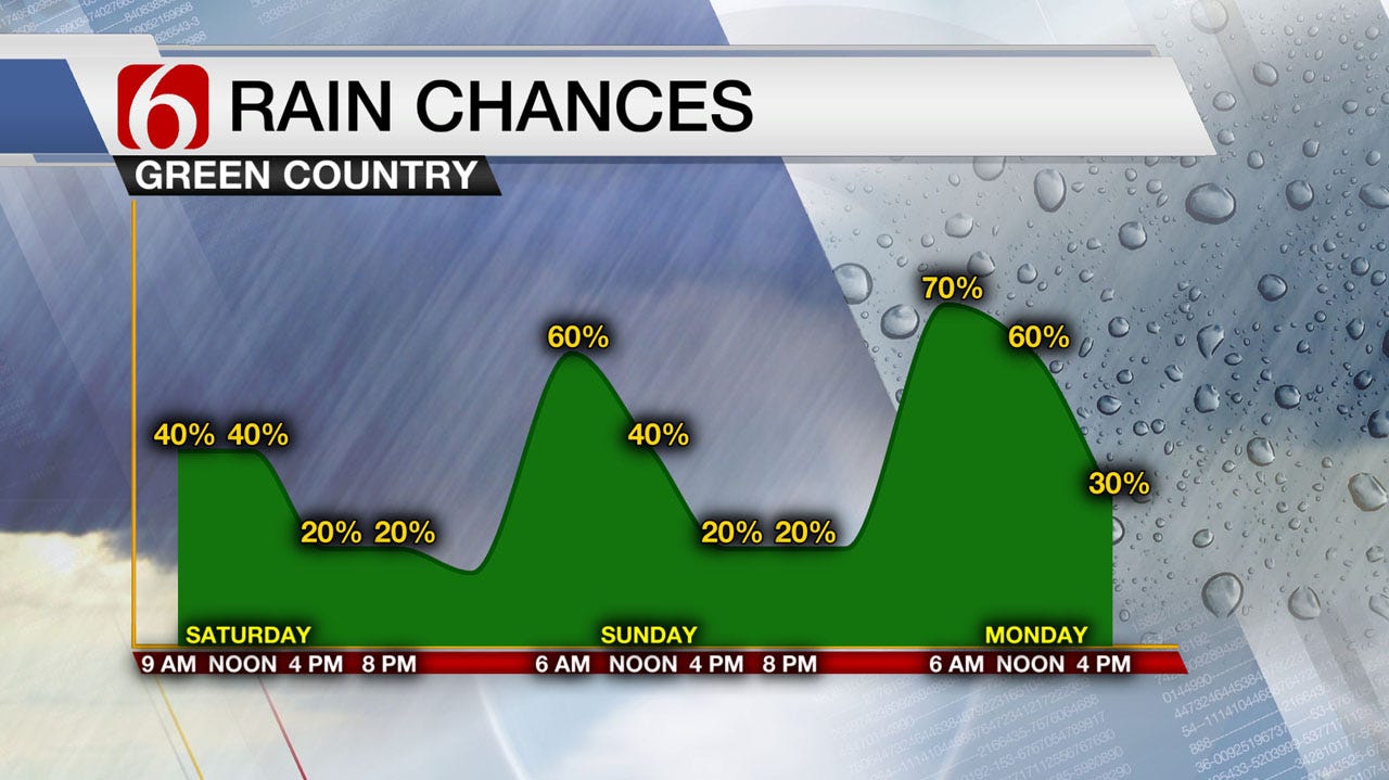
Areas of hit-or-miss showers and storms will be hanging around for the morning and early afternoon hours across eastern Oklahoma, with about a 40% chance for any one location to see a storm. Most activity will be relatively brief and some of us may miss out, but some heavy downpours and gusty winds will be possible, so be aware if you have outdoor plans!
Despite some early day rains, the afternoon still looks quite warm as partly sunny skies return later in the day. That should be enough to push highs into the lower 90s from Tulsa to the west, with cooler readings in the 80s if you’re east of Tulsa.
If you don’t pick up some rain today, don’t worry! More chances are on the way. A more organized complex of storms looks to roll into northeastern Oklahoma sometime early Sunday morning. This could bring with it a few strong to severe wind gusts, but also some beneficial rainfall that may be a bit more widespread than Saturday’s activity.
Much like Saturday, storms look to be a bit spottier Sunday afternoon, but lingering clouds and a few more hit-or-miss showers should keep our highs generally in the mid to upper 80s on Sunday! Talk about a nice break from the dog days of summer.
One more round of widespread showers and storms arrives on Monday as a cold front surges into Green Country. Some locally heavy rains are possible on Monday particularly from Tulsa to the south, and once again rain and clouds should keep our daytime temperatures well down into the 80s!
Rain chances clear out after Monday as drier air moves in behind that cold front. We’ll be in for some very refreshing mornings by Tuesday and Wednesday as lows dip into the lower 60s in many spots! Nice! Below normal temperatures look to continue through mid-week with highs in the 80s through Wednesday before we start to nudge back into the 90s by late next week.
Be sure to follow me on Twitter @StephenNehrenz as well as my Facebook page Meteorologist Stephen Nehrenz to stay up to date with the very latest!

Get The Daily Update!
Be among the first to get breaking news, weather, and general news updates from News on 6 delivered right to your inbox!
More Like This
July 28th, 2018

April 15th, 2024

April 12th, 2024

March 14th, 2024
Top Headlines


April 19th, 2024


