Rainy & Cold Friday Before Sunshine Returns
Rain gear and big coats this morning as rain will remain near the metro for the next few hours along with cold weather.Friday, January 17th 2020, 6:34 am
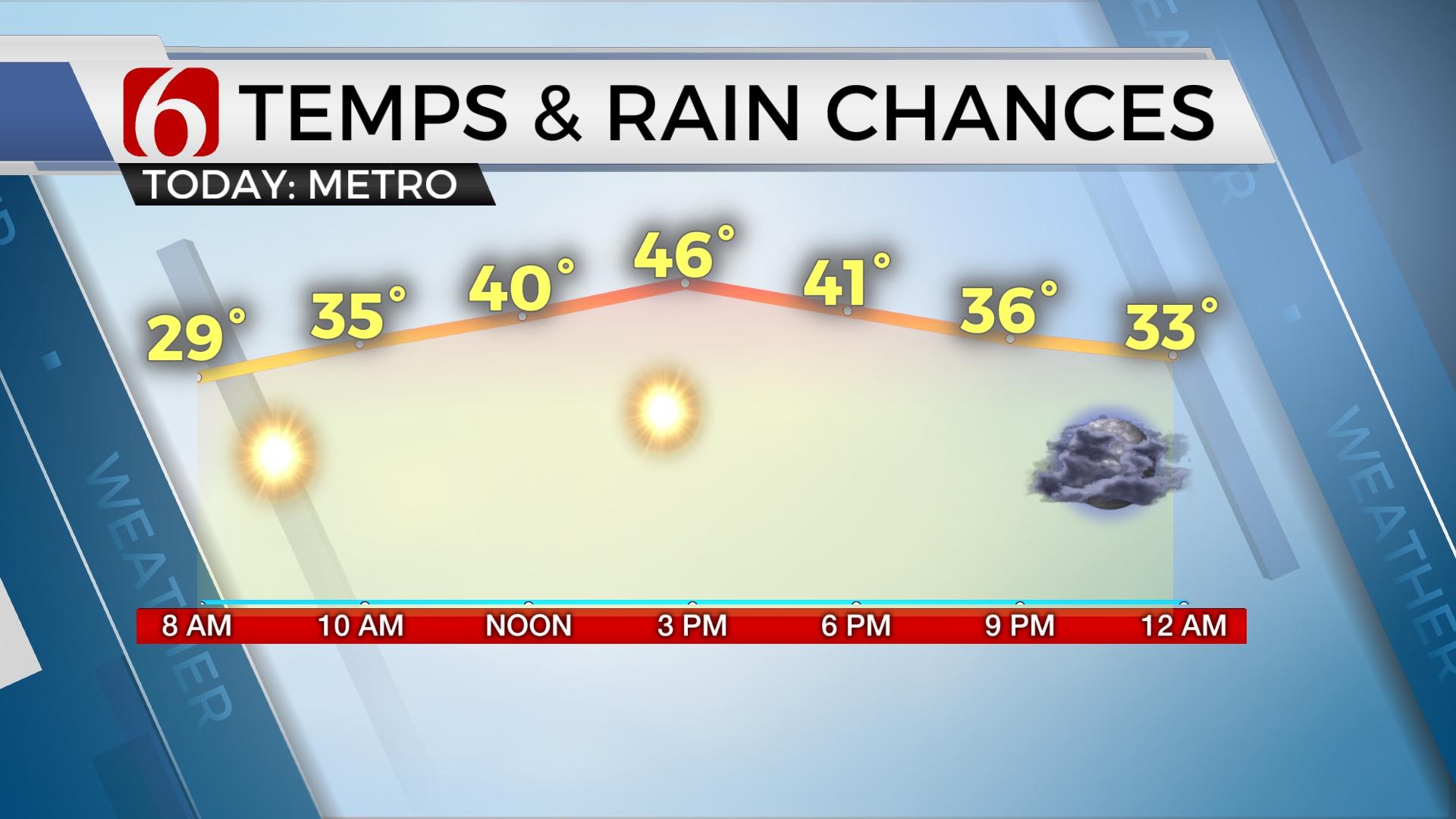
Rain gear and big coats this morning as rain will remain near the metro for the next few hours along with cold weather. We may see a small thinning of the rain around midday before the final round arrives this afternoon. Pockets of moderate downpours may also be possible along both sides of the I-44 region with a few sleet reports. Locations across central and eastern Kansas will continue with freezing rain and wintry weather threats. Northbound drivers should remain aware of this potential that remains into central and northern Kansas this morning. Our surface temperatures will remain above freezing this morning across northeastern OK.

We’re in the middle of wet and cold weather this morning across most of northeastern OK and southern Kansas. Generally raw and cold conditions will remain for the day until this system exits from the west to east later this afternoon into the evening. Far southeastern OK will be relatively dry for the next few hours before rain and some thunder will approach the area for the 2nd half of the day. Temperatures into the afternoon will reach the lower 40s across far northern OK and the upper 40s to the south.
A surface low will move across central Kansas later this evening with temperatures across NE OK climbing into the lower 50s near the metro right before midnight before falling as the low passes to our northeast and the associated cold front moves southeast. This will bring dry air into the region later tonight into the weekend. Saturday morning starts in the mid-30s with highs expected in the mid to upper 40s along with sunshine and strong northwest winds for the first half of the day before decreasing later Saturday evening. Another back-door front arrives Sunday with colder weather that will continue for the early part of next week along with dry conditions. It appears a quick moving shot of shallow arctic air arrives Sunday evening and will keep Monday's highs mostly in the 30s.

The pattern for the middle to the end of next week will be unsettled and the data is not conclusive regarding some important factors. Additional changes for the middle of the week will be likely. At this point, our next weather system will near Tuesday night into Wednesday with a slight a chance of showers before strong south winds return Wednesday into Thursday with our next surface low pressure area. This means increasing chances again for showers and storms Thursday followed by another cold snap next Friday with the low-end potential for some wrap-around wintry weather.
Thanks for reading the Friday morning weather discussion and blog.
Have a super great day!
Alan Crone
More Like This
January 17th, 2020
November 30th, 2022
November 1st, 2022
August 26th, 2022
Top Headlines
April 18th, 2024
April 18th, 2024


