Warm, Muggy Weather Continues Friday For Northeastern Oklahoma
Warm, Muggy Weather Continues Friday For Northeastern OklahomaFriday, June 5th 2020, 6:34 am
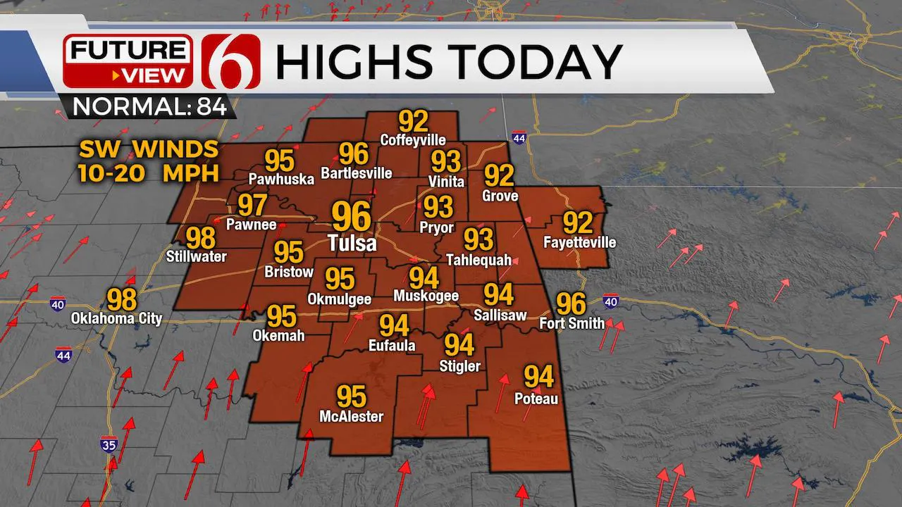
Good morning. We’re looking at a very low chance for a few storms this morning across extreme NE OK and NW Arkansas, but the chance is higher across southwestern Missouri. Most of our area will experience warm and muggy weather today and this weekend. Highs this afternoon are expected to also reach the mid-90s with heat index values nearing 100 to 105 or slightly higher. Our friends at the National Weather Service will issue a het advisory today for part of the area. Regardless, I’ll encourage you to keep hydrated through the day and take frequent breaks when working outdoors. The mid-level ridge of high pressure is still west of the area this morning but is expanding eastward and should encompass most of the area by this afternoon and evening. This means any activity (storm chances) should remain to the north or east of the ridge later tonight or Saturday morning. We’ll keep our forecast dry for most of the area, but storms are likely to brush western Arkansas later this afternoon and evening. A few of the hi-res models will bring outflows into far eastern OK later tonight into early Saturday morning. A few storms could develop along and behind these features, but most locations will remain dry.

Temps this weekend will not change much with morning lows in the mid-70s and highs in the lower to mid-90s. The local dew points may mix down slightly Sunday and take the heat index down a notch or two, but not much.
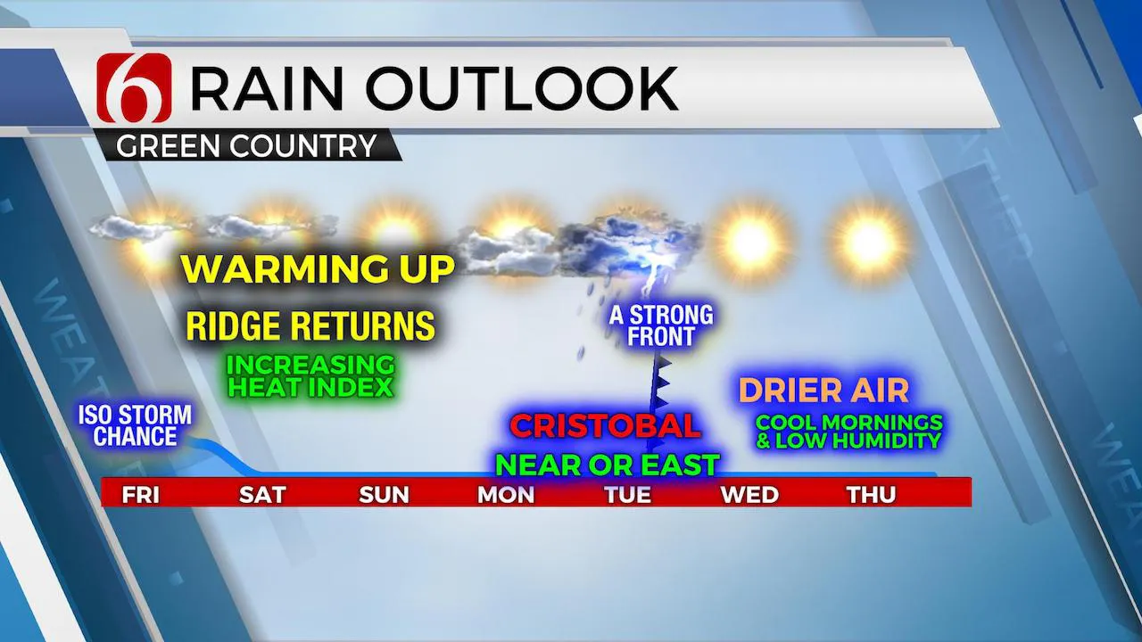
Next week, our attention will remain with TS Cristobal. It’s moved very little in the last days but should emerge into the Gulf later today and impact the southern U.S. Sunday night into Monday morning as a strong tropical storm or category one hurricane. Most data place this impact near southern Louisiana. The trajectory for inland keeps the remnant low slightly southeast of eastern OK Monday night and accelerating away into central Arkansas Tuesday morning. This will be close enough to keep some shower chances for southeastern to east-central OK Monday evening. Most of the active weather will remain near or east of the low-pressure area.

A strong front, by June standards, arrives Tuesday afternoon and will offer some storm chances before moving out the state Tuesday evening. This system is scheduled to bring much drier air into the state and should usher in pleasant morning lows Wednesday and Thursday with highs in the mid to upper 80s. The best part of this front will be the drier air that will erode the heat index for a few days next week.
Thanks for reading the Friday morning weather discussion and blog.
Have a super great day!
Alan Crone
More Like This
August 8th, 2023
July 4th, 2023
May 8th, 2023
Top Headlines
April 23rd, 2024
April 23rd, 2024
April 23rd, 2024


