Morning Storms Before The Weekend Heat Arrives
Morning Storms Before The Weekend Heat ArrivesFriday, August 7th 2020, 7:00 am
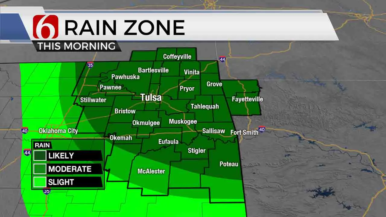
Storms will continue near the metro for the next few hours before exiting to our east as temps climb from the 70s into the lower 90s later today. Gusty winds are also likely to develop behind this system and heat index values will be more noticeable this afternoon before reaching even higher levels this weekend. After benefiting from unseasonably pleasant and cool weather earlier this week, we’re expecting a more normal August pattern this weekend into early next week.

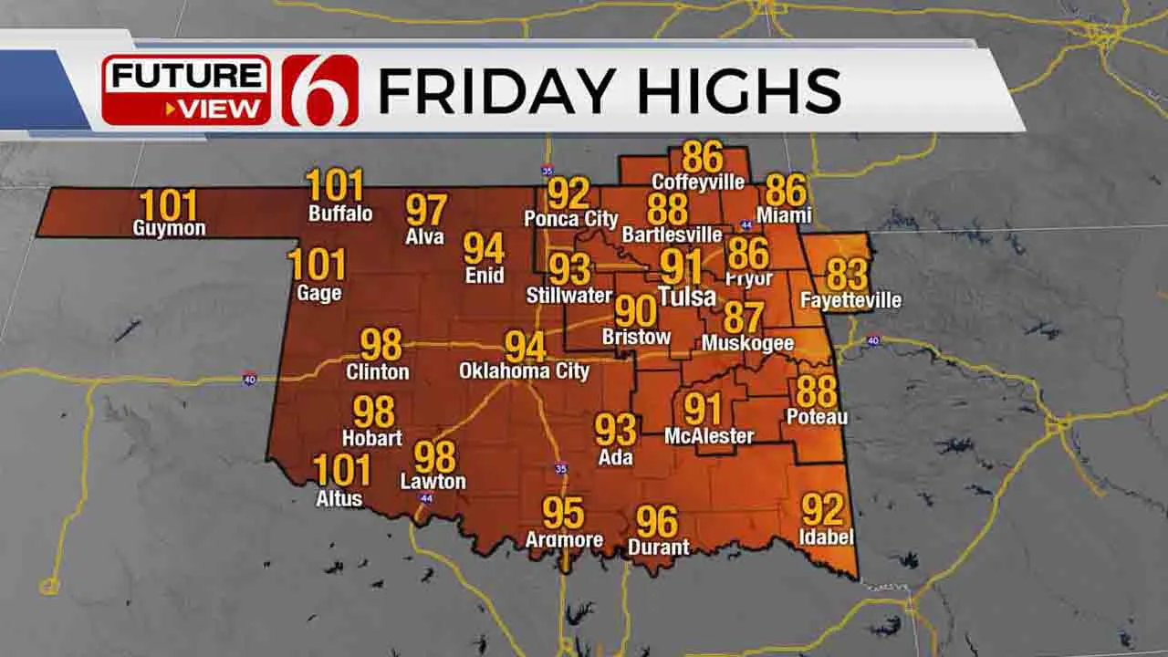
The last part of the system that brought heavy storms yesterday evening will be exiting the area this morning. Some heavy rainfall, gusty winds and some small hail will remain possible in a few locations during the morning hours. Later today, the ridge of high pressure will continue expanding eastward bringing summerlike conditions back into the state. Afternoon highs will reach the upper 80s east and lower 90s west of the metro today, and into the mid-90s today through the weekend with heat index values nearing 105 to 107 this weekend. Heat advisories are possible this weekend.

After this morning’s activity exits the area, gusty south winds should develop from 15 to near 30 mph by midday to afternoon. The pressure gradient will continue this weekend with southwest winds gusting from 15 to 30 mph along with mostly sunny conditions as the heat and humidity quickly build across most of eastern OK. A few isolated showers or storms may develop Saturday, but mostly along the far eastern OK and western Arkansas region. I’ll include low pops near Grand Lake tomorrow through midday.

Just as the mid-level ridge expands early next week, most data also support the ridge moving back to the west by Tuesday and Wednesday allowing another northwest flow pattern to persist through the end of next week. This would bring additional storm chances along with another minor reduction in daytime highs. We’ll intro some pops for Tuesday and Wednesday.
This morning some of the storms could be strong to heavy along with gusty winds before exiting. Severe threats are limited but not zero. Remain aware. Some additional changes or updates to the timing will remain possible this morning.
Thanks for reading the Friday morning weather discussion and blog.
Have a super great day!
Alan Crone
More Like This
August 7th, 2020
August 8th, 2023
July 4th, 2023
May 8th, 2023
Top Headlines
April 18th, 2024
April 18th, 2024
April 18th, 2024


