Windy Weather Remains
Cloudy Skies and cool temperatures are expected on Thursday.Thursday, April 7th 2022, 7:42 am
TULSA, Oklahoma -
Cloudy skies and cool temperatures are expected on Thursday.
Here are the details from News On 6 Meteorologist Alan Crone:

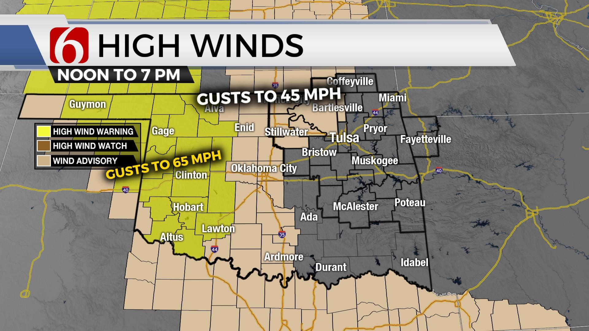
Once again strong northwest winds will remain the common denominator across most of the area through the day. A wind advisory will be underway for those locations northwest of I-44, and some additional counties may be added to the advisory later in the day Thursday. Afternoon humidity will remain quite low, but daytime highs will be slightly cooler than Wednesday. Fire danger remains very high. Slightly cooler weather Thursday afternoon will keep red flag warnings mostly to our west. Regardless, fire danger threats remain very high for the next several days.

A vigorous upper-level trough located across the Midwestern US will continue to influence our weather for the next 48 hours. As this system moves east this weekend a new developing trough across the western United States will begin to influence our weather.

Late Friday night and early Saturday morning, clouds should vacate the area with lighter winds through overnight and early morning. Dry air combined with a clear sky will foster temperatures dropping to near or even below freezing for a few hours Saturday morning. A frost or freeze warning is possible for early Saturday morning. By the afternoon, south winds at 10 to 20 mph with mostly sunny conditions will support highs in the lower 70s. By Sunday stronger south winds return at 20 to 35 mph as afternoon highs climb into the lower 80s. Late Sunday night, storm chances arrive too early Monday morning.

Early next week a powerful upper-level trough in the western US will send waves of energy around the base of the trough across the plains states. A surface area of low pressure, a dry line, and a cold front will influence Oklahoma for several days with thunderstorm chances. Based on the pattern, severe thunderstorm potential will be increasing during these periods. Early indications support this system exiting our area sometime Wednesday. As we draw closer to next week, will be able to offer more specific information regarding storm threats and timing.
Thanks for reading the Thursday morning weather discussion and blog.
Have a super great day!
Alan Crone
KOTV
If you’re into podcasts, check out my daily weather update below. Search for NewsOn6 and ‘Weather Out The Door’ on most podcast providers, including Spotify, Stitcher, Tune-In and down below on Apple.


Get The Daily Update!
Be among the first to get breaking news, weather, and general news updates from News on 6 delivered right to your inbox!
More Like This
April 7th, 2022

February 7th, 2024

October 21st, 2023

October 3rd, 2023
Top Headlines

April 24th, 2024

April 24th, 2024

April 24th, 2024

April 24th, 2024
