Cooler Day Before Additional Weekend Storm Chances
Some parts of the state could see early morning scattered showers and storms before some sunshine and pleasant temperatures arrive later in the afternoon.Thursday, June 2nd 2022, 6:32 am
TULSA, Oklahoma -
Some parts of the state could see early morning scattered showers and storms before some sunshine and pleasant temperatures arrive later in the afternoon.
Here are the details from News On 6 Meteorologist Alan Crone:

The surface front is positioned across far southern OK and continues moving south early Thursday morning. Scattered convection remains near both sides of this boundary, mostly across far southern OK. We'll expect mostly cloudy conditions Thursday morning before some afternoon sun later in the afternoon. The upper air pattern is slowly changing and will become more favorable for late night and early morning storm complexes to move near or into the area for the next several days, continuing through the first two weeks of June. We’ll see a few spotty showers early Friday morning nearby, but most of Friday should be good with highs in the upper 70s as south winds return by afternoon and evening.

Most data support a mostly west to east flow this weekend, but this will eventually tilt more from the northwest Sunday into early next week and beyond. This is a typical pattern for June allowing for storm systems or disturbances to move along the flow across the state. Just based on climo and the expected pattern, we'll continue with some rain and storm chances this weekend into several days next week. By Friday night into Saturday morning, the first wave arrives from the west with storm chances into Saturday morning before additional storms may develop Saturday evening. Some of these storms could be strong to severe.

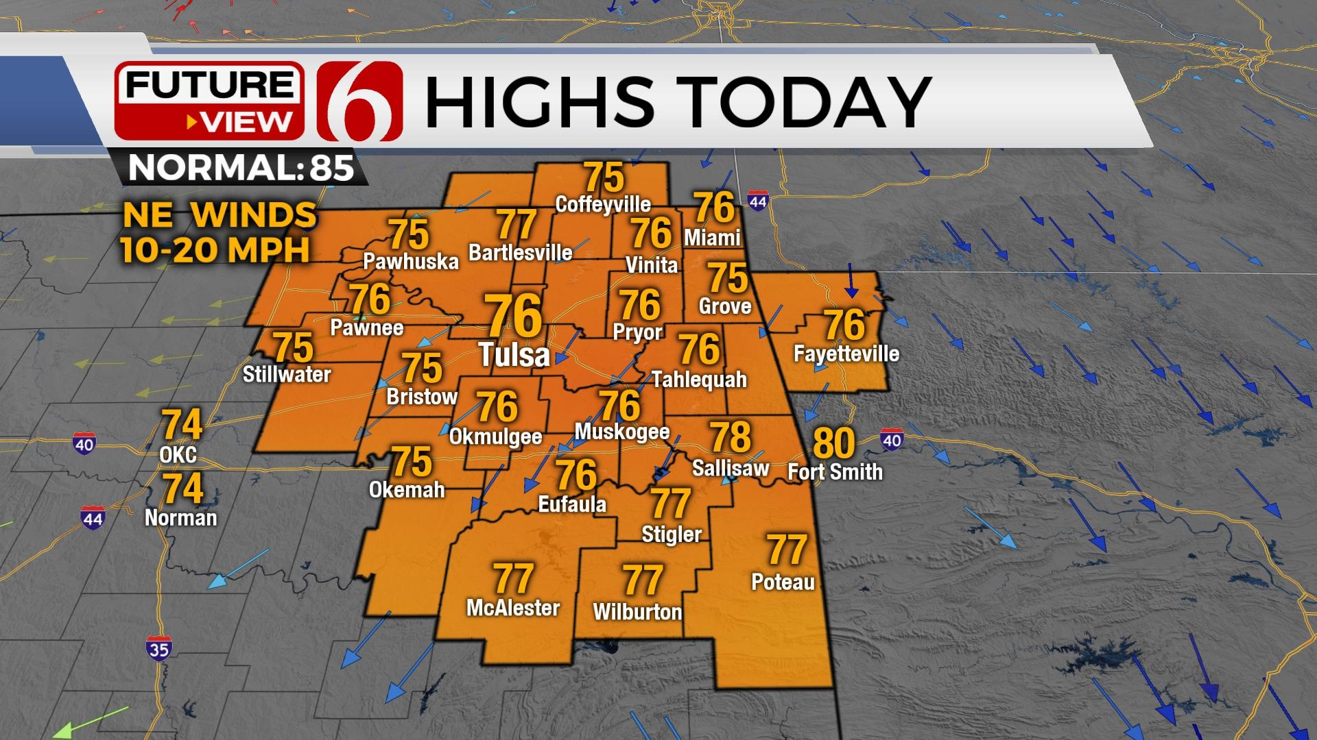
Temps on Thursday will remain cool with morning lows in the upper 50s and lower 60s. Afternoon highs will reach the mid-70s with northeast winds from 10 to 20 mph. Friday features a return to south winds by afternoon, with south winds increasing in speed this weekend as daytime highs reach the lower 80s Saturday and mid to upper 80s Sunday. Near normal temps along with muggy weather will be likely for most of next week.
Thanks for reading the Thursday morning weather discussion and blog.
Have a super great day!
Alan Crone
KOTV
If you’re into podcasts, check out my daily weather update. Search for NewsOn6 and ‘Weather Out The Door’ on most podcast providers, including Spotify, Stitcher and Tune-In, or Click Here to listen on Apple Podcasts.

Get The Daily Update!
Be among the first to get breaking news, weather, and general news updates from News on 6 delivered right to your inbox!
More Like This
June 2nd, 2022

February 7th, 2024

October 21st, 2023

October 3rd, 2023
Top Headlines

April 25th, 2024

April 25th, 2024

April 25th, 2024

April 25th, 2024
