Heat Advisories Before A Sunday Morning Cold Front
The hottest days of the season to date arrive Friday and Saturday as the midlevel ridge of high pressure brings temps into the upper 90s to near or even above 100.Friday, June 24th 2022, 6:00 am
TULSA, Oklahoma -
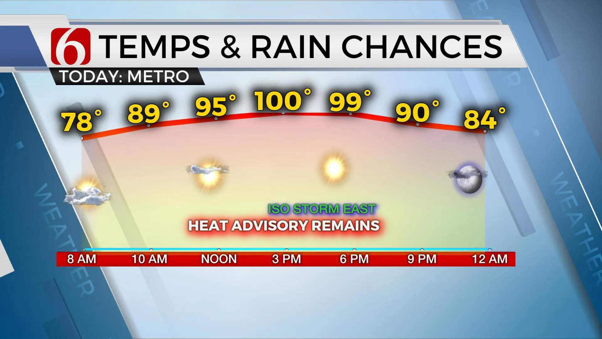
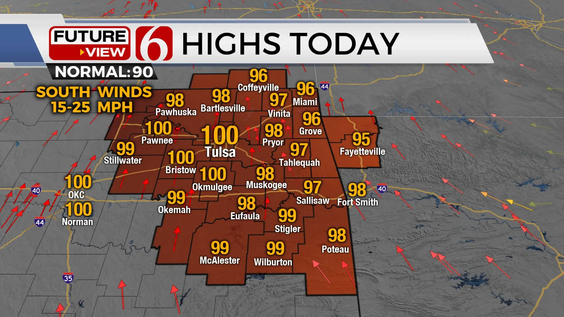
The hottest days of the season to date arrive Friday and Saturday as the midlevel ridge of high pressure brings temps into the upper 90s to near or even above 100.
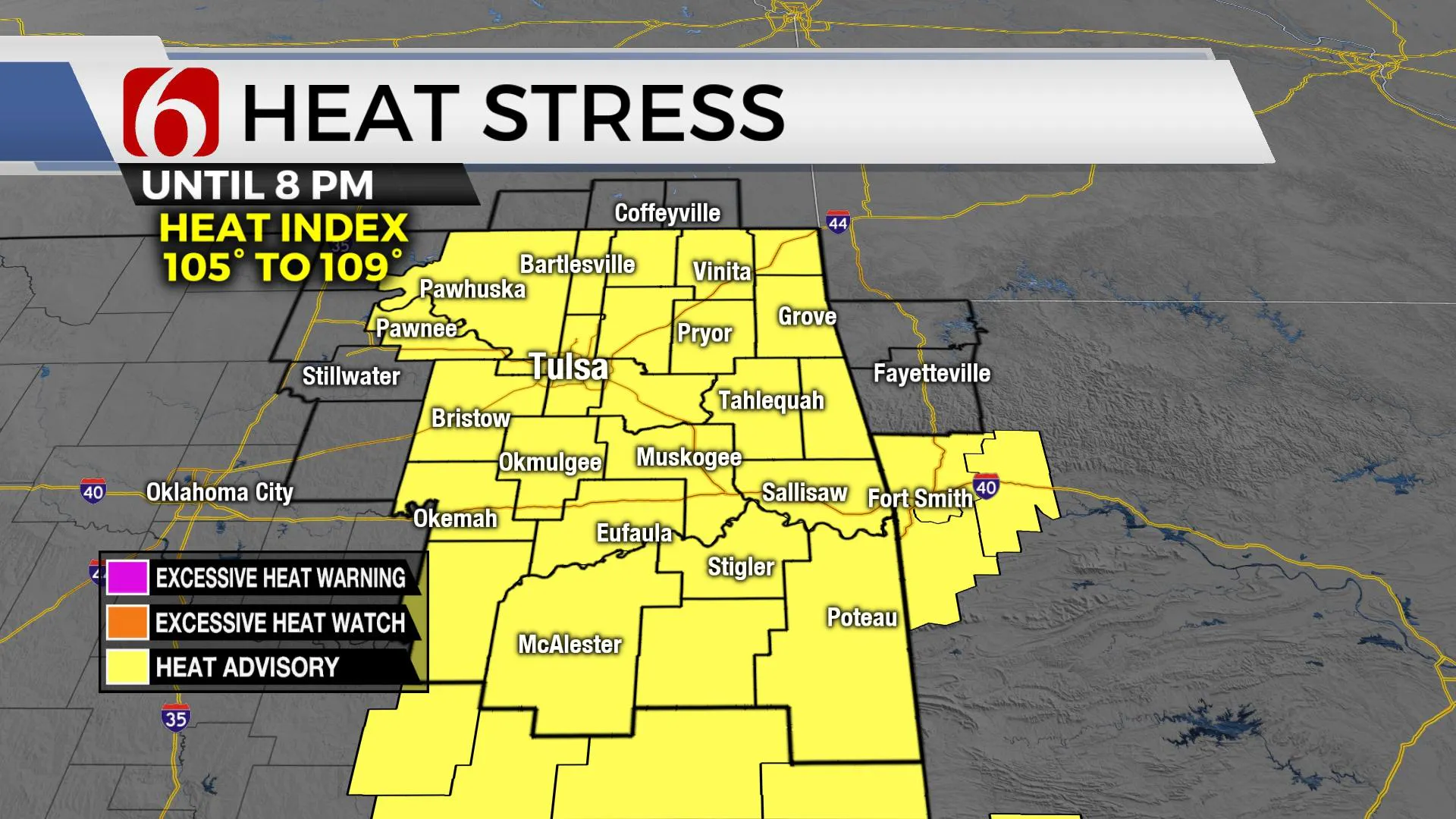
Pressure gradients will increase Friday and Saturday, allowing for increasing wind speeds. Regardless, afternoon heat index values are expected from 105 to 110 with heat advisories required for the area.
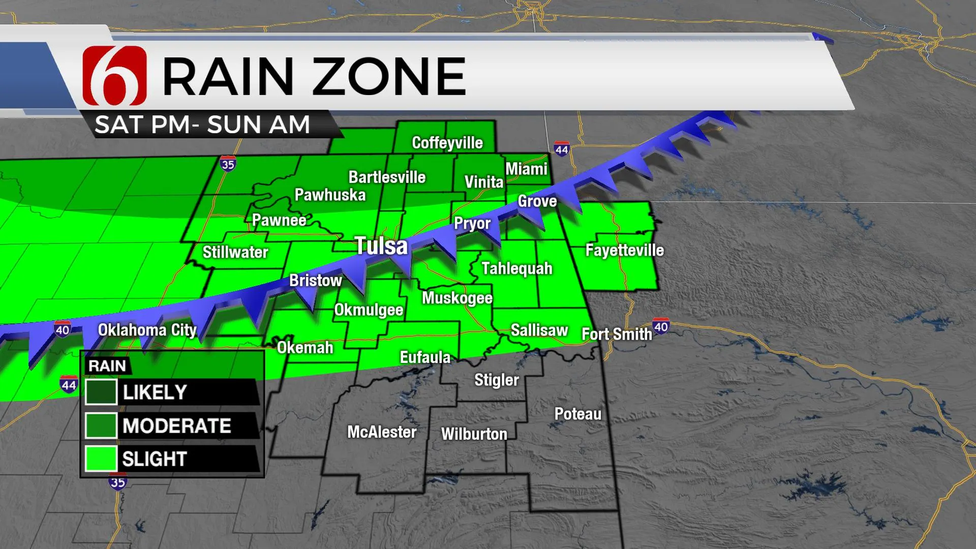
A strong upper-level system will move across the northern high plains and Midwest while a surface front progresses across the state Saturday night and Sunday morning.
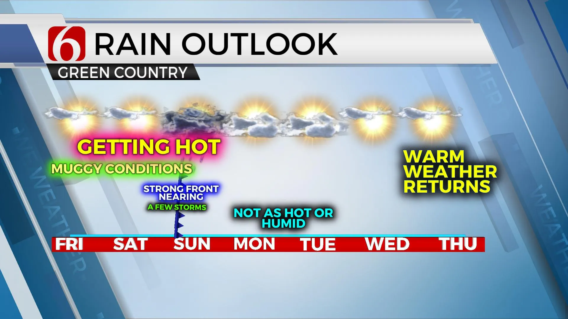
This front will bring relief from the heat Sunday through Wednesday before gradually increasing heat and humidity return. This front also brings the possibility of a few showers and storms late Saturday into early Sunday morning.
Dew points in the lower to mid-70s are likely this morning but should mix-down some Friday and Saturday.
But with the increasing thermal profile in the midlevel, hot weather will combine with humidity to create heat index values in the 105 to 110 range.
Please remain hydrated and take plenty of breaks for outdoor activities both Friday and Saturday.
The front is expected to enter the area late Saturday evening and make good progress southeast Sunday morning. A layer of warm air aloft (The Cap) may keep pre-frontal storms from developing, but post-frontal showers and storms will be possible. The higher chances appear to be along the Oklahoma and Kansas state line region Saturday evening and pre-dawn Sunday, but chances will also occur elsewhere.
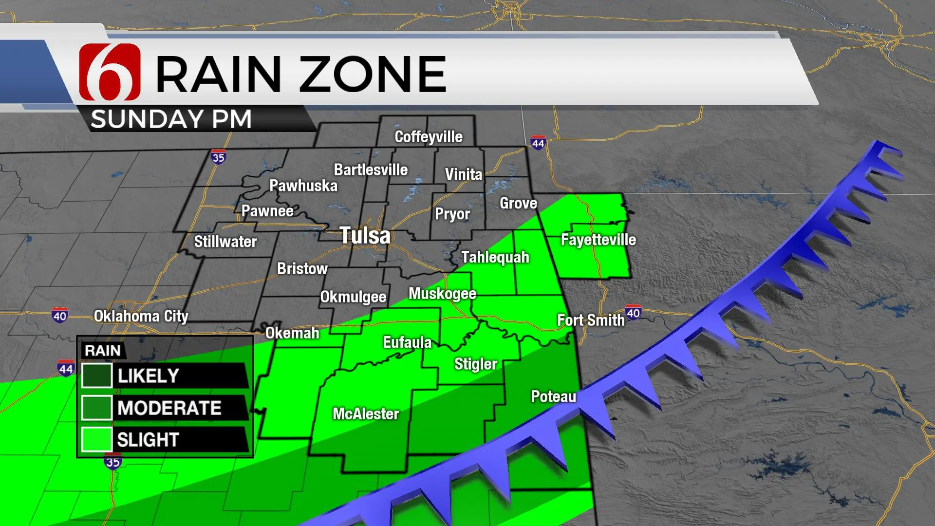
The front will move southward Sunday afternoon with some additional storm development across southeastern Oklahoma by afternoon.
Temperatures will start in the lower 70s Sunday morning. By midday to afternoon, northeastern sections of the state will top out in the mid to upper 80s with northeast winds at 15 to 25 mph.
Southeastern Oklahoma may still reach the lower 90s before cooling down by the end of the afternoon.
Starting Monday, much drier air will be likely across the area early next week. This will bring morning lows into the mid-60s and afternoon highs reaching the lower 80s north and mid 80s south.
We are not expecting any heat index issues Monday or Tuesday. A weak northwest upper flow Monday and Tuesday may allow a few showers nearby, but the probability remains too low for the forecast at this point.
The pattern will change with increasing heat and humidity by the end of next week.
Thanks for reading the Friday morning weather discussion and blog.
Alan Crone
KOTV
The morning podcast link can be found by clicking here.
More Like This
June 24th, 2022
April 17th, 2024
April 17th, 2024
April 16th, 2024
Top Headlines
April 17th, 2024
April 17th, 2024


