Drought, Fire Danger to Continue.
High Fire Danger again Sunday, turning cooler for the coming week.Saturday, January 18th 2014, 5:43 pm


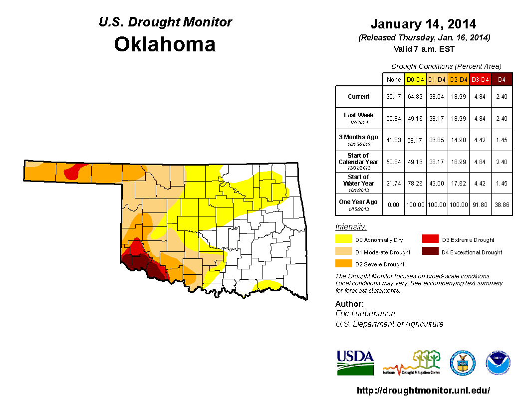
As you can see from the first map on the right, drought is rearing its ugly head once again across the state. Matter of fact, it never really left the more western counties and is now spreading back eastward. Combine the dryness with gusty winds, low humidity values, dormant vegetation and sunny, warmer than normal temperatures and you get a high fire danger situation which is what we have had again today.
The strong NW winds of this afternoon will be subsiding during the overnight hours and returning to a more southerly direction by early morning. This is all in response to another rapidly moving cool front that is moisture starved so no rain and lots of wind. However, since we are just getting a glancing blow with this system there will not be much of a cool down. In fact, temperatures Sunday will be warmer than today as the light southerly winds by early morning will quickly pick up from the SW to 15-25 mph with some higher gusts. Not as strong as today, but a SW wind is a very warm wind for us and temperatures should zoom from the 20s first thing in the morning to the upper 60s by late afternoon. Those very warm temperatures will result in a minimum relative humidity near 20% during the heat of the day which together with the brisk SW winds means another high fire danger situation.
Another dry cold front will arrive Sunday night with brisk northerly winds for much of the day Monday. This system will bring cooler air our way, but you really will not notice it till Tuesday. Daytime highs on Monday should still be in the 50s under sunny skies. Tuesday will only be in the low 40s with a brisk NE wind.
Temperatures will rebound into the upper 40s to near 50 on Wednesday along with a return to southerly winds and lots of sunshine. However, another stronger cold front will arrive that night and the colder air associated with this system will come more directly over us instead of just a glancing blow. As a result, daytime highs will only be in the 30s Thursday and overnight lows should be dropping into the teens that night. Friday also looks cold, but a rebound should start again by Saturday.
Notice one thing that is missing from these frequent frontal passages and that is moisture. In fact, as you can see from the 7 day QPF map on the right, our chances of any significant moisture are pretty much non-existent through this forecast cycle. That means the drought will only worsen and there will continue to be problems with wildfires.
So, stay tuned and check back for updates.
Dick Faurot

Get The Daily Update!
Be among the first to get breaking news, weather, and general news updates from News on 6 delivered right to your inbox!
More Like This
January 18th, 2014

April 15th, 2024

April 12th, 2024

March 14th, 2024
Top Headlines

April 16th, 2024


April 16th, 2024

