Rain Drenches Parts Of Eastern Oklahoma
Much of Northeastern Oklahoma is under a severe thunderstorm watch through 9 p.m. Saturday.<br />Saturday, June 28th 2014, 12:44 pm


Scattered storms with heavy rain and lightning moved across northeastern Oklahoma Saturday.
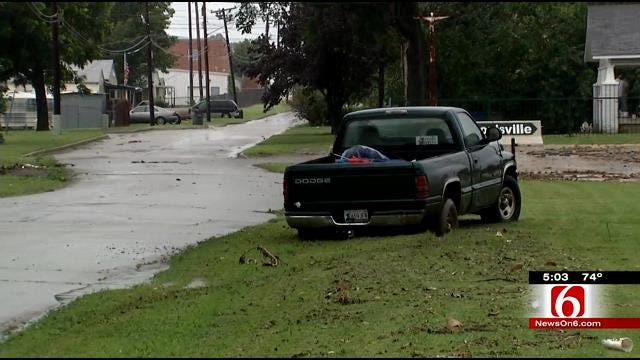
The storm moved through Tulsa County with heavy rainfall, which made travel difficult in spots. Some flooding was reported.
One woman had to be rescued by firefighters in a heavy downpour at Pine and Harvard in Tulsa during the afternoon. She said she the water standing in the road was only an inch or 2 thick, but in the thick of it, it was thigh-level.
The water rushed her truck off the road.
"I came through and there was just a little bit of water and when I started going through it got deeper and deeper," Victoria Dearman said. "The water pushed me over here on the grass, and now I can't get out."
Read Mike Grogan's Weather Blog
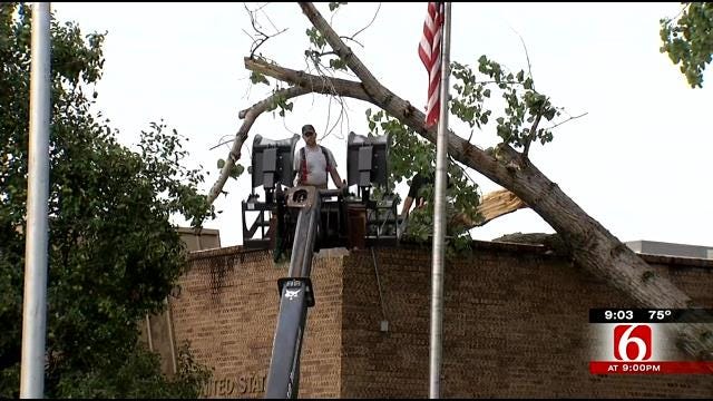
In Adair, officials said a tree hit a post office and another building had roof damage off West Main.
People in Adair didn't skip a beat, after a storm gave the town a beating.
"All the sudden rain, wind, everything just started blowing," Amy McCoy said.
High winds and heavy rain shook the fireworks stand Amy McCoy was working.
She says the storm came as fast as it went.
"We just kinda stood there wondering what to do and then it all blew over," she said.
Minutes later, residents got to work -- picking up downed trees at the post office, power lines off West Main and debris, which blew from this dilapidated building, onto this shopping center.
"Blowed down tree received some damage, made some holes in the roof, so what we're going to do is help the tree trimming crew just get it off there," firefighter Trent Pepper said.
A block from the post office, Bessie Shultz watched the storm come through, then watched cleanup begin across the street.
"All of a sudden all of this stuff started coming through the air. Just pieces of tin and everything," Shultz said. "I know it's going to be a long time before they can open their shop."
But the consensus is that it could've been a lot worse.
"It's really not that bad of a storm," Brad Dyer said. "Could've been a lot worse. We're pretty fortunate we have the damage that we have."
A severe thunderstorm watch is in effect for several counties expired about 7 p.m.
The National Weather Service issued a tornado warning for Craig, Delaware, and Mayes County that expired at 4 p.m. Viewers on Grand Lake said heavy cloud cover and rains forced boaters to shore.
Track Storms On WARN Interactive Radar
By Sunday morning, the storms will have moved on and the heat will start to build.
"Back into the 90s we'll go by afternoon, making for a hot, but dry late afternoon and evening for Rockets over Rhema," Grogan said in his weather blog.
"The heat will crest on Monday with heat index values around the century mark thanks to the moisture in the air. Another round or two of storms may provide temporary heat relief between Monday night and Independence Day."
The Fourth of July so far looks like seasonable weather with highs in the lower 90s, a southern breeze and an isolated shower or storm during the afternoon.
Stay with NewsOn6.com and News On 6 for the latest weather updates. Sign up for Weather Alerts.

Get The Daily Update!
Be among the first to get breaking news, weather, and general news updates from News on 6 delivered right to your inbox!
More Like This

June 28th, 2014

April 15th, 2024

April 12th, 2024

March 14th, 2024
Top Headlines

April 25th, 2024


April 24th, 2024

April 24th, 2024
