Turning Colder This Weekend Across Oklahoma
<p>Let’s enjoy the weather for today and tomorrow because another stout cold front rolls into the area late Friday night into Saturday morning bringing more cold air back to the region along with a mention of some wintry precip. </p>Thursday, February 8th 2018, 3:57 am


Let’s enjoy the weather for today and tomorrow because another stout cold front rolls into the area late Friday night into Saturday morning bringing more cold air back to the region along with a mention of some wintry precip. This shallow, arctic air mass will arrive sometime late Friday night into pre-dawn Saturday with falling temps along with some post frontal wintry precip potential. The first glance supports some freezing drizzle possibly transitioning to some very light sleet. Amounts will be very light but could result in some travel issues again for part of northeast Oklahoma for a few hours Saturday morning. The tail end of this wave will brush us late Saturday night and may result in some light snow showers across southern Kansas and northern Oklahoma. Exact types and amounts will continue to be refined in the next day or so. Once this wave exits to the east, we’re in the holding pattern until the next system nears by the middle of next week.
The northern stream will drop a short to medium length wave across the central plains Friday into the weekend and will be the driving force behind the incoming system. A southern stream low is expected to develop later this weekend and will hold back to our west until it gets a kick eastward around Tuesday or Wednesday of next week. This type of pattern with cold air nearby should always be watched for a big winter impact, but the data, so for, keeps the cold air north of us with this Tuesday or Wednesday system and has been trending more southward with precip potential.
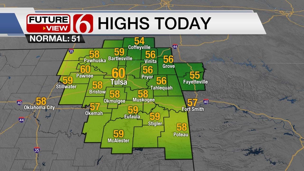
Temperatures today will be quite cold with morning lows in the teens and lower 20s. Yet south winds will return today along with sunshine and highs moving into the mid to upper 50s with a few spots nearing 60. As stated here many times, the fire danger never totally goes away this winter season, but at times will be muted and others extremely high. Today and tomorrow the fire spread will be slightly increasing again due to the gusty south winds.
In summary, pleasant weather will continue for today and tomorrow before the next front arrives either late Friday night or pre-dawn Saturday. Shallow air masses tend to show-up faster and not slower than most data will support. We may be adjusting the arrival time but for now this front arrives Friday evening.
Thanks for reading the Thursday morning weather discussion and blog.

Get The Daily Update!
Be among the first to get breaking news, weather, and general news updates from News on 6 delivered right to your inbox!
More Like This
February 8th, 2018

April 15th, 2024

April 12th, 2024

March 14th, 2024
Top Headlines

April 25th, 2024

April 25th, 2024


April 25th, 2024
