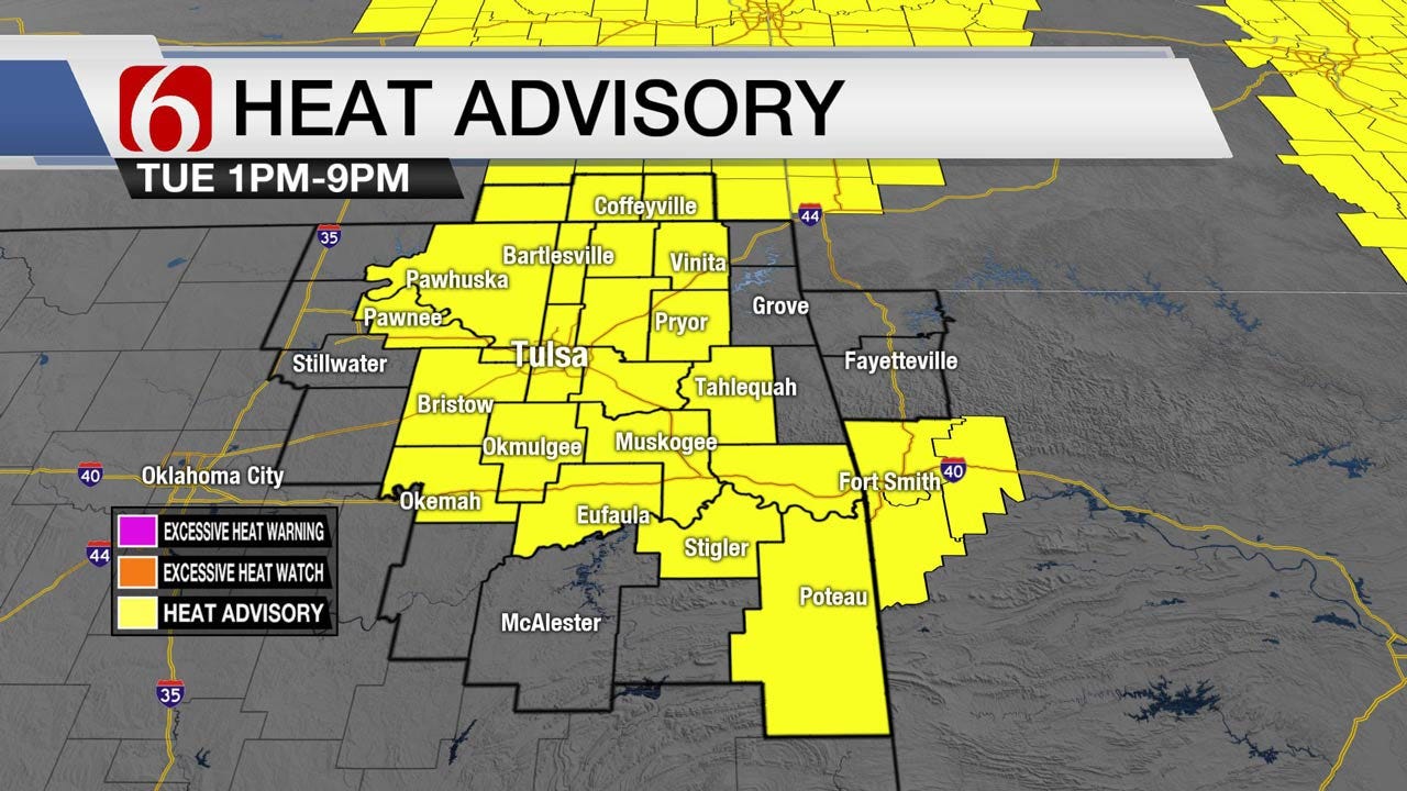
Heat Advisory For Eastern Oklahoma Continues
<p>Our forecast centers upon the positioning of the mid level ridge of high pressure as it moves westward by the middle to end of the week. ..</p>Tuesday, July 3rd 2018, 3:44 am


Our forecast centers upon the positioning of the mid level ridge of high pressure as it moves westward by the middle to end of the week. This will place the eastern Oklahoma region in a favorable spot for some scattered showers and storm chances occasionally before a rare July front moves across the area Friday. We could see a few isolated showers or storms today but the odds will remain very low and mostly on the eastern edge of the ridge. We still think most of the 4th will be fine for most spots across the state but a few isolated storms will be possible by the afternoon and early evening across extreme southeastern Oklahoma into western Arkansas.
This morning a small yet stout thunderstorm developed around Guthrie and moved due north, right along the I-35 corridor. We’re also watching a MCV located along the western Oklahoma state line region this morning. And finally, is the easterly wave motion across southern Louisiana and Mississippi this morning. Despite these features, most locations will remain dry and hot again today across eastern Oklahoma.
Highs this afternoon will be the hottest for the week across eastern Oklahoma for the week with readings nearing 98 for the metro along with THI values nearing 105 to 110. Just like yesterday, if the local dews don’t mix down a few degrees, we’ll be in the heat advisory criteria for part of eastern Oklahoma and it appears our friends at the National Weather Service will keep the advisory up and running for part of the area today.
As the ridge retros westward later this week, the additional cloudy cover combined with the chance for scattered showers and storms will act to keep the highs down a few degrees. We’ll shoot for a high near 90 to 92 Friday through the weekend with morning lows in the lower to mid-70s. A weak boundary may move across northern Oklahoma Friday giving us a few more scattered showers and storms along with northeast winds Friday through Saturday but no changes in the air mass would be initially expected. The data this morning, however, does suggest some dryer air would arrive Saturday evening into Sunday across northeast Oklahoma and may stick around through Monday morning. The data this morning also suggests the better pops would be Friday with very limited activity through the weekend. I’ll probably make some minor adjustments downward on the weekend pops will keeping Friday at the 30% range.
To summarize today: Hot and humid with a heat advisory. Dry for most but a few isolated showers or storms today will be possible across extreme southeastern Oklahoma into western Arkansas.
The wild card(s) will be the isolated early morning storms near Guthrie and the MCV to our west.
Thanks for reading the Tuesday morning weather discussion and blog.

Get The Daily Update!
Be among the first to get breaking news, weather, and general news updates from News on 6 delivered right to your inbox!
More Like This
July 3rd, 2018

April 15th, 2024

April 12th, 2024

March 14th, 2024
Top Headlines

April 24th, 2024

April 24th, 2024

April 24th, 2024

April 24th, 2024
