High Fire Danger For Wednesday Before Cold Front Arrives
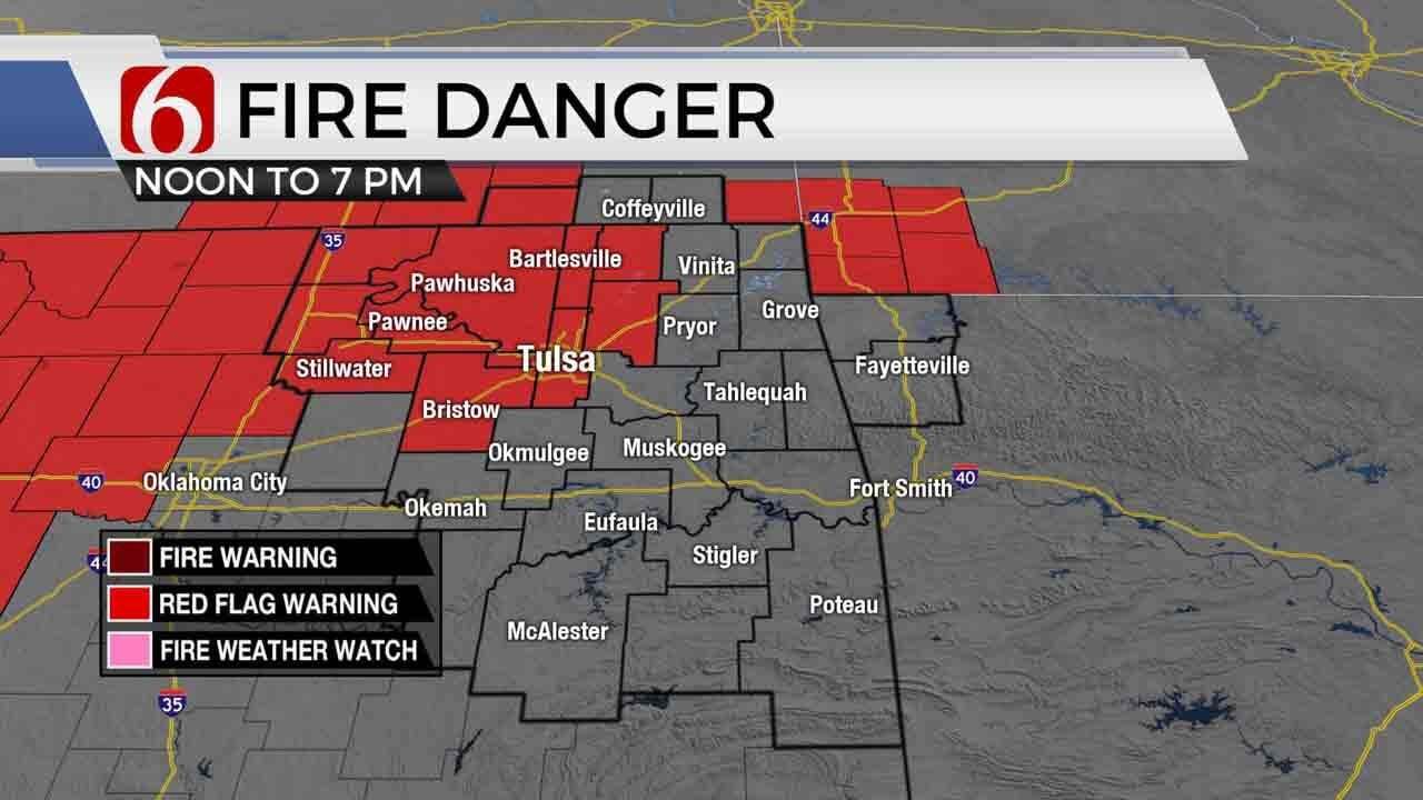
Windy weather arrives later today along with the potential for rapid fire spread. A Red Flag Warning will be issued for part of northeastern OK by midday lasting into the evening hours.Wednesday, January 8th 2020, 6:11 am
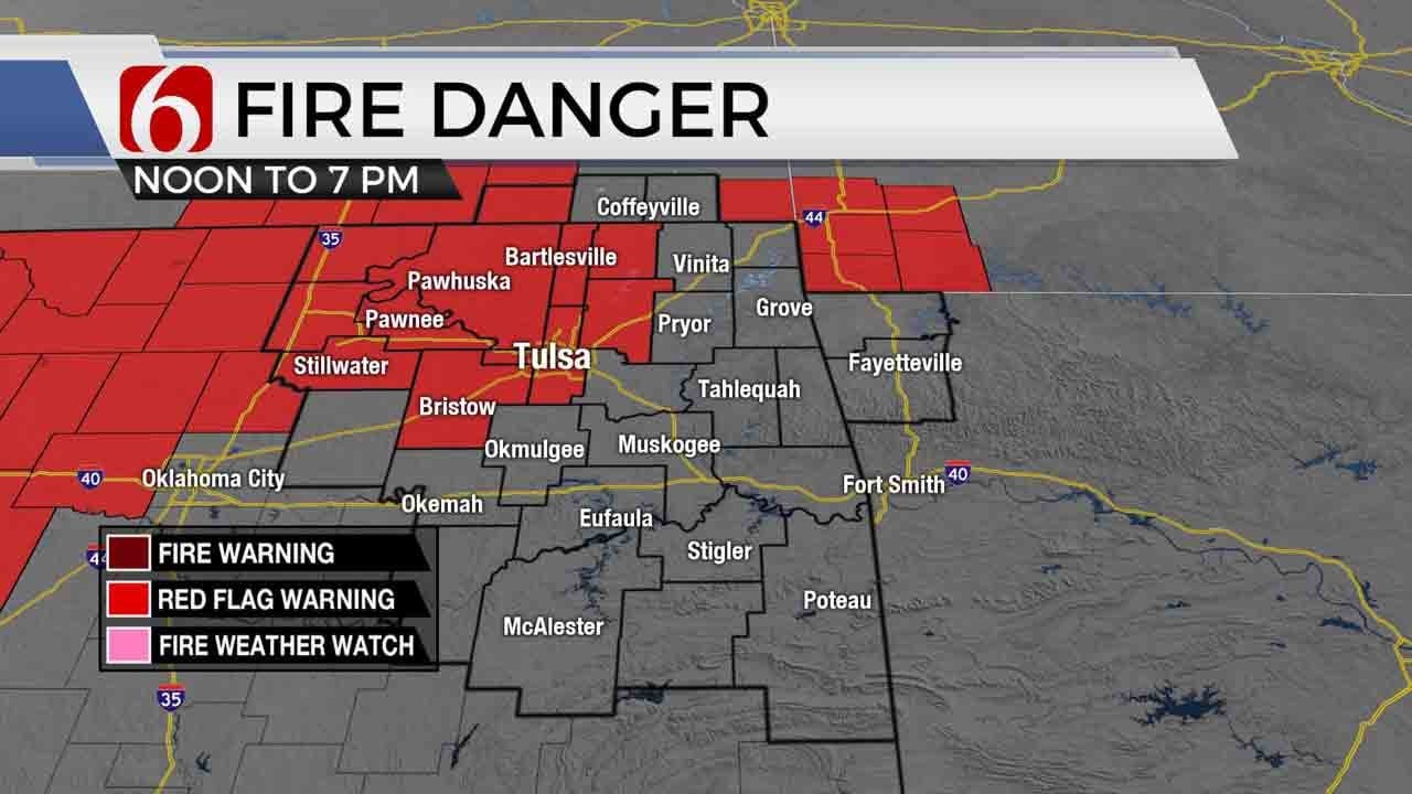

Windy weather arrives later today along with the potential for rapid fire spread. A Red Flag Warning will be issued for part of northeastern OK by midday lasting into the evening hours. Strong south winds from 20 to 40 mph combined with low relative humidity and dormant vegetation will allow any fires to spread quickly and become out of control. You are encouraged to refrain from outside burning or doing anything that may create a spark or fire today. These strong south winds will continue overnight bringing low level moisture back into the region Thursday allowing for a few spotty showers or pockets of drizzle developing as the first of two upper level waves draw near the region. Windy weather will also exist Thursday, but the increasing moisture will offset the fire danger issues compared to today. Highs both today and tomorrow should remain into the lower and mid-60s with a sun-cloud mix today and mostly cloudy sky Thursday.

The stronger and 2nd wave will near the state Friday bringing more rain and thunder including the possibility of severe weather to portions of eastern and southeastern OK as well as northeast Texas. As the cold front passes the area Friday night, the main upper level trough will be nearing the state with much colder air aloft moving directly over northeastern OK Saturday morning. Any moisture remaining near the region will have a chance to transition to some wintry mix into snow before ending Saturday midday to early afternoon. This 2nd and stronger upper level wave is still almost 3000 miles removed from the region this morning and will not be approaching the Pacific Northwest until Thursday morning. Until this system draws closer to the continental U.S. mainland, the winter portion of the forecast for Saturday may continue to go through some major changes. I usually wait until these pacific based systems are on-shore before making specific forecasts such as exact locations, amounts and precipitation types due to the potential for large errors in the 72 hour to 84 hour periods out from a possible winter event.

Our forecast for Saturday will continue to keep a broad-based approach of some wintry mix Saturday morning transitioning to some snow, at least across far northeastern OK and southern Kansas. We will keep a 30-40% chance of wintry precipitation in the forecast Saturday, but additional changes, with higher or lower chances will remain highly possible. The pattern would support a classic deformation zone setting up somewhere across NE OK or SE Kansas that could drop some accumulating snow. It appears that much colder air will almost likely occur with highs in the lower 30s during the day. After the upper trough quickly leaves the area Saturday night, improving conditions will occur Sunday into Monday before another surge of true arctic air arrives across the nation by the middle of next week. We’ll be fine-tuning the forecast and making updates regarding the Saturday wintry potential soon. Stay tuned. But let’s not overlook the Friday severe weather potential across eastern OK.
Thanks for reading the Wednesday morning weather discussion and blog.
Have a super great day!
Alan Crone

Get The Daily Update!
Be among the first to get breaking news, weather, and general news updates from News on 6 delivered right to your inbox!
More Like This
January 8th, 2020

November 30th, 2022

November 1st, 2022

August 26th, 2022
Top Headlines


April 23rd, 2024

April 23rd, 2024
