Chilly Start Friday For Northeastern Oklahoma
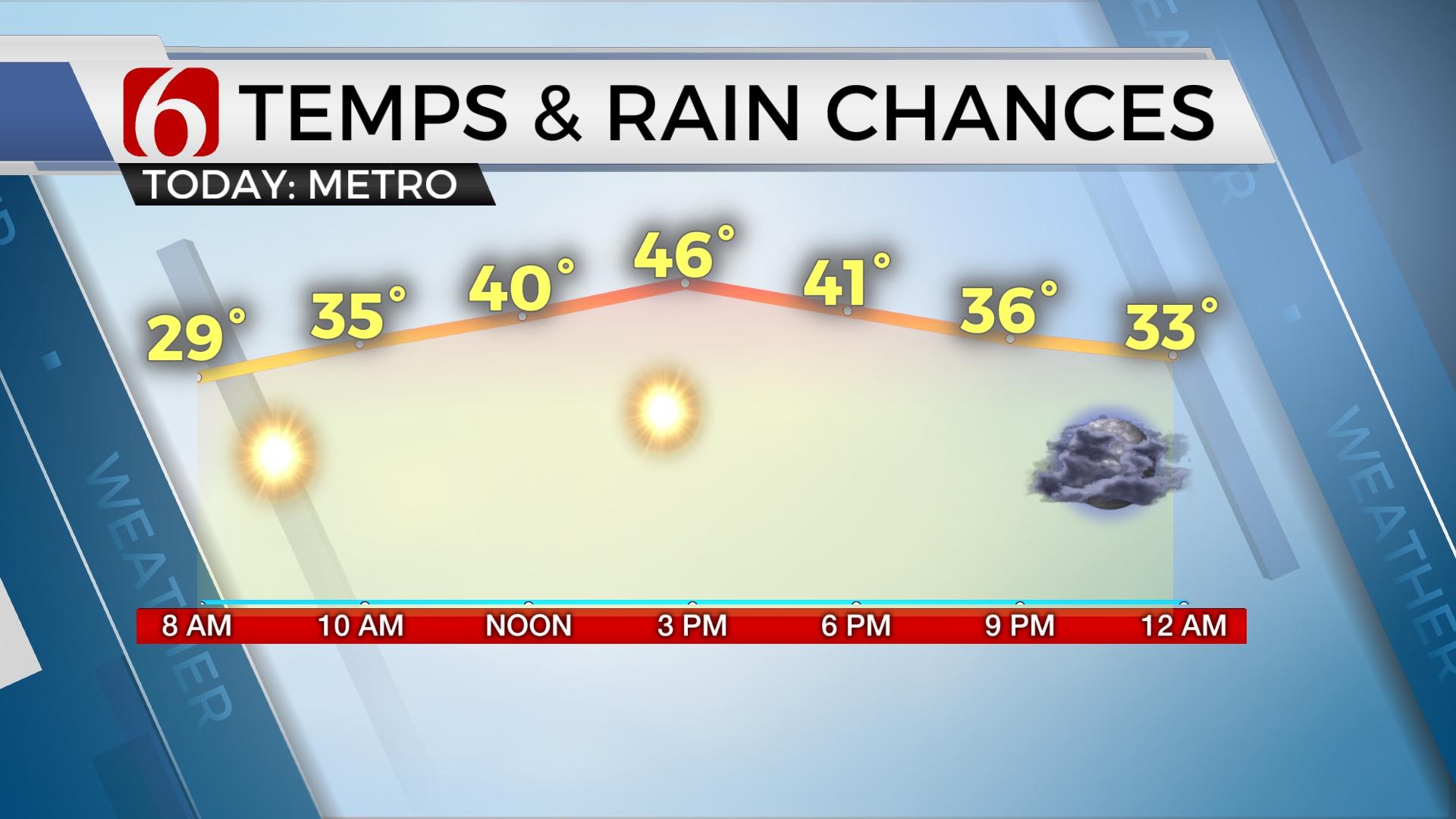
Chilly weather remains this morning with lows in the upper 20s and lower 30s. Afternoon highs will reach the mid or upper 40s today and into the lower to mid-50s Saturday.Friday, February 7th 2020, 9:38 am
We’re in good shape for the next 48 hours before more rain chances arrive Sunday across eastern OK. Chilly weather remains this morning with lows in the upper 20s and lower 30s. Afternoon highs will reach the mid or upper 40s today and into the lower to mid-50s Saturday. We’re tracking another active upper air pattern for the next two weeks, including several items on interest for our area during the next 7 days.

The powerful trough that has been producing severe weather across the southeastern U.S., and the same system that brought the snow and winter weather to the state, is continuing its trek eastward across the extreme eastern section of the nation this morning. The broad backside of this system will bring some energy across the state this morning through the northwest flow aloft and will be exiting the area early Saturday morning. A few sprinkles may be possible, but the atmosphere will remain very dry. We’ll keep a low mention for these small windows, but no impacts to sensible weather will be expected.
A stronger upper level low will detach from the main northern stream and park to our west Sunday, while some energy with the main northwest flow will bring a chance for showers into eastern Oklahoma Sunday, with some chances also remaining near the metro. Highs may reach the upper 50s to lower 60s before a surface cold front moves across the region with gusty northwest winds and falling temps into the lower 30s by Monday morning. Monday afternoon highs will more than likely remain in the lower to mid-40s.

The data this morning attempts to bring a weak disturbance across northern OK Monday night into early Tuesday that could produce some flurries or snow showers, but any impact would be minimal. I have included a low chance, near 10% for this period. A stronger system should be nearing the state Wednesday bringing widespread active weather to the region, including the chance for widespread rainfall. But data this morning has thrown a curve-ball. The GFS now keeps the main upper level system well south across southern Texas, while the EURO continues north across part of Oklahoma. The GFS has some support from the Canadian model. I lowered the pops compared to yesterday for Wednesday but will still give the EURO higher credence at this point with a 50 pop on the map. The thermal profile currently supports all liquid if we do receive the system. Colder weather may arrive Thursday into the following weekend. A reminder that winter is still upon us.
Thanks for reading the Friday morning weather discussion and blog.
Have a super great day!
Alan Crone
More Like This
February 7th, 2020
November 30th, 2022
November 1st, 2022
August 26th, 2022
Top Headlines
April 25th, 2024
April 25th, 2024
April 25th, 2024


