Arctic Air Invades Northeastern Oklahoma
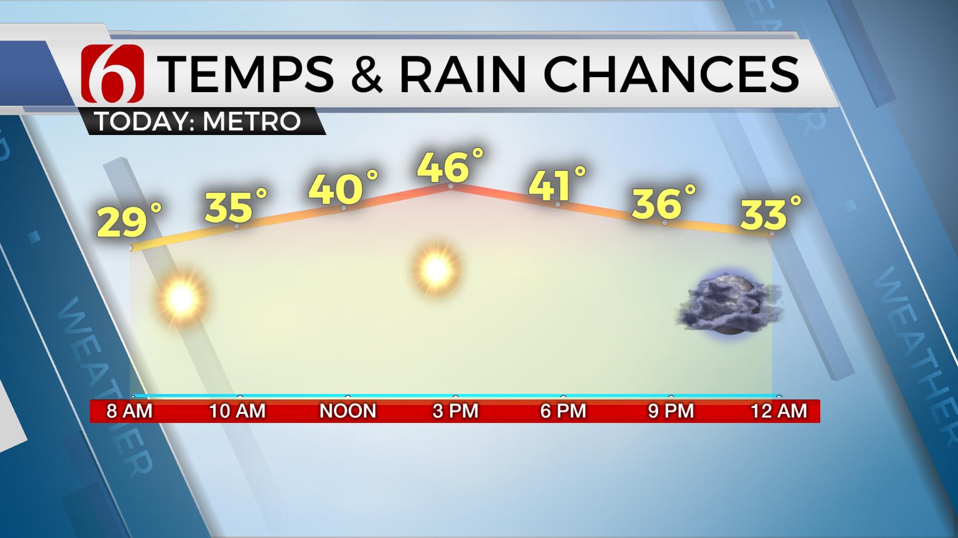
Very cold air will greet you out the door this morning along with strong and gusty north winds allowing wind chill values dropping in the single digits to lower teens as true arctic air invades northern OK and the surrounding vicinity.Thursday, February 13th 2020, 7:37 am
Very cold air will greet you out the door this morning along with strong and gusty north winds allowing wind chill values dropping in the single digits to lower teens as true arctic air invades northern OK and the surrounding vicinity. The stronger winds overnight have tended to dry-out the pavement from yesterday’s rains, but I'll encourage you to remain aware of the potential for a few slick spots this morning for your commute. If it looks wet, it will be ice.

South winds return Friday as our next fast upper level disturbance passes the area well north. We'll track several disturbances in the upper air flow that will bring a few clouds through the weekend, but low-level moisture is expected to remain too low for any precipitation other than a few sprinkles. A stronger wave will drop from the northern plains and become cut-off across the southern region near Baja early next week before ejecting eastward by Tuesday or Wednesday. Almost a carbon copy of this past week’s pattern.

Sunshine returns today across the northern areas with some low clouds lingering across southern OK for the next few hours. A few additional clouds will arrive later this afternoon or evening from the northwest and a few flurries could occur in a few spots.

Temperatures Friday will begin very cold with the metro dropping into the upper teens. Valleys and locations north will be in the single digits to lower teens, but winds will be lighter tomorrow morning compared to this morning. Highs Friday afternoon will remain chilly with temperatures reaching the mid to upper 40s. But thermal properties in the atmosphere will allow quickly warming temperatures Saturday as highs climb near the upper 50s to lower 60s and possibly into the upper 60s Sunday along with gusty southwest winds Saturday afternoon.
The upper air disturbance that brushes the Missouri Valley Sunday morning should drive a weak boundary southward Sunday bringing lower wind speeds and possibly a minor wind shift through the morning hours before quickly returning from the south at midday with warming temperatures. Sunday night into Monday gusty south winds quickly respond as pressure falls to our west. This will bring Monday highs possibly into the lower 70s before the next cold front passes across the state by evening with a chance of a few showers or storms across southeastern OK or western Arkansas. Colder air should also follow this front and lower our temps Tuesday and Wednesday into the lower 40s with a low chance of wintry weather across the Red River Valley region of north Texas.
Thanks for reading the Thursday morning weather discussion and blog.
Have a super great day!
Alan Crone
More Like This
February 13th, 2020
November 30th, 2022
November 1st, 2022
August 26th, 2022
Top Headlines
April 23rd, 2024
April 23rd, 2024
April 23rd, 2024


