Winter Returns, Chance Of Flurries For Northeastern Oklahoma
Colder air continues to slowly filter into the state this morning and will remain for the next few days.Tuesday, February 18th 2020, 7:07 am
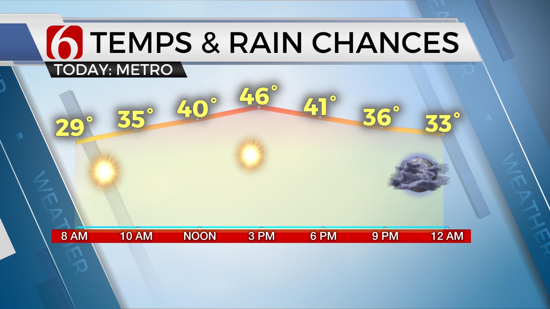
Colder air continues to slowly filter into the state this morning and will remain for the next few days. Temperatures currently in the upper 30s to lower 40s will rebound into the upper 40s or lower 50s today along with a stout north wind and a sun-cloud mix. Almost identical conditions are expected tomorrow before our next storm system brings a mention of rain and some light snow or flurries across part of Oklahoma. While today will be dry for almost the entire area, a very small region of extreme northeastern OK would experience a few sprinkles at midday, yet this chance will remain near or less than 10% for today. Other chances will arrive Wednesday night into Thursday morning and then again into the weekend. A very active flow remains across the North American continent with a strong mid-level ridge positioned across the equatorial regions of central America.

A medium to long wave trough will move down the flow and influence the southern plains Wednesday night into Thursday as moisture attempts to move across the state from the southwest to northeast. Light rain will develop to our southwest and attempt to move northward late Wednesday night into Thursday morning with colder air aloft and at the surface across the northern third of the state. While most data are now suggesting a decent chance of this occurrence, the limited or thin moisture may result in very light amounts for this event. We'll continue to keep a 40% chance for showers through the Wednesday evening period that would change to some light snow or flurries during the early morning hours Thursday. Due to the limited moisture content in the atmosphere, some areas may not experience the precipitation for this event. At this point, we feel amounts may be so low that winter weather advisory criteria may not be met across northeastern OK. Slightly higher amounts may develop west of I-35 but would still be rather meager. While surface temperatures will be in the upper 20s or lower 30s, almost all data also suggest the readings will rise into the upper 30s and lower 40s Thursday afternoon with little impact on roadways. This system should be exiting our region after the early morning hours with improving conditions through the rest of the week.

This weekend another stronger upper level trough will again become quasi-cut-off from the flow before ejecting near the state Sunday afternoon or evening. This type of feature in spring would be a severe weather maker. But I don’t think we'll have enough time between the exiting Thursday system and arrival of the Sunday disturbance to warm sufficiently ahead of the storm with most data suggesting a chilly rain with some thunder Sunday. South winds will return Saturday with highs reaching the lower 50s and then staying in the lower to mid-50s Sunday along with gusty south winds with chances for showers and some thunder across eastern OK. As this system exits the state, some light wintry precip would be possible across far NE OK and NW Arkansas late Sunday night or early Monday morning. Again, no major impacts are expected under the current data.
Thanks for reading the Tuesday morning weather discussion and blog.
Have a super great day!
Alan Crone
More Like This
February 18th, 2020
November 30th, 2022
November 1st, 2022
August 26th, 2022
Top Headlines
April 24th, 2024
April 24th, 2024
April 24th, 2024
April 24th, 2024


