Warm Wednesday Before Rain, Cooler Temperatures Return To Green Country
Breezy south winds return later today in advance of our next storm system bringing a slight chance for showers and storms Thursday and better opportunities Friday.Wednesday, April 1st 2020, 1:31 am
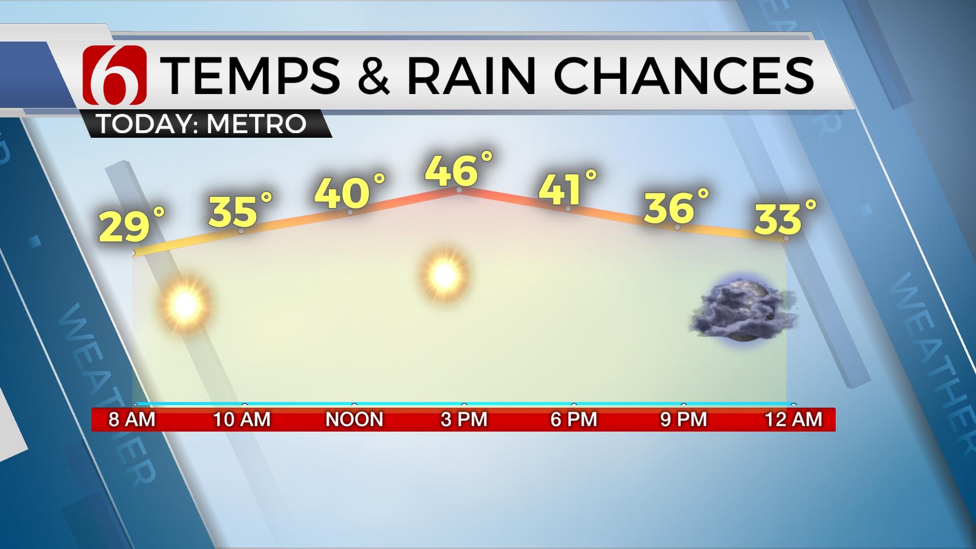
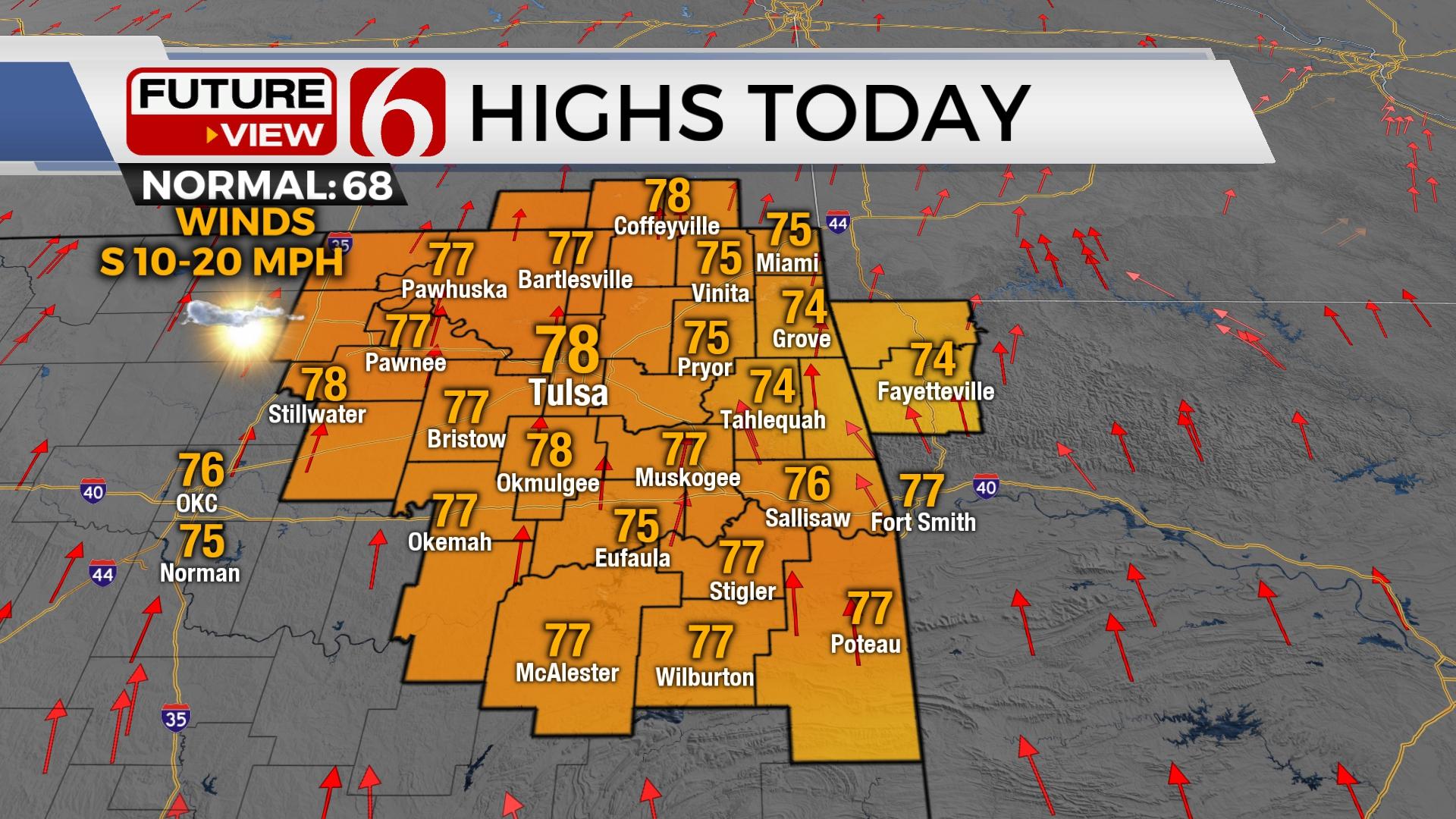
Breezy south winds return later today in advance of our next storm system bringing a slight chance for showers and storms Thursday and better opportunities Friday as a strong cold front moves across the state. Severe weather threats continue to appear low Thursday and Friday for our immediate areas of concern. Temperatures Friday may start in the 60s but drop into the 50s by afternoon and the lower 40s by 6pm Friday night with gusty northwest winds and chilly conditions. Highs today are expected in the mid-70s along with sunshine before clouds arrive this afternoon and evening. South winds from 10 to 25 mph are likely today and possible from 20 to 30 mph Thursday.

The bulk of our next upper level system will be taking more of a northern route over the next few days with a small disturbance exiting the base of the trough by Thursday afternoon and evening. As early as Thursday morning, we may track a few spotty showers or storms across northern OK and southern Kansas as this feature influences the state. At the surface, a dry line will be establishing across extreme western OK Thursday afternoon with most of the state positioned with increasing low-level moisture along with gusty south winds and highs in the lower 70s. Most data also support another elevated capping inversion which may limit storm activity Thursday afternoon or evening. But one or two could develop.

By Friday morning the main trough is influencing most of the intermountain region and the central plains with a surface cold front rapidly dropping from Kansas into northern OK by Friday morning to midday. A stronger belt of mid-level winds will also be displaced well south of the region, mostly across central Texas by Friday afternoon and evening. Ahead of this boundary, low level moisture reaching the lower 60 dew points will be near to the southeast of Tulsa, with higher chances along and south of the Red River. Regardless, as this front rolls across the area, temps will take a dive with gusty north winds by afternoon and evening. Our readings may start in the lower 60s Friday morning but drop into the lower 40s by afternoon. Some locations west of the I-35 corridor could be near freezing Saturday morning. We’re anticipating some clouds near the eastern sections that may keep us in t eh upper 30s to lower 40s. This still may change.

Sunday night into Monday another stout looking system will be nearing the state with increasing chances again for showers or storms. Next week the pattern suggests a nice warm-up with a southwest upper air low. This should allow us to get into the lower 80s but may also bring better chances for strong or sever weather later next week.
Thanks for reading the Wednesday morning weather discussion and blog.
Have a super great day!
Alan Crone
More Like This
November 30th, 2022
November 1st, 2022
August 26th, 2022
Top Headlines
April 18th, 2024
April 18th, 2024


