Storms Return And Flood Watch Issued Through Saturday
We’re tracking rain and thunderstorms that will move from southern Kansas into portions of northern OK this morning through midday.Friday, August 2nd 2019, 7:10 am


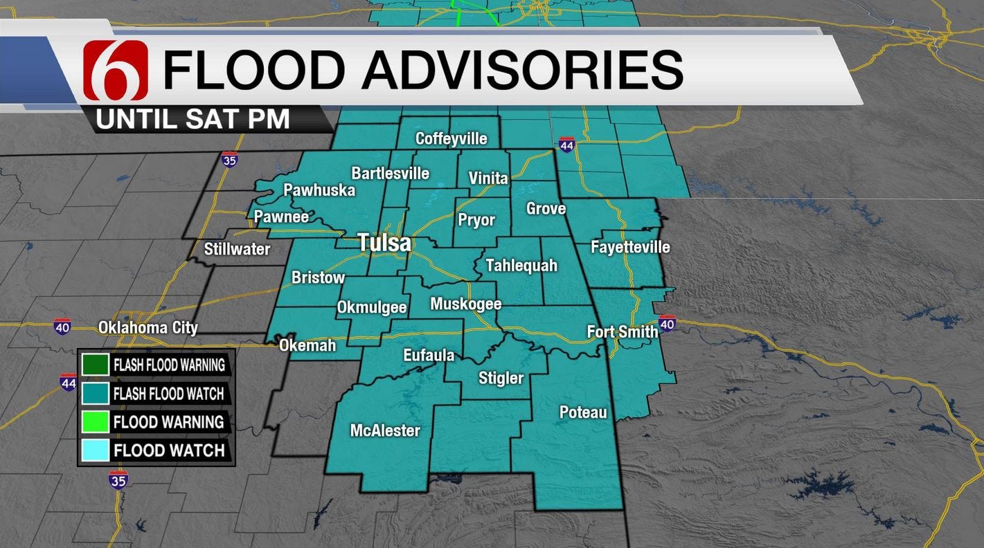
Take the rain gear today. We’re tracking rain and thunderstorms that will move from southern Kansas into portions of northern OK this morning through midday. Then another round is likely later tonight into Saturday morning. Pockets of moderate to heavy rainfall will be possible. A flash flood watch is posted for a large portion of southern Kansas and northeastern OK through Saturday. Additionally, a few strong to severe storms may also be possible. Another broad range of temperature is expected across the state today, but northeastern OK will mostly be in the upper to mid-80s with locations slightly west back into the lower and mid-90s. A few spots across far western OK will once again hit 100. After Saturday mornings storms, daytime highs tomorrow will be much lower and well below the seasonal average. Morning lows will start in the upper 60s and lower 70s, but daytime highs may stay in the upper 70s and lower 80s across northeastern OK along with northeast winds at 10 to 15 mph. Our break from the heat continues Sunday with morning lows in the upper 60s and highs in the upper 80s with no appreciable heat index values across Eastern OK. It appears we’ll gradually warm back into the lower 90s early next week and the mid-90s by midweek. A weak system may near our area Wednesday evening into Thursday with a slight chance for a few showers or storms.
The main midlevel ridge of high pressure remains centered to our west and will continue to influence western OK today with hot weather. The eastern and northeastern periphery of the ridge will feature a sharp northwest flow allowing central plains storms to move southeast this morning into part of northern OK. The tropical like airmass in place will allow any thunderstorm activity today to become higher efficient rainfall producers. Pockets of moderate to heavy rainfall will be likely in those areas that do receive thunderstorm activity this morning through midday. A few strong to severe storms may be possible with gusty winds and nickel hail, but the odds will remain low for these types of storms.

Later today, the morning storms will be moving east and southeast allowing a break for most of northern OK early this afternoon. The sharp temperature gradient with much higher readings to our west could provide a focus for late afternoon and early evening storm development. If this occurs, the storms will have a slightly higher chance of producing severe weather. Eventually storms will converge across our immediate areas later tonight through Saturday morning and move southeast with time, producing heavy rainfall over a large portion of eastern OK. The ending point of this Saturday morning precip may not occur until early afternoon. The big dividend will be a major reduction in temperature with Saturday afternoon highs staying in the lower 80s for most locations across NE OK.
Thanks for reading the Friday morning weather discussion and blog.
Have a super great day!
Alan Crone

Get The Daily Update!
Be among the first to get breaking news, weather, and general news updates from News on 6 delivered right to your inbox!
More Like This

August 2nd, 2019

April 15th, 2024

April 12th, 2024

March 14th, 2024
Top Headlines

April 18th, 2024

April 18th, 2024

April 18th, 2024

