Warm Today, Storms Saturday Across Eastern Oklahoma
<p>Warm and windy later today across northeastern Oklahoma. Highs in the mid to upper 70s with south winds 15 to 25 mph. Partly cloudy and chance for scattered showers during the day.</p>Friday, October 20th 2017, 6:32 am
Warm and windy later today across northeastern Oklahoma. Highs in the mid to upper 70s with south winds 15 to 25 mph. Partly cloudy and chance for scattered showers during the day. Only about a 10 percent chance, little higher east and southeast of Tulsa. Tonight lows in the mid 60s. Warm and windy tomorrow with a chance for spotty showers in the morning.
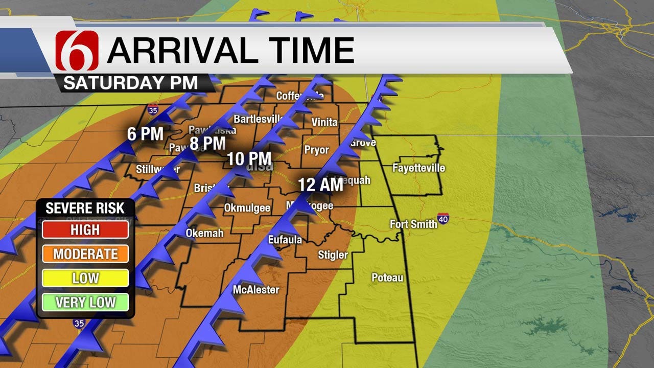
A cold front will be positioned across central Kansas into Oklahoma tomorrow afternoon and storms will develop along that boundary. Storms will merge into a line and become severe moving east southeast into Green Country during the evening hours and overnight on Saturday. The main window in Tulsa still looks to be between 8 pm and 12 am.
It is very important to stay weather aware. A lot folks will be headed out to events such as Oktoberfest and when these storms move into your area, the biggest risks will be wind gusts 70 mph or high along with large hail and very heavy rainfall. Some areas could see over 3” of rain from these storms. Localized flooding could be an issue and even small streams might have flooding concern. When storms first develop and intensify will be when the hail risk is highest. Some storms could have up to half dollar size hail. By late evening when storms have merged into a line, the hail size might decrease a little but the could still produce at least one inch hail.
It will be a late-night event, especially for locations east and southeast of Tulsa. Make sure you download our NewsOn6 weather app. Your phone will alert you when warnings are issued for your location and you’ll want the notifications to be loud enough to wake you. We will continue to track this system and bring you updates.
Conditions will improve on Sunday. A few leftover showers in the morning will be possible in far eastern and southeastern Oklahoma. Skies will be clearing from west to east and highs should be around 70. We’ll warm up some on Monday before another front comes through on Tuesday. Tuesday’s frontal passage will be dry but will open the door to cooler and drier air.
More Like This
October 20th, 2017
April 15th, 2024
April 12th, 2024
March 14th, 2024
Top Headlines
April 17th, 2024
April 17th, 2024
April 17th, 2024


