

Heat Wave Continues To Build Across Oklahoma
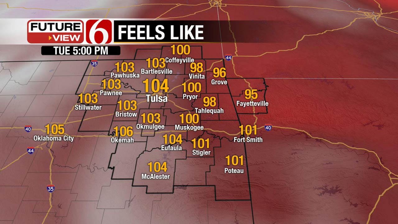
<p>The mid-level ridge of high pressure is building and growing across eastern Oklahoma today. This means hot and humid weather will remain with highs in the mid to upper 90s across eastern Oklahoma along with THI values nearing 100 to 105. </p>Tuesday, July 18th 2017, 4:07 am


The mid-level ridge of high pressure is building and growing across eastern Oklahoma today. This means hot and humid weather will remain with highs in the mid to upper 90s across eastern Oklahoma along with THI values nearing 100 to 105. This pattern typically brings the hottest temperatures of the year into eastern OK through the end of the month and this will probably be the case for the next few days with actual triple digits likely to be reached either Thursday or Friday across the region that may last into the weekend. The only chance for any shower or thunderstorm activity in the short term (the next few days) will be highly localized and very unlikely for most the area. A few isolated late afternoon pulse storms will be possible across extreme southeastern or east- central Oklahoma into west central Arkansas. This chance is around 5%.
A deeper fetch of low level moisture with 70 to 74 dews will be arriving Wednesday into Thursday. This means the temperature heat index values will be nearing 105 to 110 by the middle to end of the week and additional heat advisories may possibly be issued for part of the area from the National Weather service. But we’ll need to see exactly how the atmosphere responds to the role of evapo-transpiration and the actual temperatures. For example, yesterday there was some minor mixing and the dews dropped a few degrees. We’ll take it!
The morning lows may stay near the upper 70s near 80 Friday through the weekend for the metro with THI values from 102 to 108.
The mid-range data suggest the mid-level ridge may briefly flatten or even slide eastward across the southern U.S. Friday through the weekend. This may allow a weak disturbance to arrive Monday or Tuesday of next week along with a summer front sagging into southern Kansas with a few storms during this period. I’ll keep a slight mention for Monday into Tuesday for this low chance. Even though data suggest a higher chance, it’s usually very unlikely a front will survive into the body of the state this time of year. I tend to favor the ridge reestablishing near the state for the middle to end of next week.
Thanks for reading the Tuesday morning weather discussion and blog.
Have a super great day!
Alan Crone

Get The Daily Update!
Be among the first to get breaking news, weather, and general news updates from News on 6 delivered right to your inbox!
More Like This
July 18th, 2017

September 29th, 2024

September 17th, 2024

Top Headlines

December 12th, 2024

December 12th, 2024
December 12th, 2024

December 12th, 2024