Heat Wave Begins To Build Across Green Country
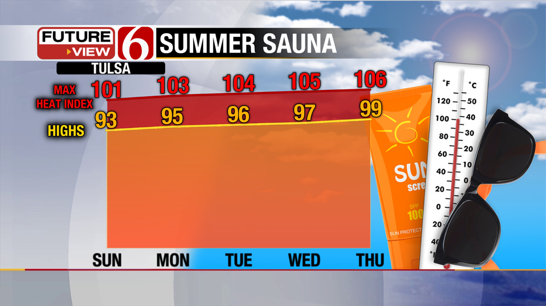
<p>We’ll have enough sunshine to push our highs back into the low 90s, with heat index values near or just above 100. </p>Sunday, July 16th 2017, 8:57 am
Familiar heat and humidity are on the menu for our Sunday, and there’s plenty more where that came from as a heat wave begins to build across Green Country.
Partly to mostly sunny skies are expected today along with another day of very light winds. We’ll have enough sunshine to push our highs back into the low 90s, with heat index values near or just above 100. As we say frequently this time of year, take it easy during any outdoor events!
An isolated shower can’t be completely ruled out during the day, so don’t be surprised if you get caught under a brief downpour. However, the large majority of Green Country will be staying dry today, and the next several days for that matter.
A very typical mid-summer heat wave is setting up as we head into the upcoming work week. A dominant ridge of upper-level high pressure will be settling over the middle of the country, shutting off our rain chances and bringing us some of our hottest days of the year so far.
High temperatures will keep climbing further into the upper 90s later this week, and we could see our first 100-degree day of the year by the end of the week with heat index values well above that. Yikes!
There is the potential that this heat wave could last through the next few weeks, so don’t expect any major relief anytime soon. Time to look for plenty of ways to stay cool in the days ahead!
More Like This
July 16th, 2017
September 29th, 2024
September 17th, 2024
Top Headlines
December 12th, 2024
December 12th, 2024
December 12th, 2024
December 12th, 2024


