Mostly Clear, Cold Wednesday For Northeastern Oklahoma
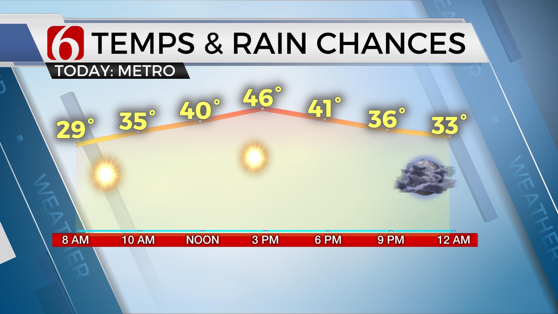
Mostly clear and cold weather greets you out the door today with highs expected to reach the lower 50s with morning to midday sun before becoming cloudy into the afternoon.Wednesday, February 19th 2020, 7:03 am
Mostly clear and cold weather greets you out the door today with highs expected to reach the lower 50s with morning to midday sun before becoming cloudy into the afternoon. We're tracking two systems for the next few days, including one later tonight and another stronger system for the 2nd half of the weekend.

We're in a holding pattern for a few hours before the next upper level wave zips across the state bringing a chance for some light snow for a few locations to the north and light rain south. Any accumulation of snow should be light and mainly on grassy areas along the state line into southern Kansas for our immediate areas, with a slightly higher accumulation possible into south-central Kansas. The Tulsa metro will have a window for some snow flurries or snow showers with no travel impacts on roadways if we receive any precip. Locations along both sides of I-40 will have chances for some light shower activity for the period from later tonight through Thursday morning before the wave quickly exits the area. A surface ridge of high pressure will build into the central plains and influence northeastern OK Thursday night into Friday morning with another of cold and dry air allowing Friday morning lows dropping into the teens or lower 20s with clear sky and light wind. The ridge will move eastward Friday night as the next stronger upper level wave draws closer to the state for the weekend bringing unsettled weather with rain and thunder chances back to central and eastern OK, mostly Sunday. A few showers will be possible Saturday afternoon or evening, but likely categories will unfold Sunday with most locations picking-up showers and possibly some thunder. Current data support only limited instability with rain, but the main upper level low will be strong.

Temperatures Friday will reach the upper 40s or lower 50s with sunshine. The weekend numbers will be influenced more by cloud cover with Saturday highs in the upper 40s and lower 50s and Sunday anywhere from the upper 40s to upper 50s from north to south across northeastern OK. I anticipate the metro highs nearing 53 to 55 Sunday with rain likely. The pressure gradient will be increasing by Sunday allowing south winds from 15 to 25 mph for most of the day and early evening before the cold front passes the area late Sunday night. As stated yesterday, this upper level system would be a severe weather maker for the state if delayed a few days with warmer weather and higher moisture in its path. As it stands now, locations to our east will experience severe weather Monday and Tuesday from Arkansas, Louisiana and points across the southeastern U.S. Another strong looking system may quickly follow with additional rain and storm chances Wednesday of nest week for NE OK, yet major differences exist between data.
Thanks for reading the Wednesday morning weather discussion and blog.
Have a super great day!
Alan Crone
More Like This
February 19th, 2020
November 30th, 2022
November 1st, 2022
August 26th, 2022
Top Headlines
December 13th, 2024
December 13th, 2024
December 13th, 2024
December 13th, 2024


