Spring-Like Temperatures before Winter Returns To Northeastern Oklahoma
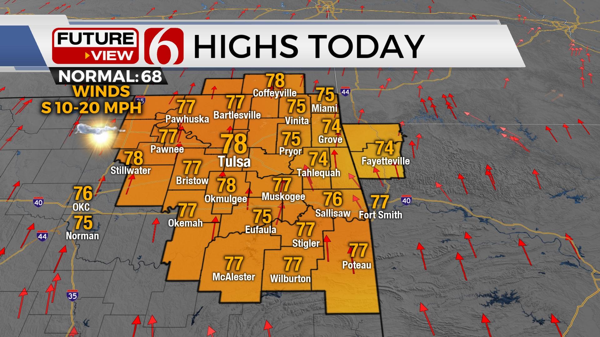
Highs today will reach the mid-60s north and lower 70s south before a cold front brings chilly weather back to the region for most of the week.Monday, February 17th 2020, 7:32 am
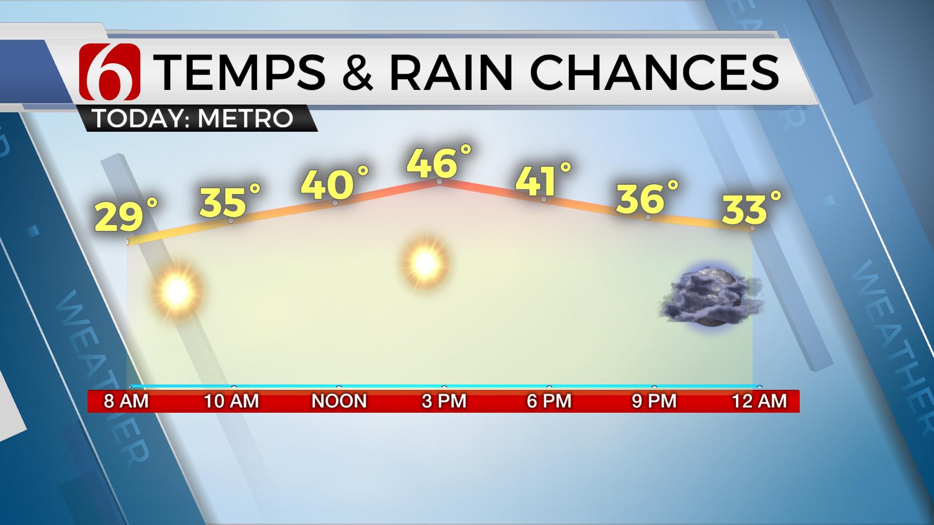
Highs Monday will reach the mid-60s north and lower 70s south before a cold front brings chilly weather back to the region for most of the week. We’re tracking several upper level systems that could bring some precipitation chances back into the region, but some differences continue in the data regarding specifics.

The clouds killed the fun yesterday by keeping most of the afternoon highs in the upper 550s and lower 60s, while far south-central OK, under mostly sunny conditions hit the lower 70s. Once again, this will be the case for afternoon highs today. Locations under the clouds (and morning fog) will stay in the 60s (including the metro) with far southeastern sections having a good chance at the lower 70s again today before a cold front brings the end to the moderate temperatures. If the front will slow down, even an hour or two, this would bring the upper 60s and lower 70s northward near the metro. As the boundary passes the area later today, some clearing should follow by later this afternoon into the evening. It’s possible that we could have a shower at midday along with some sunshine later this afternoon. But the warmer weather will leave after today.

We’re back to chilly weather and more winter with highs Tuesday and Wednesday into the upper 40s for afternoon readings and into the upper 20s and lower 30s for morning lows Wednesday morning and Thursday morning. The data has continued to struggle with any consistency regarding the middle of the week precipitation chances but We'll need to keep some mentions for not only today along the boundary, but the middle of the week across part of the state while another upper level system arrives from the west.

Our first chance for a few showers or sprinkles will arrive around midday to early afternoon today along the cold front that will move from the north to south across the area. The Tulsa metro window is mostly around midday with southeastern OK later this afternoon or early evening. This chance remains mostly around 20% for most locations. There may be just enough instability for a rumble of thunder if showers do develop across southeastern OK. Again, as the boundary passes, some clearing should occur in the clouds for later this afternoon and evening.

The first thoughts for precipitation for Tuesday would be a small mention for a sprinkle or two, mostly across far northern OK but the chances will remain extremely low. Another upper wave should approach the area Wednesday night into Thursday morning that could bring some precipitation chances back across a larger portion of the state with some colder air across the northern half of Oklahoma. I brought this probability up compared to previous days.
As we examine some data, the pattern could support a northward trend in chances Wednesday night into Thursday with enough cold air in place for some mention of light wintry mix or snow across central and northern OK with all rain across far southeastern OK. Not all data support these conclusions and our chances will remain around 30 to 40% for this period. Additional changes seem highly likely but could go up or down.
Once this system clears the state, we'll see a general moderation of temps with highs moving back into the upper 40s to lower 50s Friday and possibly near 60 by Sunday before another front nears the state Sunday evening bringing a chance for a few showers and storms.
Thanks for reading the Monday morning weather discussion and blog.
Have a super great day!
Alan Crone
More Like This
February 17th, 2020
November 30th, 2022
November 1st, 2022
August 26th, 2022
Top Headlines
April 25th, 2024
April 25th, 2024


