Northeast Oklahoma To See Chilly Thursday Before Weekend Warm Up
Another chilly day will be ahead of us but the pattern brings warmer weather into the state for the weekend.Thursday, January 30th 2020, 10:10 am
Another chilly day will be ahead of us but the pattern brings warmer weather into the state for the weekend.
The next fast-moving upper trough will pass to our south later tonight into Friday morning while a stronger system will dive down the northern plains Friday exiting eastern OK quickly Friday night. This first wave may produce a few spotty showers today or early Friday across east central to southeastern OK, but the odds are very low. We’ll keep a 10% chance on the big map for all of our area of concern, but the lower level moisture is lacking. If any precipitation falls in your area, it will be extremely light and very spotty at best.
This 2nd wave will develop into a stronger system as it enters the state tomorrow afternoon and exits Oklahoma Friday night into Saturday morning. This is the type of system with colder air aloft that can produce snow showers directly under the column but once again, moisture will be lacking. As this wave pulls away from our area Friday evening, a surface front will pass and will help to scour-out the low-level cloud deck from the west to east. A mid-level ridge of high pressure quickly establishes residence over the state for the weekend bringing unseasonably warm weather across the southern plains.
We’ll be in the lower 60s Saturday and into the upper 60s and lower 70s Sunday with mostly sunny and breezy conditions. The pleasant weather should continue Monday, but strong south winds will quickly develop in advance of the next system bringing much colder weather across the state Monday night into Tuesday. Most data support a series of arctic fronts moving across the nation next week, with the pattern supporting at least two to three weeks of additional shallow cold fronts moving southward from the polar regions.

The Monday evening and Tuesday morning front may bring some light pre-frontal showers, but the odds will be low. Of a slightly higher chance will be some wintry weather developing post-frontal across part of Kansas. Climatology reminds us that late January to early February is a prime period for arctic intrusions in the state. These patterns can lead to overrunning precipitation from the southwest resulting in ice. While no model output suggests this potential at this point, we will be watching carefully over the next 2 weeks for these types of patterns developing.
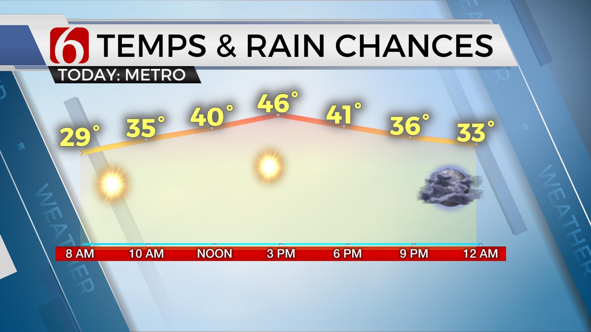
In summary, you’ll need the big coats again today with morning temps in the upper 20s north and lower to mid-30s south. Afternoon highs will reach the lower 40s with mostly cloudy sky along with northeast winds near 10 mph. Clouds may briefly clear around sunset tonight with additional clouds arriving overnight into Friday. A few spotty showers or sprinkles are possible later this evening into Friday but not very likely for most of the area. This weekend features pleasantly warm and sunny weather.
Thanks for reading the Thursday morning weather discussion and blog.
Have a super great day!
Alan Crone
More Like This
January 30th, 2020
November 30th, 2022
November 1st, 2022
August 26th, 2022
Top Headlines
December 13th, 2024
December 13th, 2024
December 13th, 2024
December 13th, 2024


