Near Record-Low High Temps, Rain For Northeastern Oklahoma
Near Record-Low High Temps, Rain For Northeastern OklahomaMonday, May 11th 2020, 5:48 am
The upper air flow will remain rather weak and from the west to east for the next two days before regressing to normal with a southwest upper flow pattern for the 2nd half of the period into the weekend. Once the upper air pattern changes, the threat for severe weather across northeastern OK will increase from Wednesday through part of the weekend.

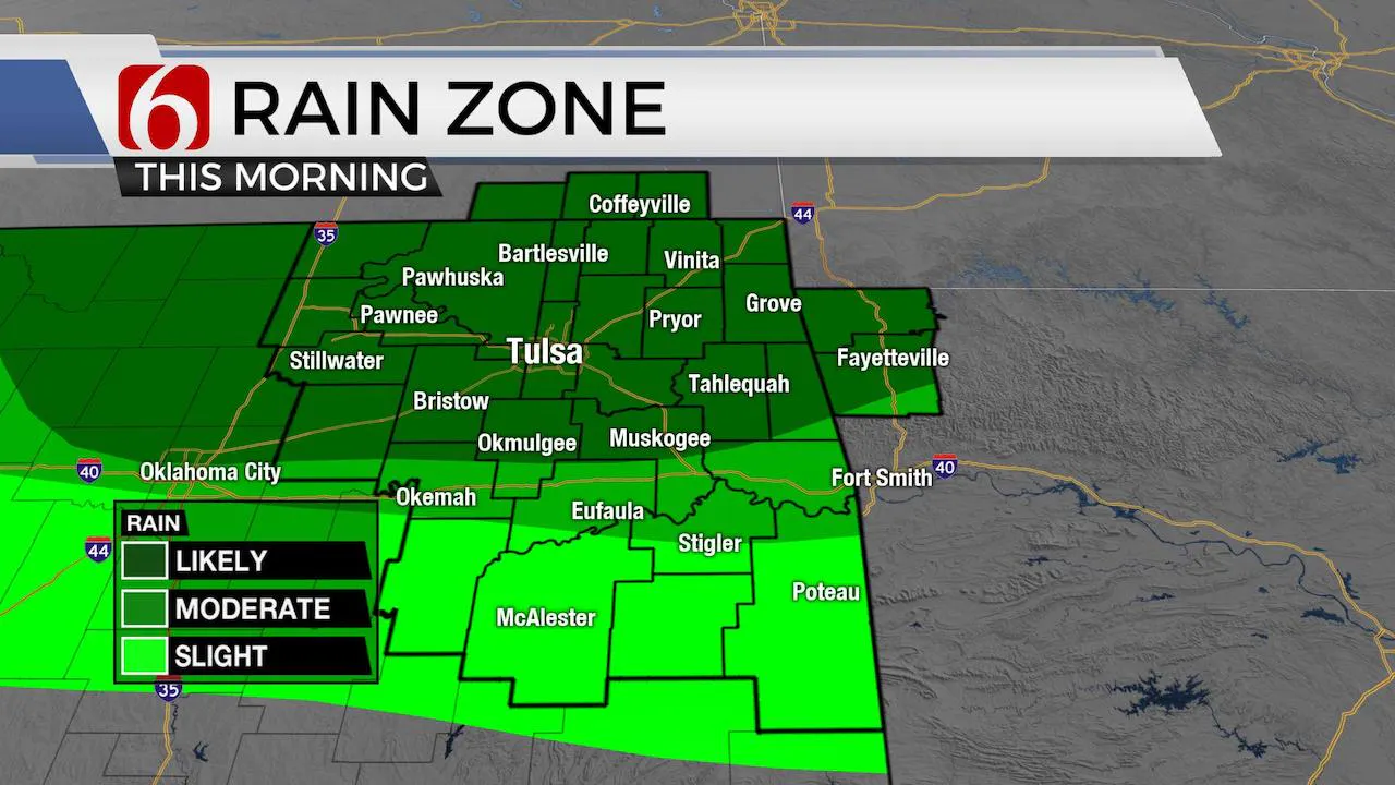
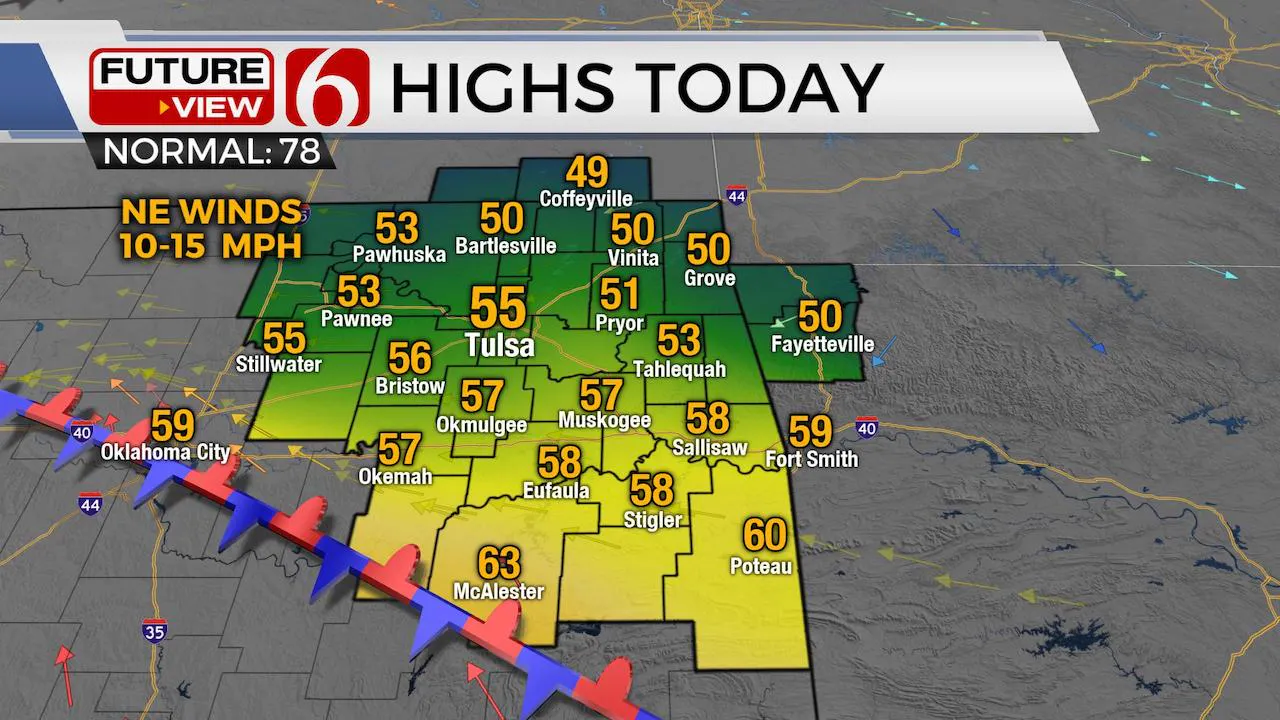
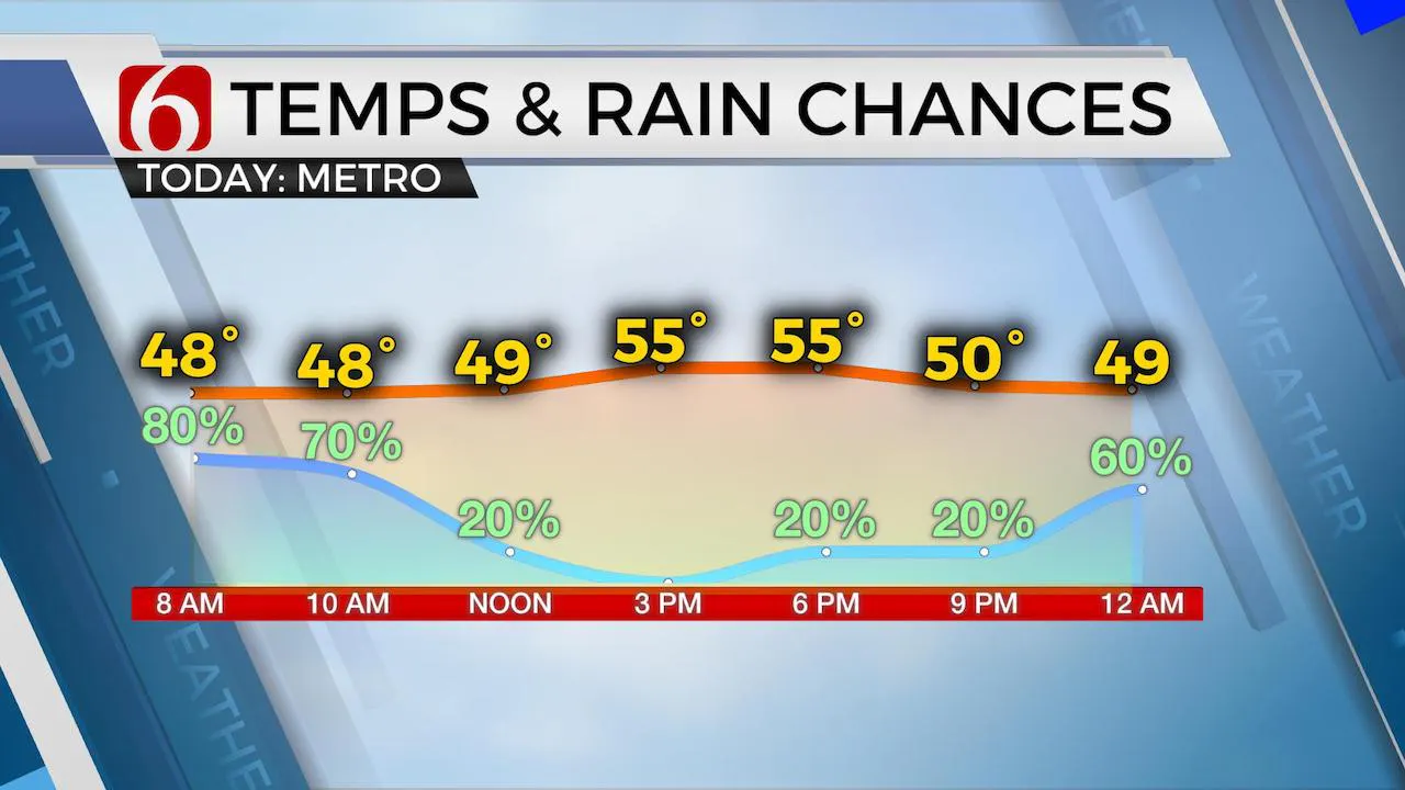
A series of cold fronts have been moving across the nation including part of Oklahoma over the past few days, with the last front moving across the area yesterday. The deep upper air trough across the eastern third of the nation has led to record low temps, both minimum and maximum lows, along with snowfall across part of the NE U.S the past few days. Oklahoma has been located on the far western edge of influence but will continue to feature well below normal temps trough Tuesday before experiencing a fast warm-up along with increasing humidity values by Wednesday into the latter half of the week. Our current pattern will bring a weak disturbance near the state this morning which should bring increasing rain chances for at least northern OK today and over a larger area by Tuesday morning. Highs both today and tomorrow should remain well below seasonal averages, with readings both days in the lower or mid-50s before temps in the 80s return for the 2nd half of the week. Our forecast high today for the metro currently stands at 55, which would be cooler than our previous daily record low-high temp of 58 from 1912. Another record is likely Tuesday.

The boundary that moved across the area yesterday is positioned to our south this morning and will remain stationary across part of north TX today and early tomorrow. Tuesday night this boundary will begin lifting northward as a warm front due to pressure falls across the Rockies as the upper air pattern changes. A surface dry line is more likely to develop across far western OK or the panhandle by Thursday with a series of weak upper impulses traveling over the region daily spreading thunderstorms off the dry line and moving eastward. Our pattern will bring increasing storm chances from Wednesday night into Thursday morning and again Thursday night into Friday morning. This same pattern should also bring another round nearby Friday night into Saturday morning across northeastern OK. The threat of some strong to severe storms will be mentioned for these time periods.

By Saturday night into Sunday, a mid-level ridge of high pressure may develop across part of the southern plains by the approaching weekend providing for a respite from the storms, but then would more than likely retrograde or weaken by the following week with additional storm activity developing.
Thanks for reading the Monday morning weather discussion and blog.
Have a super great day!
Alan Crone
More Like This
May 11th, 2020
August 8th, 2023
July 4th, 2023
May 8th, 2023
Top Headlines
December 13th, 2024
December 13th, 2024
December 13th, 2024
December 13th, 2024


