Wet Wednesday, Storm Chances Continue For Northeastern Oklahoma
Wet Wednesday, Storm Chances Continue For Northeastern OklahomaWednesday, May 27th 2020, 6:09 am
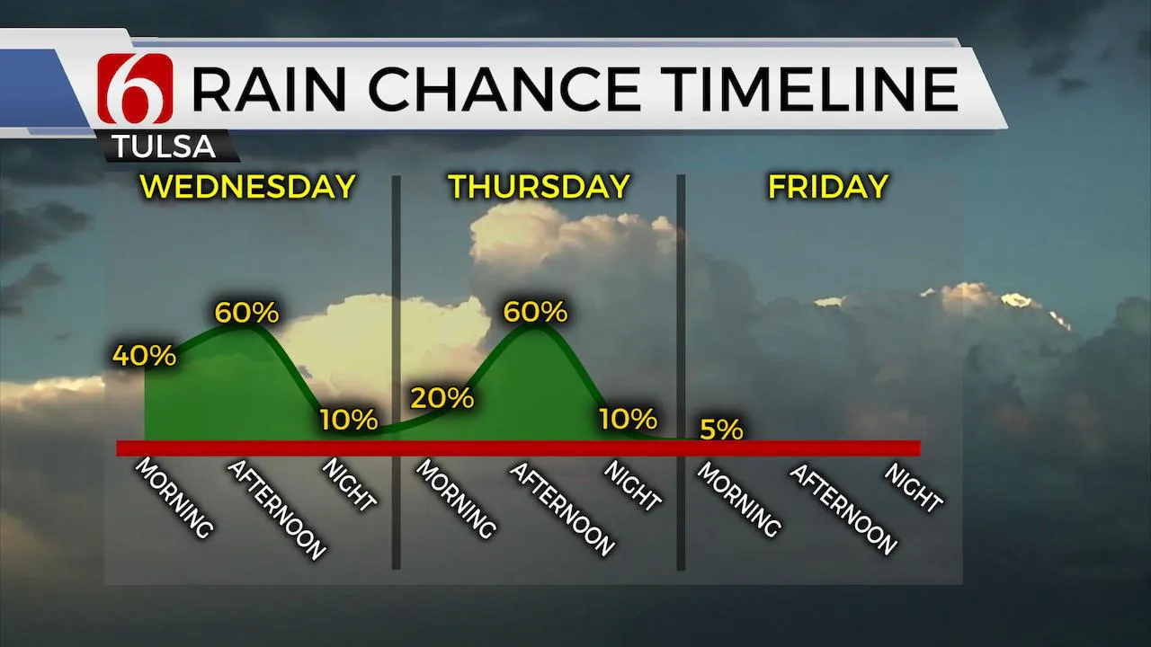
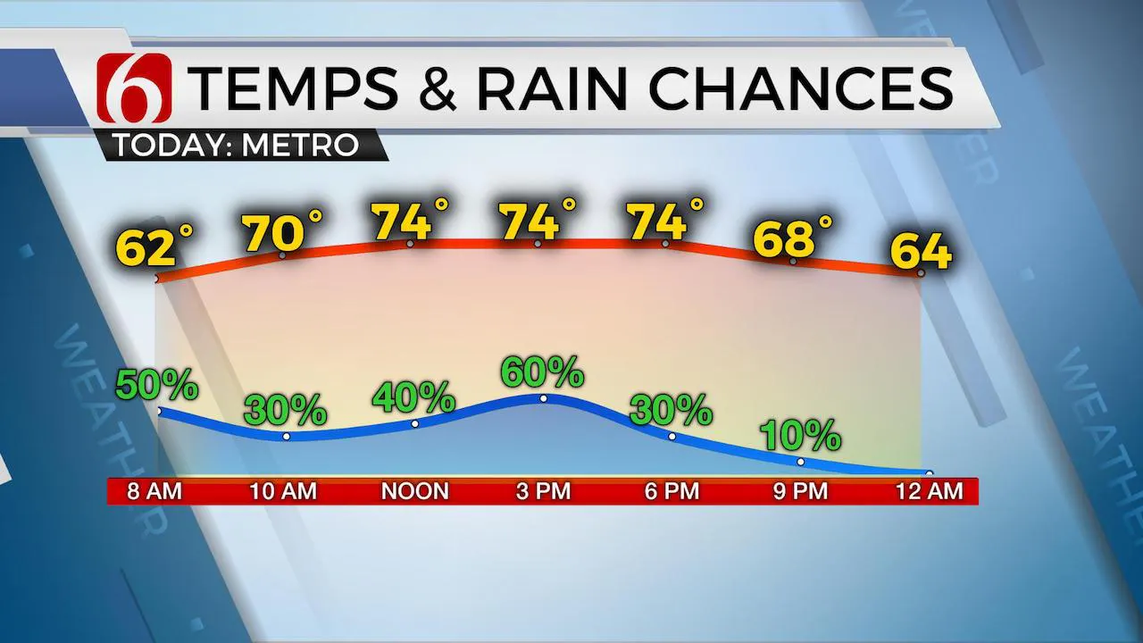
Another 36 to 48 hours’ worth of active weather before the midlevel low currently across southeastern OK gets a shove eastward and improving conditions arrive into the weekend. We’re finally looking at some sunshine and warmer weather this weekend as a midlevel ridge of high pressure arrives across most of the southern plains. This pattern may also persist for a few days next week with gradually increasing heat and humidity. Today we’re continuing with scattered showers and storms along with highs reaching the mid-70s. This pattern will also continue Thursday. A few of the storms may produce some heavy downpours and locally gusty winds and penny hail, but the overall severe weather threat should remain very low. Sometimes a few tropical funnel clouds can occur with this pattern, but these rarely descend. Based on the pattern, if this occurs, it would mostly be along the OK-AR state line and points eastward today. Morning lows will remain in the lower 60s and highs int the lower to mid-70s both today and Thursday. We’ll be reaching the lower 80s this weekend with sunshine.

The position of the midlevel low today should bring a few bands of scattered showers and storms across part of the area both later today and Thursday, but some locations will also remain dry. Hi-res data develops a few showers during the morning hours and then a few bands should be possible through the afternoon. This tropical like atmosphere can produce pockets of heavy downpours. Higher chances Thursday should arrive through the midday to afternoon as the low drifts east and activity develops on the northwest side of the low from southern Kansas into northeastern OK by afternoon. By Thursday evening, the low is moving east, and this will be the signal for the advancement of a dry weekend across eastern OK with plenty of sunshine and seasonally warm weather.

The pattern early next week may bring some early summer conditions back to the region. It’s not impossible that we’ll be approaching the upper 80s near 90 by late next week before we see a possible system nearing.
Thanks for reading the Wednesday morning weather discussion and blog.
Have a super great day!
Alan Crone
More Like This
August 8th, 2023
July 4th, 2023
May 8th, 2023
Top Headlines
December 14th, 2024
December 14th, 2024
December 14th, 2024
December 14th, 2024


