Mostly Dry, Warm Weather Pattern For Northeastern Oklahoma
Mostly Dry, Warm Weather Pattern For Northeastern OklahomaFriday, June 12th 2020, 9:56 am
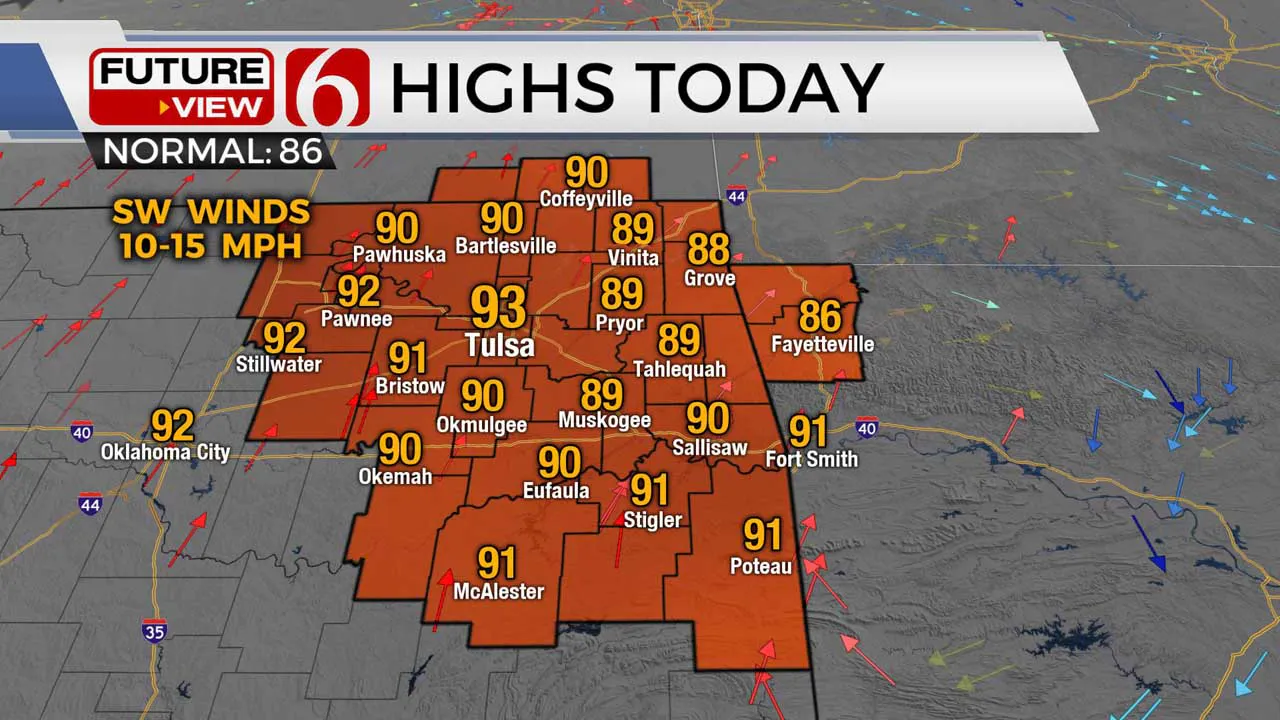
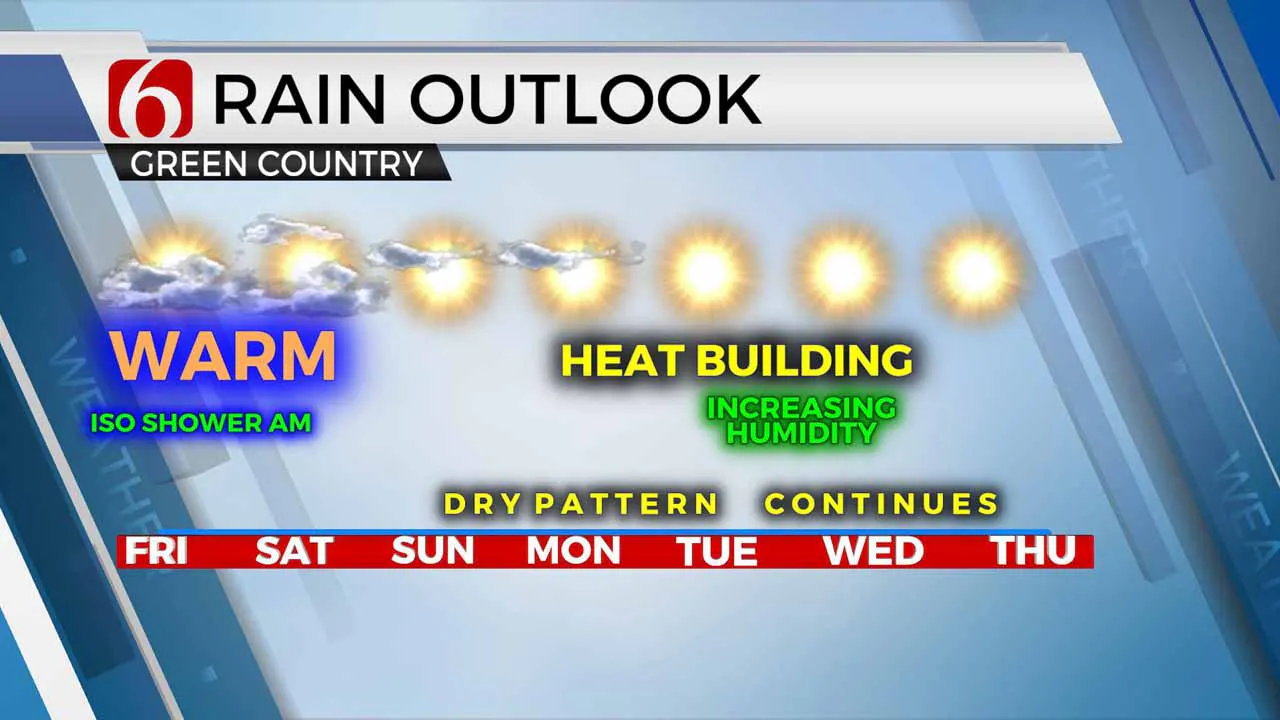
A mostly dry and warming weather pattern will persist for several days across most of northeastern OK with above normal temperatures into most of next week despite a few spotty morning showers nearby. Temperatures remain mild this morning with most locations starting the mid-60s. Later this afternoon, the metro reaches 93 with most locations across eastern OK nearing 90. Southwest winds from 10 to 15 mph will remain today and through the weekend.

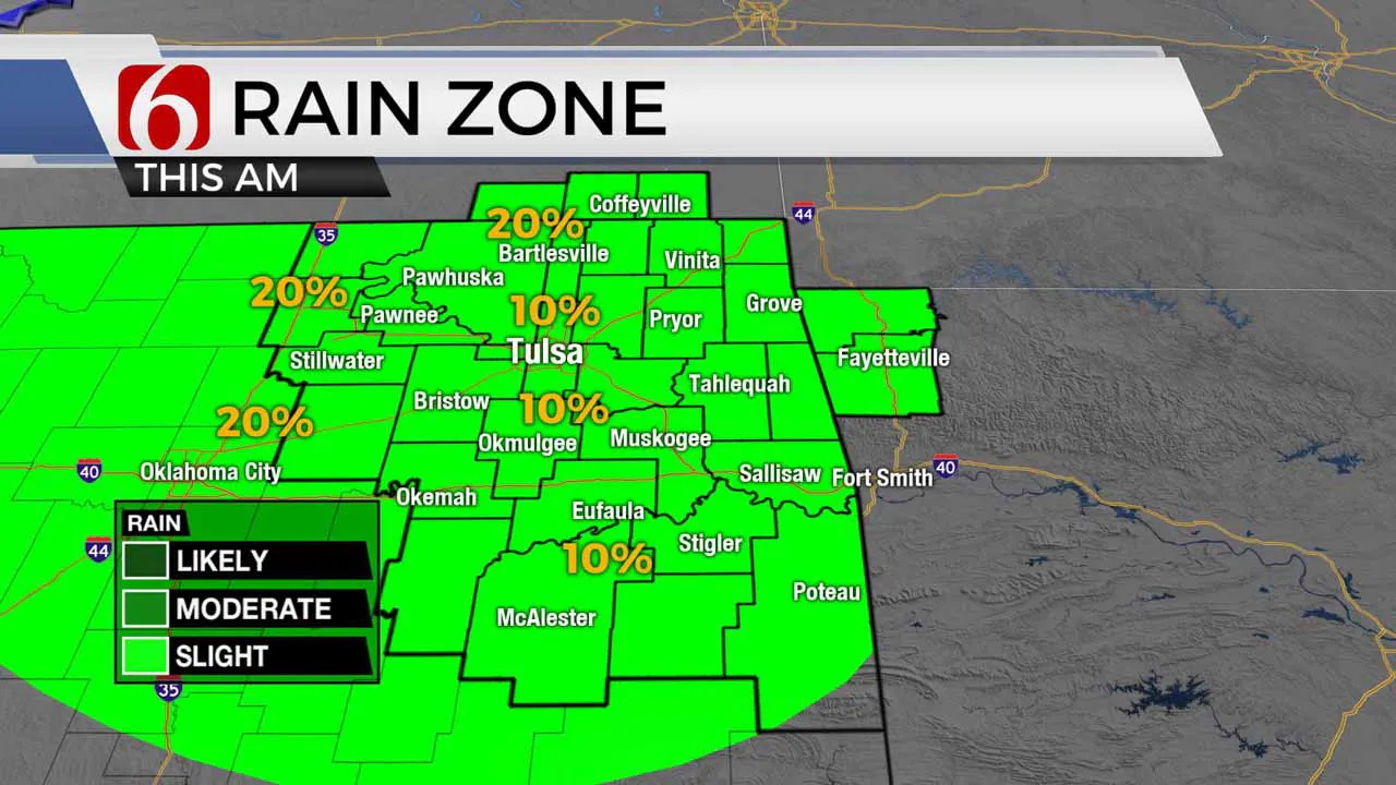
A few showers and leftover storms are located across northwestern OK this morning positioned on the top side of the center of the mid-level ridge of high pressure located across part of northwestern Texas. The ridge of high pressure, while still mostly in control across eastern OK is now centered to our west-southwest. This has created a northwest flow aloft across part of the plains, but the flow is very weak. While these showers currently across NW OK will not survive the trip eastward into our area, a few clouds should continue in our direction through the morning hours. Some of the hi-res data does produce a few small spotty showers or sprinkles across part of NE OK this morning and we’ll need to keep a mention for northeastern OK during the morning hours. This same scenario is likely to unfold again early Saturday morning along the I-35 corridor but would remain west of our main region. Saturday afternoon, there will be a small window for a few showers or storms developing across northwestern Arkansas near the state line region this weekend. All of these probabilities will remain near or less than 10% for eastern OK during the next 36 hours.

Most of us will experience a warming trend for the next few days with morning lows in the upper 60s and lower 70s with daytime highs reaching the lower to mid-90s. While significant low-level moisture remains well south across the Gulf of Mexico, evapotranspiration will slowly be increasing daily humidity levels resulting in some minor heat index values this weekend. Later next week, onshore flow across southeastern Texas will aid in returning deeper low-level moisture across east Texas into eastern OK by Thursday and Friday of next week. Before this happens, most of northeastern OK will remain under the influence of ridging keeping us dry and warm.

Later next week into next weekend, some data suggest the ridge will flatten as the westerlies migrate slightly southward with a pacific trough loading to the northwest. This pattern would bring active weather near the state with some storm chances.
Thanks for reading the Friday morning weather discussion and blog.
Alan Crone
More Like This
June 12th, 2020
September 29th, 2024
September 17th, 2024
Top Headlines
December 14th, 2024
December 14th, 2024
December 14th, 2024
December 14th, 2024


