Week Starting Off With More Summer Heat Across Green Country
Week Starting Off With More Summer Heat Across Green CountryMonday, June 15th 2020, 8:39 am
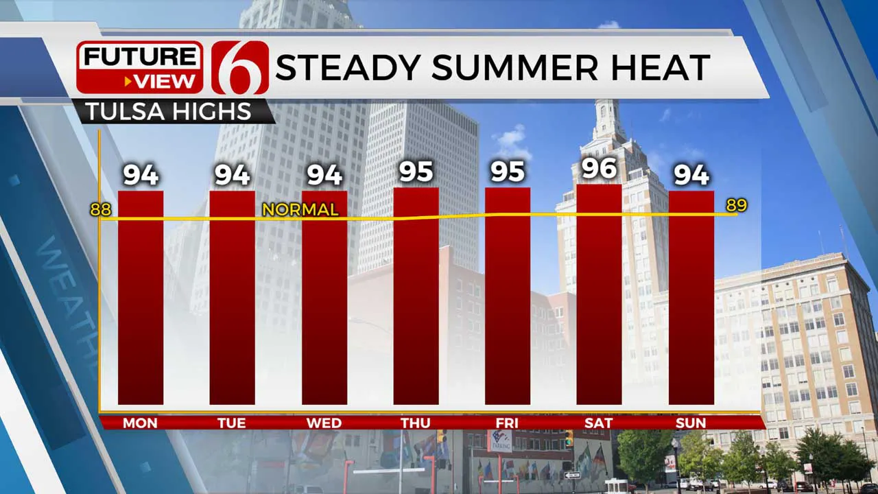
The steady summer heat is rolling right along as we start another week.
Our weather pattern is nearly a rinse-and-repeat of this past weekend. Expect plenty of sunshine, humid mornings, and toasty afternoons!

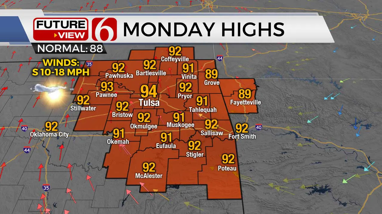
Highs will climb back into the lower 90s for our Monday afternoon with a south breeze. Humidity values are a little more noticeable, but they’re still not back to the miserably muggy levels we had at the beginning of the month. A very isolated pop-up shower or storm could bubble up across far southeastern Oklahoma, though the large majority will stay dry.

We’ll do it all over again on Tuesday. Once again expect plenty of sunshine, a humid morning, and a hot afternoon with highs back in the lower to mid 90s. There is a slightly better chance for a few rogue pop-up storms during the heat of Tuesday afternoon, though no widespread rain is expected and again a lot of us will stay dry.
And guess what: It’s almost the exact same thing Wednesday! We’re in a very persistent summertime pattern over the next several days, as an upper level ridge holds off any major storm system from impacting Green Country, and keeps the heat in place. As we head toward the end of the weekend and into Father’s Day Sunday, we may finally see a more noticeable changes towards better rain chances, but that’s still several days off.
I hope you have a great Monday, Green Country! You can follow me on Twitter @StephenNehrenz as well as my Facebook page Meteorologist Stephen Nehrenz to stay up to date with the very latest!
More Like This
June 15th, 2020
August 8th, 2023
July 4th, 2023
May 8th, 2023
Top Headlines
December 11th, 2024
December 11th, 2024
December 11th, 2024
December 11th, 2024


