Warm, Dry Thursday Before Rain Chances Arrive
Warm, Dry Thursday Before Rain Chances ArriveThursday, June 25th 2020, 6:36 am
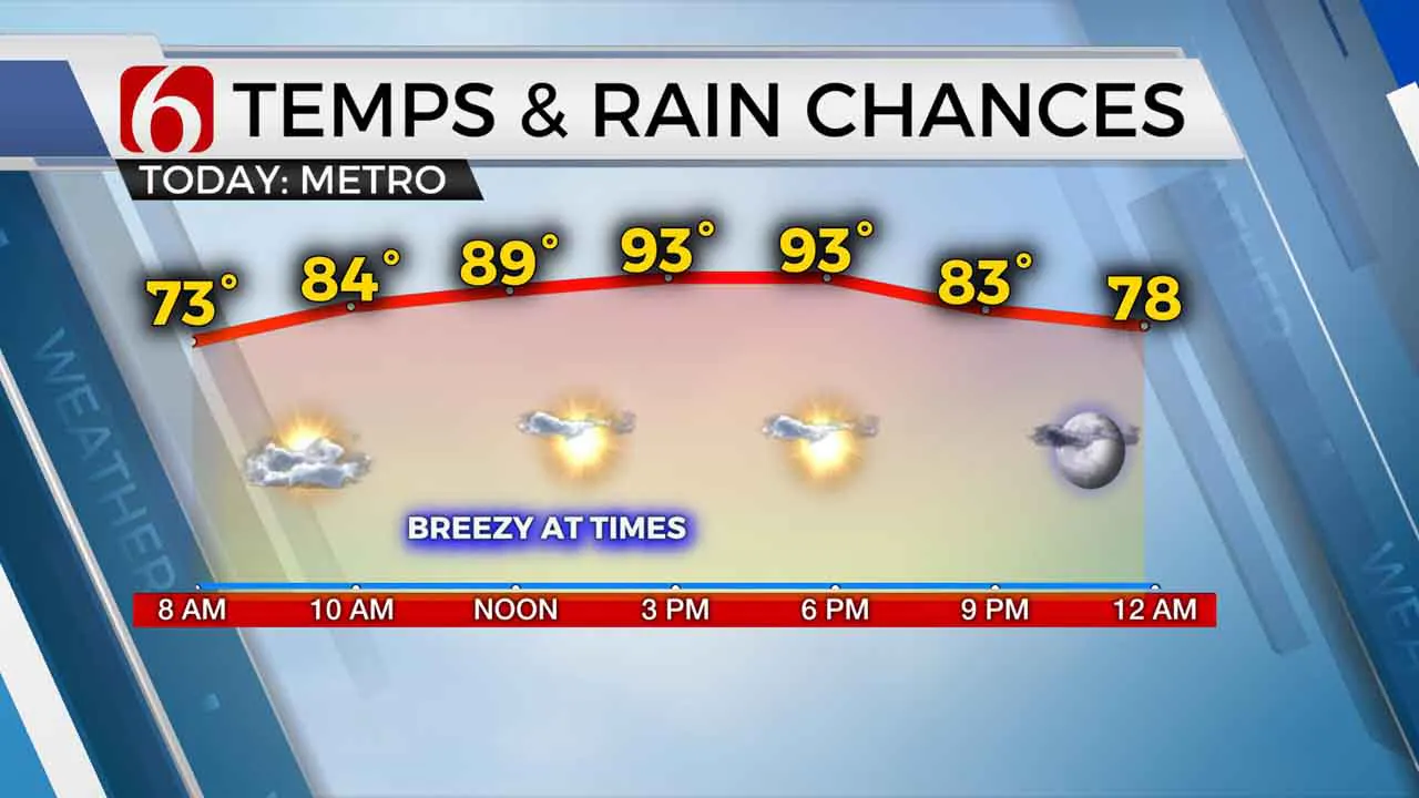
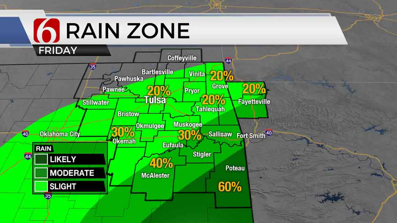
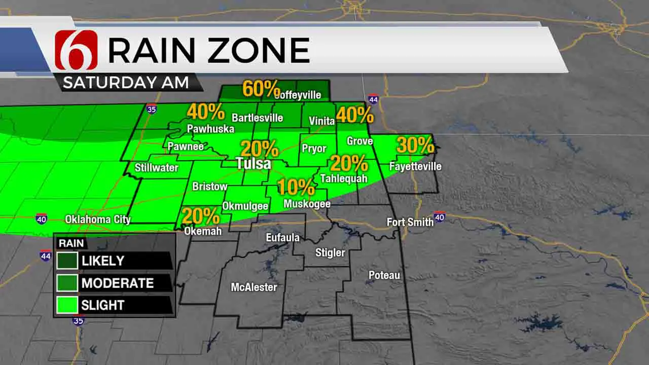
I’m tracking a few showers and storms this morning across Kansas, but these will remain too far north to impact our area of concern. After some early morning clouds, we’ll experience sunshine along with gusty south winds from 10 to 20 mph and highs nearing the lower 90s for many locations. Dry weather is likely again today and most of tomorrow for the metro before a storm complex will brush the area Friday evening into Saturday near or north of the metro. Beforehand, southeastern OK may experience a few scattered showers or storms during the day Friday. Gusty south winds will return this weekend with slowly increasing heat index values approaching the mid-90s. A few additional storms will remain possible Saturday, but overall chances will also remain low. Next week continues to look unsettled from a pattern recognition viewpoint. We’ll need to keep a slight mention for a few storms early next week but also feature increasing humidity and temperatures.

The overall set-up for the next few days hasn’t changed much from my post yesterday. The mean ridge of high pressure is located to our southwest. A strong upper trough is located across the Great Lakes region along with a developing trough across the Pacific Northwest. This trough ejects into the northern and central plains today with storms across part of the high plains. To our south, a small disturbance will arrive from southeast Texas into northeast TX Friday with a few showers and storms expanding northward into southeastern to east-central OK through tomorrow afternoon. This activity will more than likely remain south of the metro, but a few locations across southeastern and east-central OK should experience an isolated storm or two tomorrow.

Friday night into Saturday the northern trough pushes a boundary across central Kansas before the front will “wash-out” or become diffuse. Storms are likely to take a run at southeastern Kansas early Saturday morning with a few moving into far northern OK. I’ll include a mention for the metro during this time period.

Saturday, a few scattered storms will be possible, but with no major forcing mechanism nearby, the chances will remain low.
Temps this weekend will stay in the lower to mid-70s for morning lows along with lower 90s for afternoon highs. Gusty south winds will slowly increase local dew points and heat index values will be reaching the mid to upper 90s.
Next week is a toss-up at this point. The spread in the data regarding the overall upper air pattern is significant. At this point, I’ll be keeping slight mentions for some late night and early morning storms, but chances will remain low into early next week.
Thanks for reading the Thursday morning weather discussion and blog.
Have a super great day!
Alan Crone
More Like This
June 25th, 2020
August 8th, 2023
July 4th, 2023
May 8th, 2023
Top Headlines
December 12th, 2024
December 12th, 2024
December 12th, 2024


