Low Rain Chances Return with Muggy Weekend Weather
Low Rain Chances Return with Muggy Weekend WeatherFriday, June 26th 2020, 8:00 am
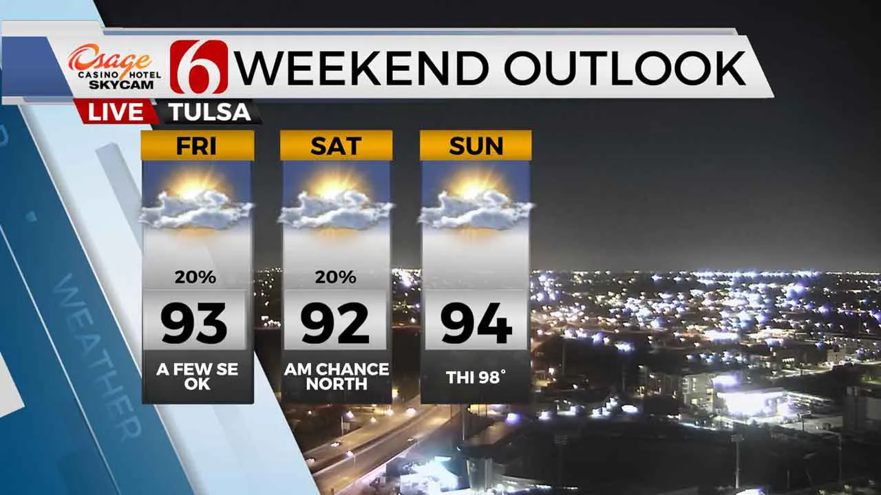
Welcome to the weekend. Well, almost. We’re tracking two distinct waves this morning that will bring a few showers and storms near the region for the next 36 hours, but many locations will remain dry. Severe weather threats will also remain quite low as stronger forcing will be located across the central and northern plains. A plume of Saharan dust overhead may also support some hazy skies into the weekend. Highs this afternoon will reach the lower 90s from the Tulsa metro region west along with some hazy sunshine and gusty south winds from 15 to 25 mph before a few clouds arrive by midday to afternoon. Locations southeast of the metro will remain mostly cloudy with highs reaching the upper 80s along with breezy weather.

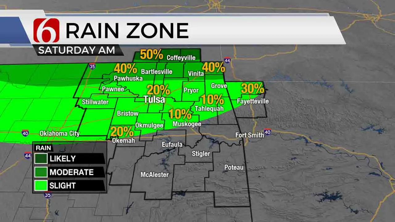
A few showers or storms will be likely across far southeastern OK today with very low mentions for the Tulsa metro. Slightly higher chances will be included for the I-40 corridor into western Arkansas this afternoon and early evening. Later tonight, storms will be developing across central Kansas and move southeast, nearing the Oklahoma and Kansas state line region by early Saturday morning. The metro will remain near or less than a 30% chance with slightly higher probabilities along the state line region. The best chance will be extended across southeastern Kansas for the early morning hours. Any additional storm chances during the day Saturday should be limited to isolated mentions as most of the forcing will be removed to the northeast of the state. The wildcard for Saturday would be the possibility of a convectively induced area of vorticity near northern OK. Basically, what happens Saturday morning with our storm chances will determine any storm chances for Saturday afternoon. Low level flow will be improving this weekend into early next week with increasing dew point temps bringing heat index values nearing 100 Tuesday and Wednesday.

The pattern next week is highly uncertain. The two major long-range models have major discrepancies in the mid to upper level flow and positioning of some important features. For this forecast update, I’ll be keeping slight mentions for a few storms Monday morning across part of eastern OK. These chances will remain low. Hopefully, my confidence will improve regarding later next week. At this point, our forecast remains with lower to mid-90s and a slight chance for storms Thursday into the weekend. Some of the data would support much higher chances for later next week than we currently have in the forecast.
Thanks for reading the Friday morning weather discussion and blog.
Have a super great day!
Alan Crone
More Like This
June 26th, 2020
August 8th, 2023
July 4th, 2023
May 8th, 2023
Top Headlines
December 11th, 2024
December 11th, 2024
December 10th, 2024


