Few Isolated Storms Tuesday Morning, Heat, Humidity Follows For Next Few Days
A few isolated storms may still develop this morning as a weak upper level disturbance exits the area, but our focus continues to be heat and humidity for the next few days.Tuesday, June 30th 2020, 6:41 am
TULSA, Okla. -
A few isolated storms may still develop this morning as a weak upper level disturbance exits the area, but our focus continues to be heat and humidity for the next few days.
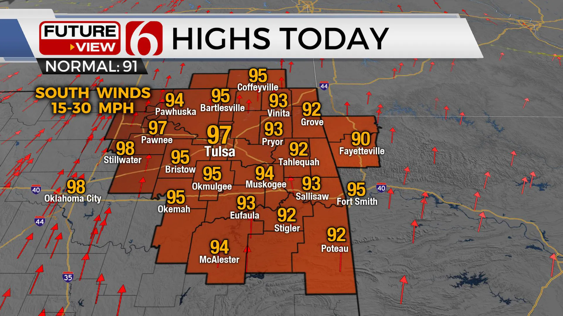
We’ll be experiencing the warmest weather of the summer season for the next three days with afternoon highs nearing 97 today and 100 Wednesday and Thursday before a weak boundary brings some minor relief for the 4th of July Holiday Weekend.

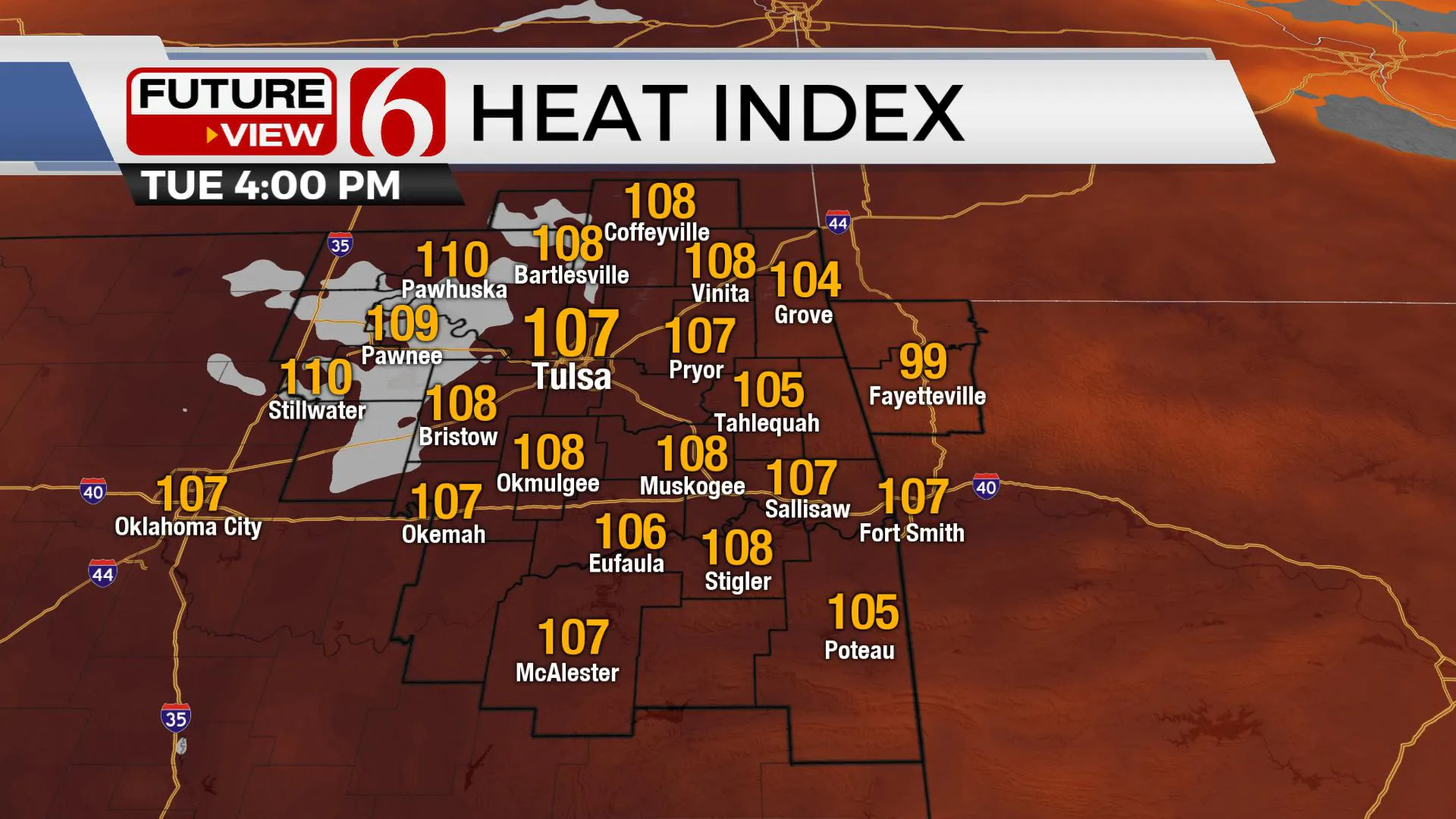
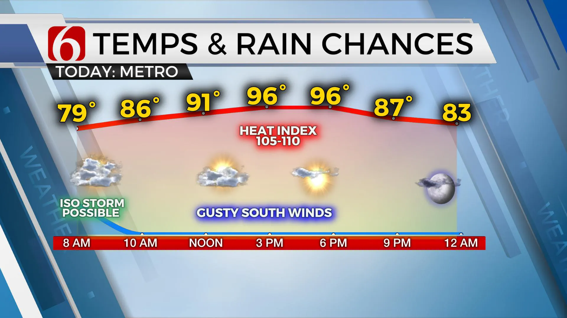
Temperatures will start this morning in the upper 70s to lower 80s before reaching the mid-90s along with gusty south winds from 20 to 30 mph. Heat index values today will reach the 100 to 110 range this afternoon through Thursday resulting in heat advisories for part of Northeastern OK. The weak boundary moves across the area Thursday afternoon and evening bringing a slight chance for a few storms followed by a minor reduction in humidity for the weekend.
A weak disturbance continues lifting northeast across part of the area this morning. A few showers and storms have developed but will continue to be rather isolated in nature. We’ll take anything we can get right now, so yes, even isolated storms will be mentioned in the forecast.

A ridge of high pressure will continue to slowly build across the area today through Wednesday before gradually moving back west Thursday into Friday. Wednesday and Thursday highs should reach near 100 but with dew points in the lower to mid-70s, heat index values are expected to reach the 105 to 112 categories for most of eastern OK. As the weak boundary approaches Thursday afternoon, moisture pooling along the front may still allow high heat indices before north winds arrive bringing some minor relief into the weekend. Any storm activity Thursday night into Friday currently will remain with low probabilities for this forecast update.

The upper air flow this weekend should remain mostly from the north. This may bring a few isolated storm chances into the state this on the 4th with highs near 94 and heat index values near 100. North to east winds Saturday may also help to ease the dust layer that will be present for the next few days across the region. The ridge will expand over the area again early next week.
Thanks for reading the Tuesday morning weather discussion and blog.
More Like This
August 8th, 2023
July 4th, 2023
May 8th, 2023
Top Headlines
April 19th, 2024
April 19th, 2024
April 19th, 2024


