Warm Muggy Weather Today, Storm Chances Increase For Thursday
Warm and muggy weather again today, but storm chances will increase into early Thursday morning.Wednesday, July 8th 2020, 6:23 am
TULSA, Okla. -
Warm and muggy weather again today, but storm chances will increase into early Thursday morning.
The main item of interest continues to be the mid-level ridge of high pressure that brings scorching weather from the southwestern U.S. into 2/3rds of the state soon while keeping part of northeastern OK in a favorable position for a few late night or midday storm complexes to roll across the area, including Thursday morning and possibly Friday morning.
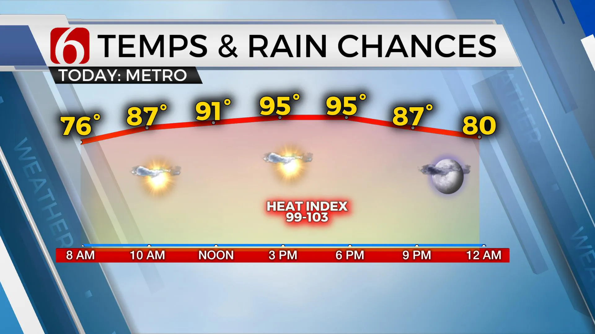
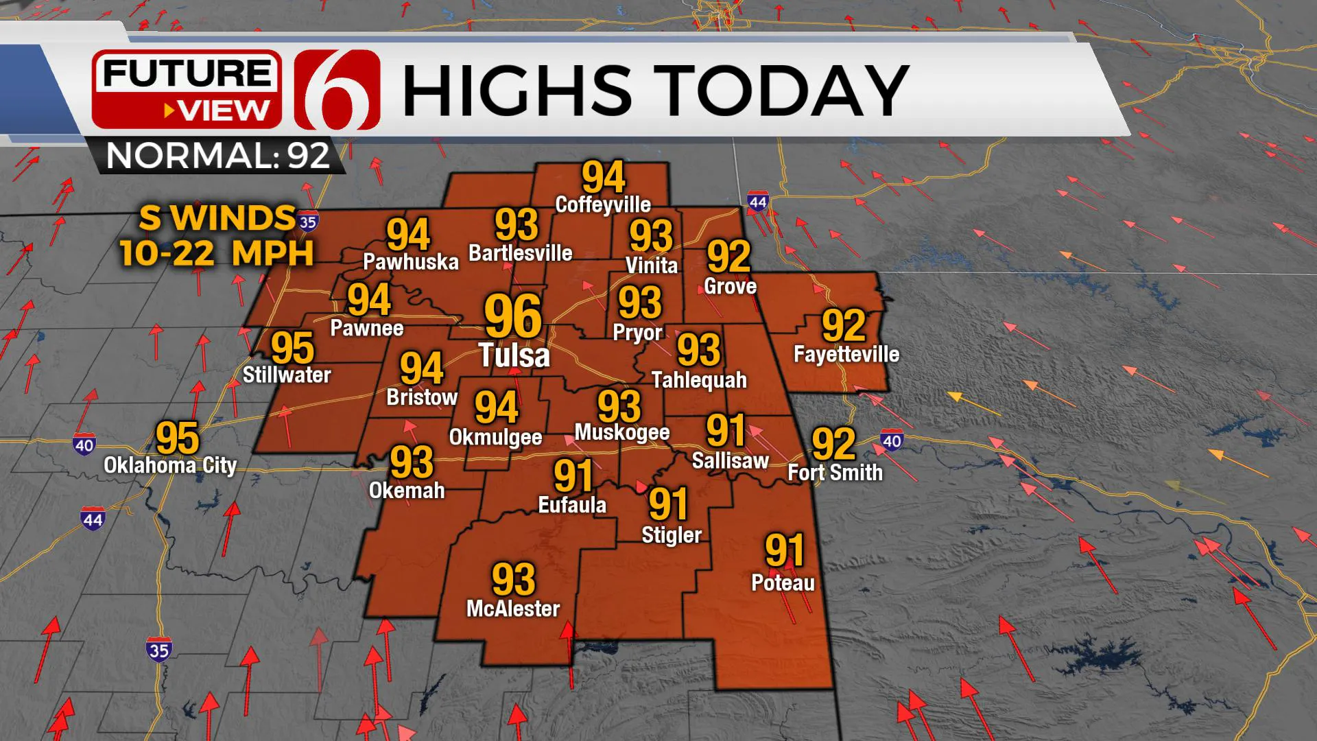
Highs today will once again reach the mid-90s near Tulsa with heat index values nearing 103 for the afternoon. I anticipate heat index numbers will move into the 105 to 110 range Thursday through Saturday and heat advisories will be required for certain locations of eastern OK.A weak back-door type front arrives Sunday bringing slightly drier air for about a day before south winds and deeper moisture surges across the area early next week.
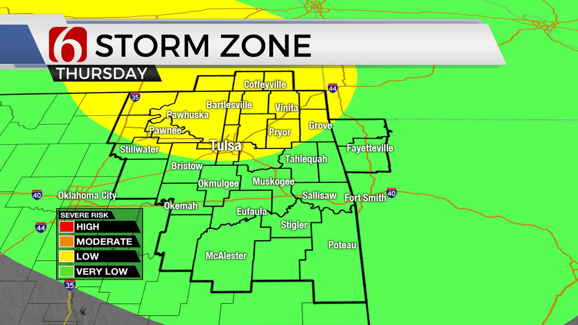
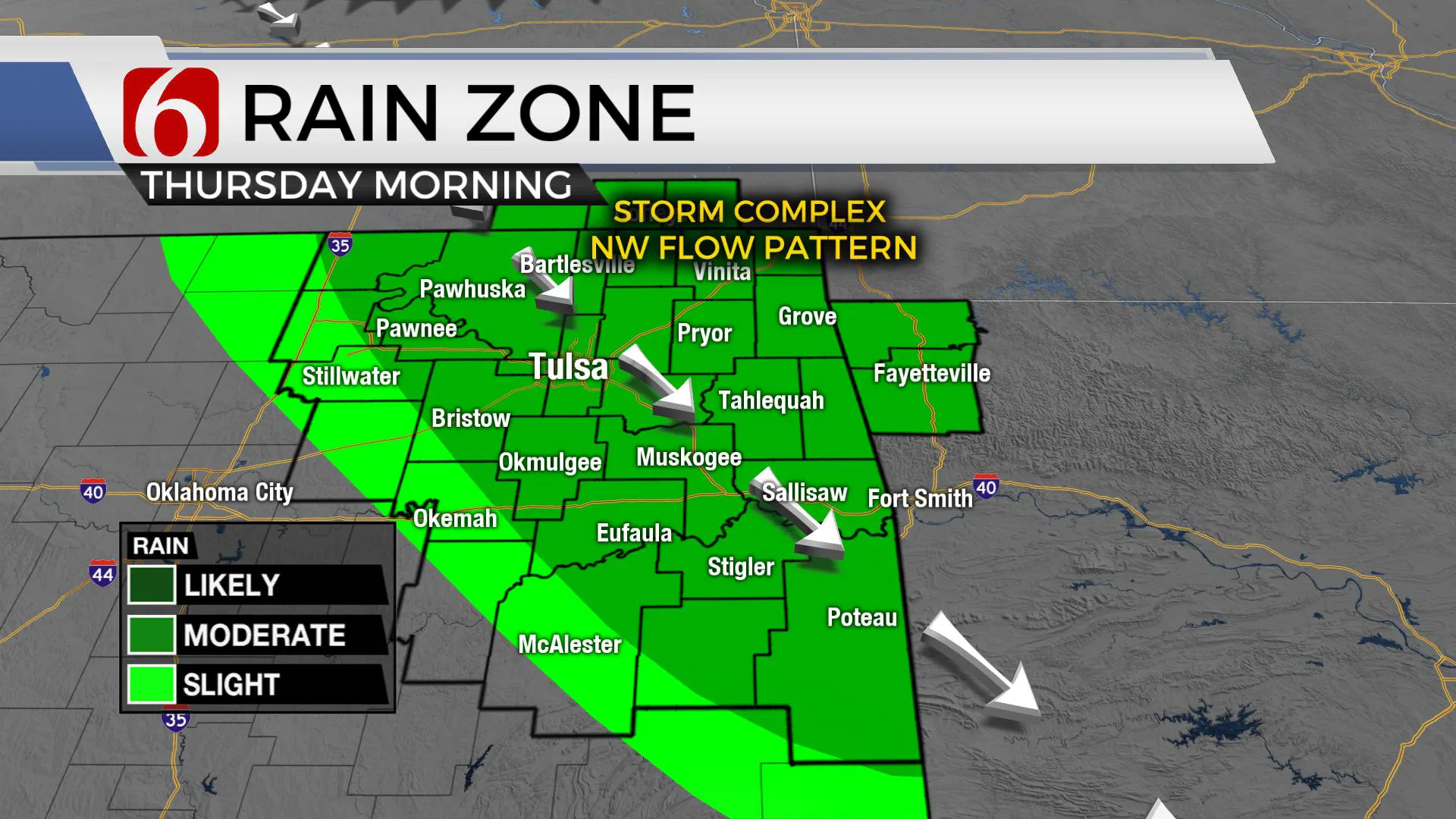
Triple digit temps are likely soon across central to western OK before gradually expanding into eastern OK early next week. A pop-up storm is possible today, but most locations will remain dry. Storms are becoming more likely early Thursday morning arriving from southeastern Kansas across northeastern OK.
The positioning of the ridge will keep a northwest flow draped across NE OK-SE Kansas and points east Thursday through part of the weekend. The various models support at least one, possibly two storm systems developing across the central plains and driving southeast into part of area, as early as Thursday morning to midday, or by Thursday night into Friday morning.
The position and strength of the ridge is different in some of the data and makes the forecast a little tricky. A stronger ridge more east will keep these storm systems near Grand Lake into southwestern Missouri. If the ridge remains slightly west, it will allow these systems to roll directly across the metro. Because of the differences in data, my confidence remains low. But keep in mind, these are chances for storm complexes, not just a pop-up storm. Real estate near or west of I-35 will be hot and dry during this period while spots near or east of the Tulsa must continue with the storm mentions.
Early next week, the ridge should eventually win-out for a few days bringing triple digit temps to Tulsa.
Thanks for reading the Wednesday morning weather discussion and blog.
More Like This
August 8th, 2023
July 4th, 2023
May 8th, 2023
Top Headlines
December 11th, 2024
December 11th, 2024
December 11th, 2024


