Tracking Storm Chances, Hot Weather For Northern Oklahoma
Storm chances remain for portions of southern Kansas and northern OK this morning through midday. A few additional chances remain for part of the weekend.Friday, July 10th 2020, 9:12 am
TULSA, Okla. -
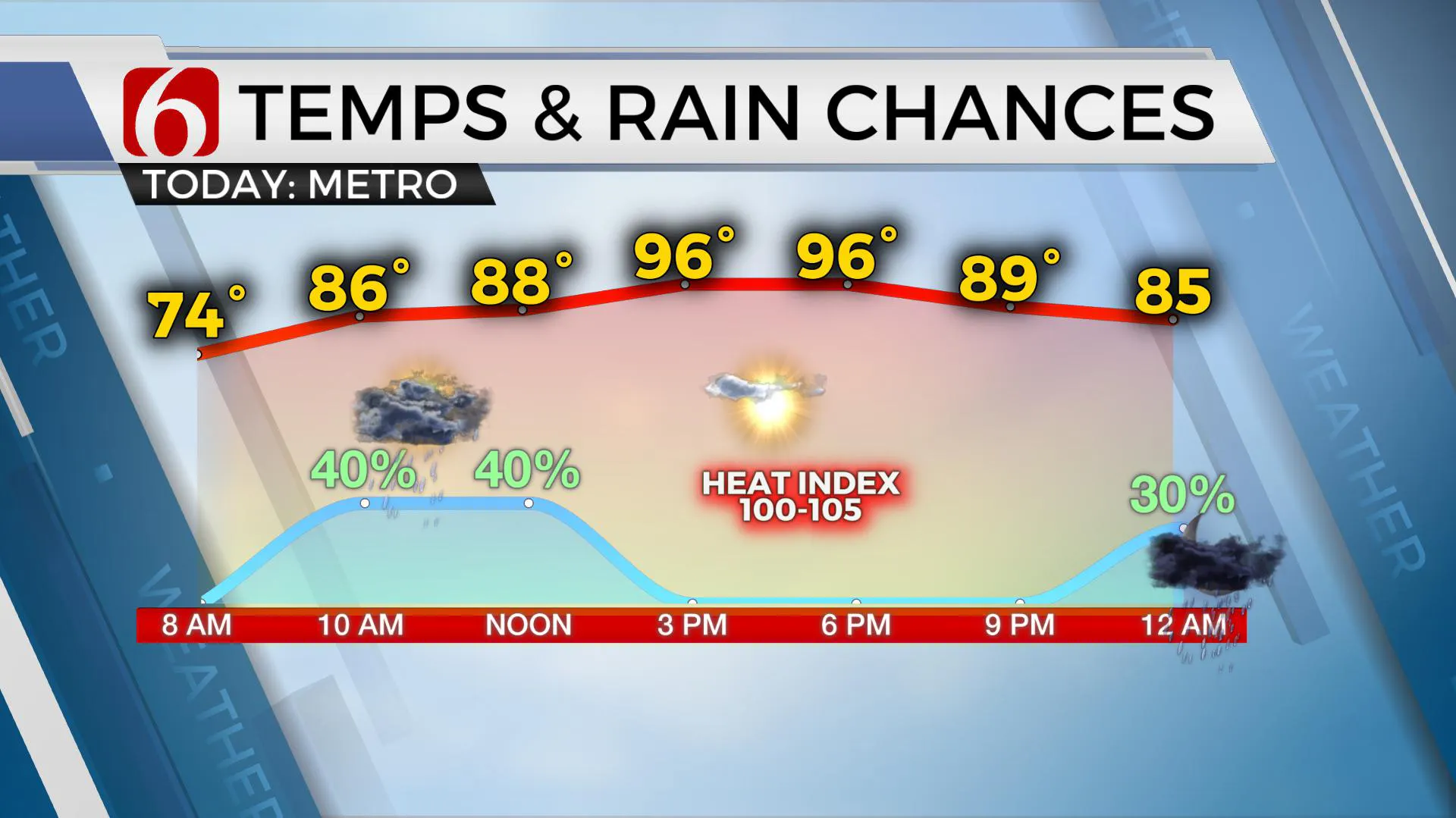
Storm chances remain for portions of southern Kansas and northern OK this morning through midday. A few additional chances remain for part of the weekend.
Some locations will remain dry. Another system may be near the area early Saturday morning with lower humidity arriving Sunday. The hottest weather of the summer season arrives next week.
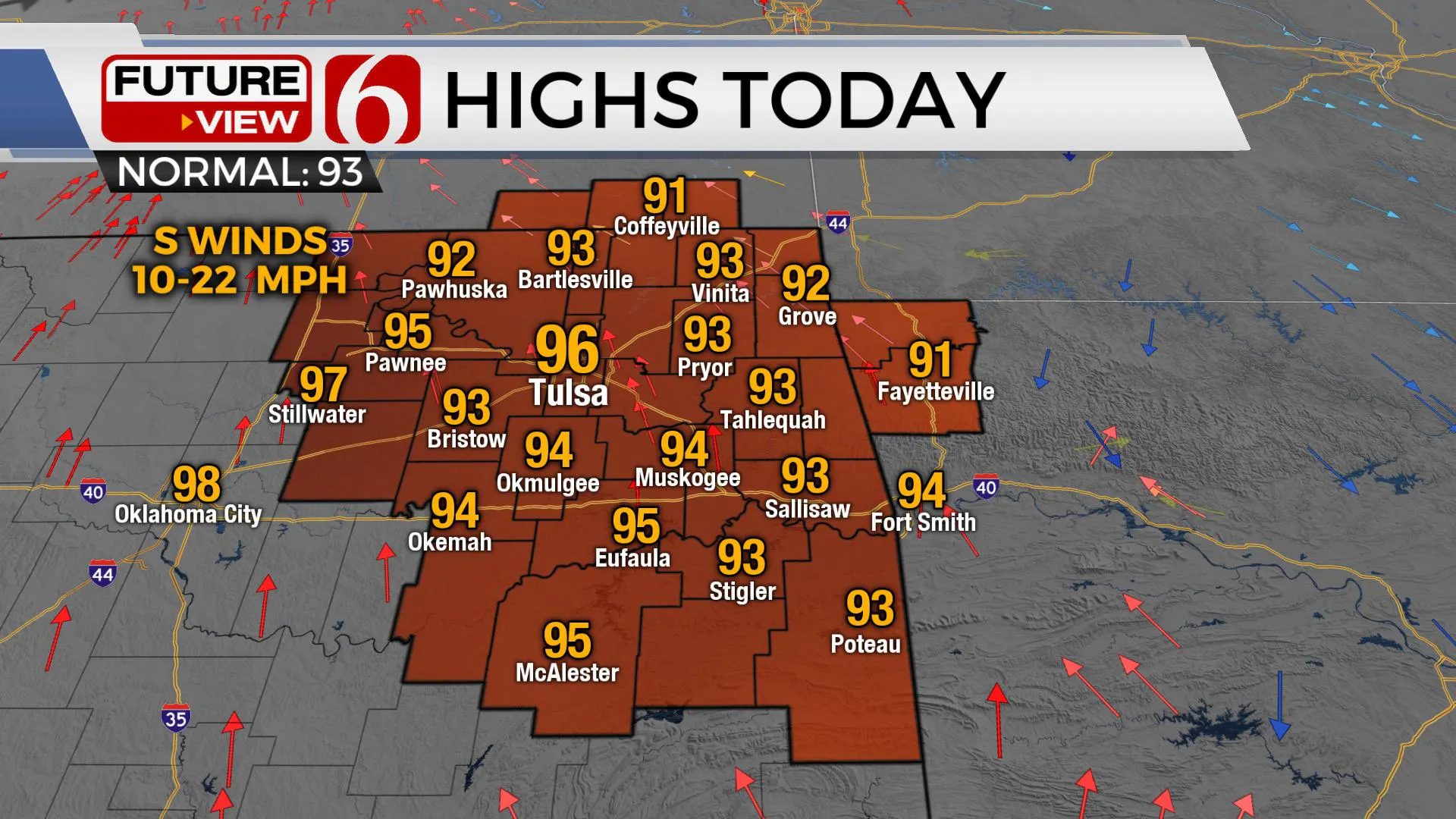
Here’s what we know this morning. The center of the mid-level ridge is centered upon Eastern New Mexico. The influence of this ridge covers most of the western third of Oklahoma with hot weather likely for several days. Heat advisories will remain for these regions. Locations near I-35 into eastern sections of the state will remain vulnerable to any disturbance that could drop down the northwest flow, which occurs due to the anticyclonic circulation around the ridge. Storms have developed this morning along I-70 in central Kansas with a severe thunderstorm watch until 10 a.m. for southern Kansas.

These will have a chance to move southeast along the periphery of the ridge, possibly moving into northern OK through the morning hours. Frankly, the data is all over the place this morning regarding different scenarios for the next 48 hours including mostly dry conditions and several chances for MCS development rolling across the area, even this morning to midday. I’ll take a compromise approach to the forecast for the weekend and continue with some chances for storms along with warm and humid weather today and Saturday.

A weak boundary nears northeastern OK tomorrow afternoon and eventually brings lower humidity across part of the area Sunday into Monday. This will bring us some minor relief in the heat index column Sunday and possibly Monday, but dry air heats efficiently and from Monday through all of next week, we’ll be placing triple digits on the 7-day planner for daytime highs.Low level moisture also slowly returns for the middle of next week. This means heat index values will also be increasing again Tuesday through the end of the week.
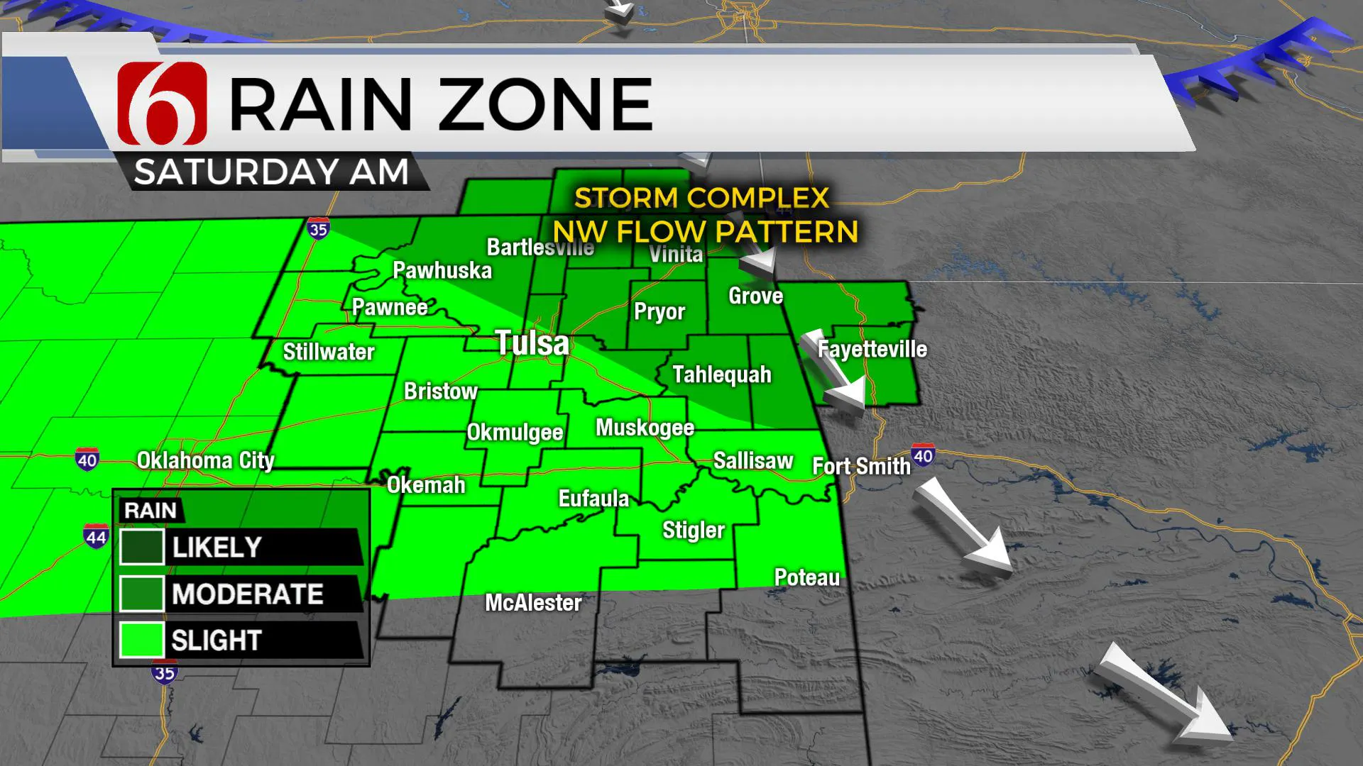
Saturday morning, we may be tracking a decaying MCS across part of Southeastern Kansas into far northeastern OK and southwestern Missouri. This could have some impacts near or east of the metro tomorrow morning.Any residual boundaries near the area Saturday afternoon would serve as a focal point for additional storm development through the afternoon. Later Saturday night into pre-dawn Sunday, another MCS signal is present and may bring a small cluster of storms across northeastern OK through the early morning hours.

Again, this is all predicated on the ridge center remaining west of the area. The forecasting issue for the last 7 days has been the strength and location of this ridge. If the ridge becomes stronger and expands eastward, even by 50 miles, this would take the storm chances completely out of the area this weekend. If the ridge remains in place as depicted this morning, the northwest flow window is wide open until Monday.
In summary, storm chances remain across part of the area today, and into part of the weekend.
Thanks for reading the Friday morning weather discussion and blog.
Have a super great day!
More Like This
July 10th, 2020
August 8th, 2023
July 4th, 2023
May 8th, 2023
Top Headlines
April 24th, 2024
April 24th, 2024


