More Storm Chances Before Pleasant Temperatures This Weekend
More Storm Chances Before Pleasant Temperatures This WeekendThursday, July 30th 2020, 7:02 am
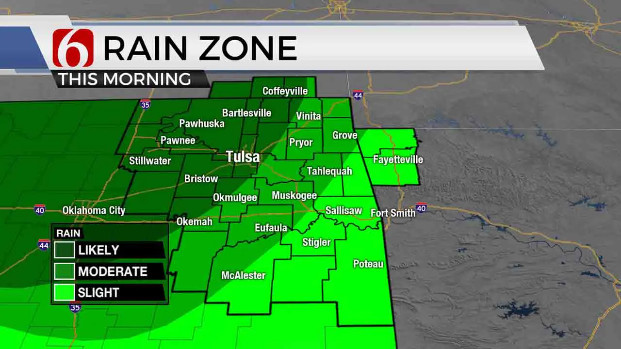
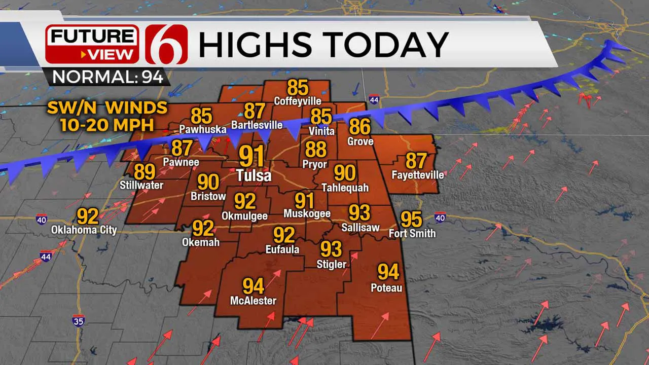
After a few morning storms, warm and muggy weather returns this afternoon in advance of a strong cold front that will bring severe weather threats to part of the area. Highs this afternoon will reach the upper 80s and lower 90s with heat index values nearing 99 to 105. After today, cooler weather will return through the weekend with no major heat index values. This pattern may continue for most of next week.

The potential for a few storms, some severe, will remain near the metro and northern Ok for the next few hours before dissipating as this batch travels south. Our focus will then return to a strong cold front approaching the area from the northwest early this afternoon bringing additional chances for storms, including the potential for strong to severe storms. The threat for severe weather later this afternoon or evening will depend upon what happens early this morning. Widespread rainfall this morning may keep the afternoon and evening severe threats south of the metro. If morning storms quickly end, locations along I-44 would be in the running for afternoon and early evening severe storms. Southeastern OK has the best chance of all based on either scenario later tonight. The atmosphere will continue supporting tropical downpours and heavy rainfall threats with this system. This front also eventually brings some slightly drier air into the area for the weekend with morning lows in the 60s and highs in the lower to mid-80s.

The ridge has amplified and is now positioned well north across the inter-mountain region and extends southward into the southwestern U.S. The clockwise flow around this feature brings a northwest flow pattern from the northern plains southward across the state. A stronger disturbance is now moving down this flow and will bring increasing storm chances into southern Kansas and northern OK early this morning before additional storms develop later this afternoon and evening. This trough will eject away from the plains early Friday morning to midday but some wrap around moisture may move across southeastern Kansas and northeastern OK Friday midday to afternoon. Even if we somehow remain dry with this feature, the additional cloud cover combined with north winds will bring highs downs into the upper 70s and lower 80s tomorrow afternoon. Most data support a pleasant weekend, but we may still see a small shower or two sneaking across the northwest flow Saturday evening into early Sunday morning and Sunday evening. I have included low probabilities for this potential. Otherwise, the pattern will support wonderful weather for the beginning of August and will remain for a few days next week. No major heat nor heat index values will be expected until possibly the end of next week.
Thanks for reading the Thursday morning weather discussion and blog.
Have a super great day!
Alan Crone
More Like This
July 30th, 2020
August 8th, 2023
July 4th, 2023
May 8th, 2023
Top Headlines
December 12th, 2024
December 12th, 2024
December 12th, 2024


