Morning Storms And Afternoon Humidity For Northeastern Oklahoma
Morning Storms And Afternoon Humidity For Northeastern OklahomaThursday, August 13th 2020, 8:22 am
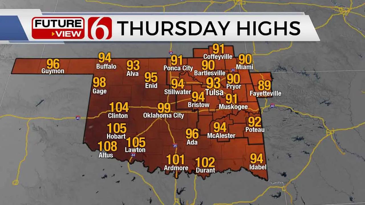
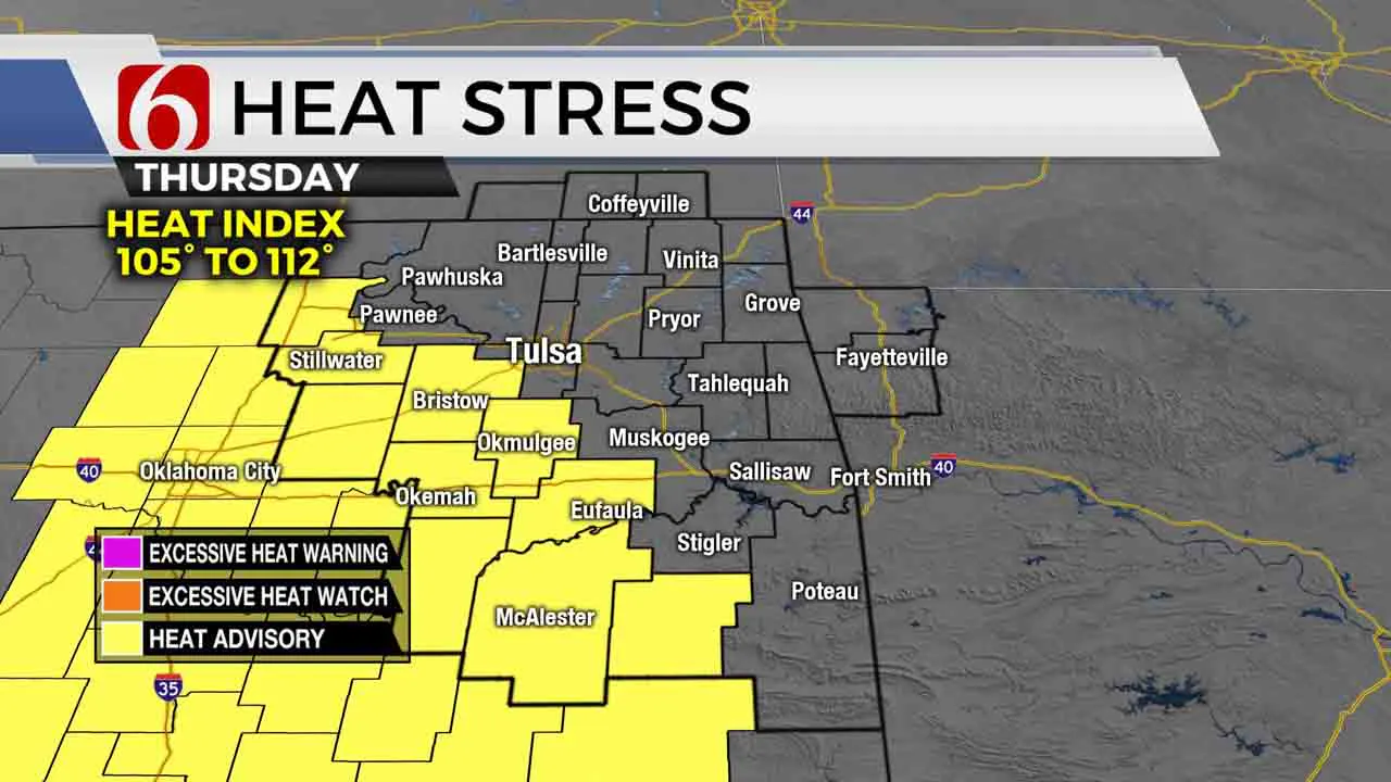
It has been a little busy early this morning with a round of strong to severe storms nearby. After the next two hours, these will be exiting the area and temps will start to climb. Highs today will be a few degrees warmer compared to yesterday and heat index numbers will trigger heat advisories for most areas slightly south of the metro. We think advisories will be required both Friday and Saturday for a larger portion of the area.

The prominent upper air flow from the northwest to southeast remains across the area today. A small complex may develop later tonight across either far southeastern Kansas or part of northeastern OK and move southeast early Friday morning. This may also support some severe weather threats, including wind, hail and very heavy rainfall. The exact trajectory of this probability will be refined later today, but current data support this remaining slightly east of Tulsa.

The same flow will remain nearby Friday night into Saturday morning with a few storms possible across southern Kansas pre-dawn Saturday before exiting. Most of the weekend looks hot and humid, but a strong front will near the state by Sunday midday to afternoon and this brings a chance for a few showers and storms by the evening hours. More importantly, the air mass behind this system will deposit some dryer air across eastern OK for a few days early next week. The result will be daytime highs in the 80s but no major heat index values. Morning lows will start in the 60s.
Thanks for reading the Thursday morning weather discussion and blog.
Have a super great day!
Alan Crone
More Like This
August 13th, 2020
August 8th, 2023
July 4th, 2023
May 8th, 2023
Top Headlines
December 13th, 2024
December 13th, 2024
December 13th, 2024
December 13th, 2024


