Foggy Morning Leads To Sunny Afternoons
Foggy Morning Leads To Sunny AfternoonsThursday, September 24th 2020, 6:41 am
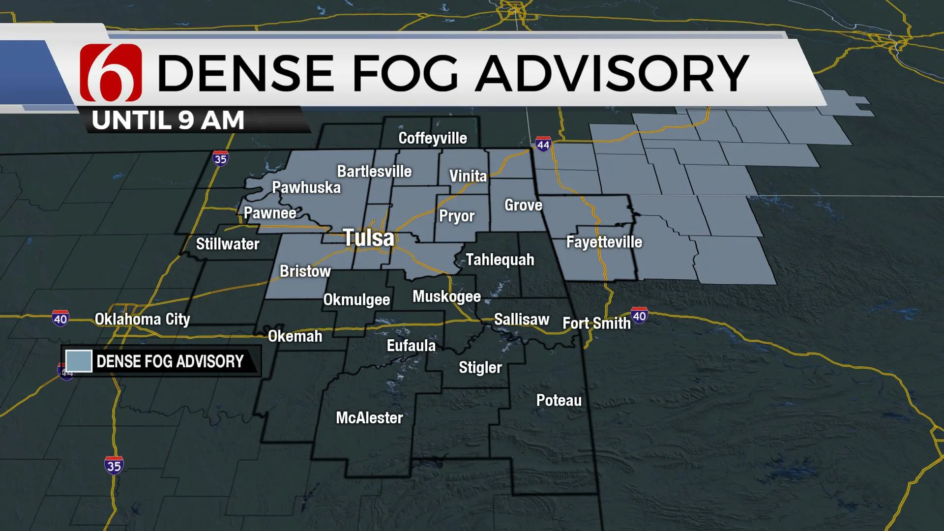
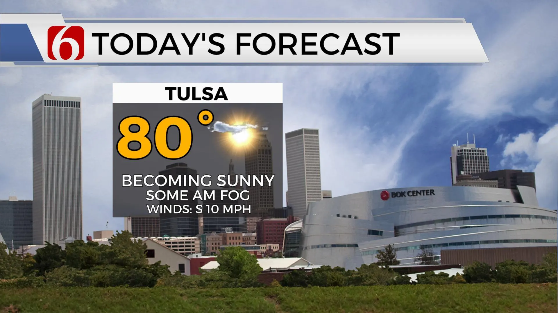
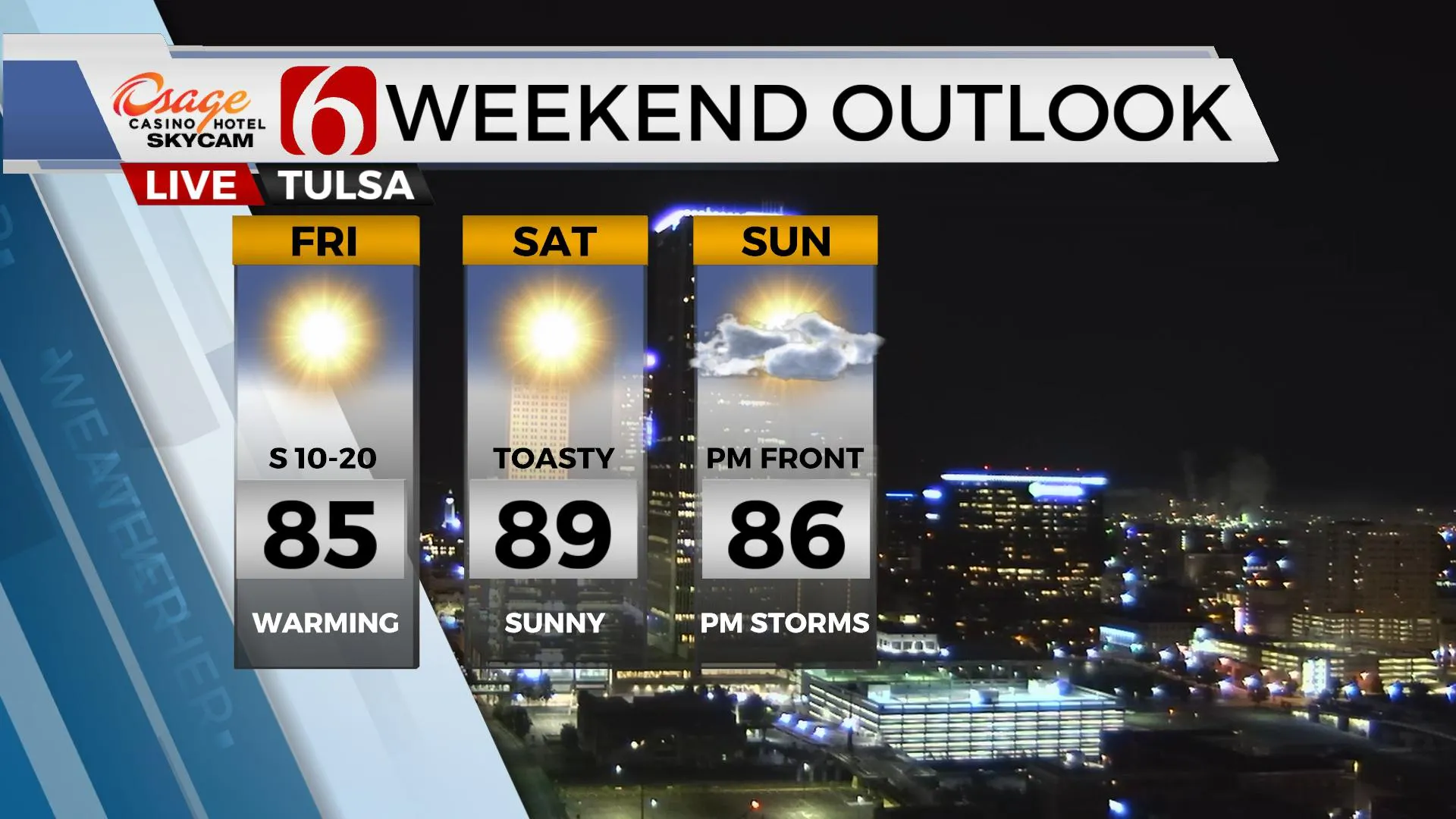
Not a lot to discuss in the short term other than some broken low clouds and patchy fog for the morning hours across northeastern Oklahoma. A dense fog advisory will remain for northern OK, including the Tulsa metro through 9am. These features will gradually mix-out by 10am to noon with abundant sunshine returning along with highs in the upper 70s near 80. Southeast winds near 10 to 15 mph will also be likely as we begin a mini-warming trend through the weekend. Normal highs should be in the lower 80s, but we’ll move into the upper 80s before a strong front arrives ushering more fall weather across the state. The data has changed significantly today compared to previous runs regarding the first front arriving Sunday afternoon and evening and now will suggest some rain and storm chances with the system. The 2nd boundary may also have a slight chance for a few showers or storms Tuesday morning. Much drier low-level air is likely arriving behind the Tuesday front which will bring a spectacular run of fall weather for the middle to end of next week.
 Image Provided By: Alan Crone
Mid-level ridging starts to arrive from the west later today as sunshine returns to the state. Temps in the mid-levels of the atmosphere will begin warming and this also will be reflected at the surface with temps at least into mid 80s for the weekend.
 Image Provided By: Alan Crone
The stronger upper air flow remains across the northern third of the nation for the next few days. As a strong upper trough develops and drops down the Canadian Prairie Provinces Monday, this will powerhouse into the upper Midwestern US. While driving a surface front south toward the state. Our confidence has been lowered due to the curveballs being thrown this morning by some incoming data regarding Sunday through Tuesday. We’ve made some minor adjustments to the forecast from previous, but additional changes, some significant, seem probable over the next few days as data hopefully becomes more consistent.
The Sunday front arrives by at least the afternoon or late in the evening and we’ll now include a chance for showers and storms near this boundary into early Monday morning. We’ve dropped Sunday afternoon highs in the mid-80s and will lower Monday to the lower 80s. The timing of the second front entering northern Oklahoma should be early Tuesday morning with a slight chance of showers along with highs dropping into the lower to mid-70s. Most projections place dew points in the 30s and 40s in a very dry postfrontal airmass which will lead to chilly morning lows and wonderful fall afternoons Wednesday through Friday of next week.
 Image Provided By: Alan Crone
Thanks for reading the Thursday morning weather discussion and blog.
Have a super great day!
Alan Crone
KOTV
More Like This
September 24th, 2020
December 13th, 2024
December 13th, 2024
December 13th, 2024
Top Headlines
December 13th, 2024
December 13th, 2024
December 13th, 2024
December 13th, 2024


