Summer Makes A Return Through The Weekend
Summer makes a return today through the weekend before two cold fronts roll across the state with more fall like weather returning to Oklahoma.Friday, September 25th 2020, 5:52 am
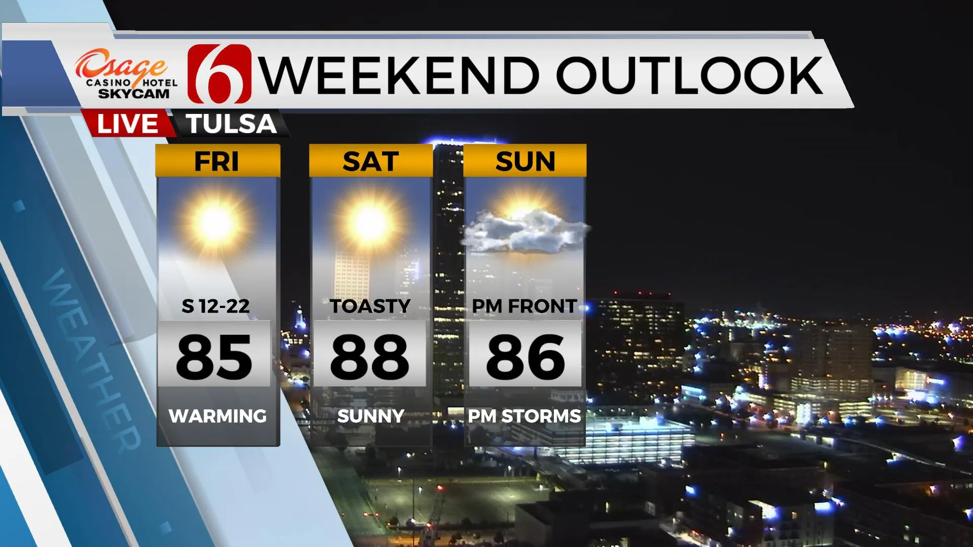
Summer makes a return today through the weekend before two cold fronts roll across the state with more fall like weather returning to Oklahoma. Most locations will start in the upper-50s this morning reaching the lower to mid-80s this afternoon along with sunshine and southeast winds near 10 to 15 mph. Even warmer weather returns Saturday with highs near 90 along the I-35 corridor region including the upper 80s near Tulsa. Southeast winds near 10 to 20 mph will be possible today into Saturday with mostly sunny conditions. The first front arrives Sunday night into Monday morning bringing a chance for some storms followed by additional fall like air for next week. The data is trending stronger with the Sunday evening system and we’ve made some adjustments with much cooler air for Monday.
 Image Provided By: Alan Crone
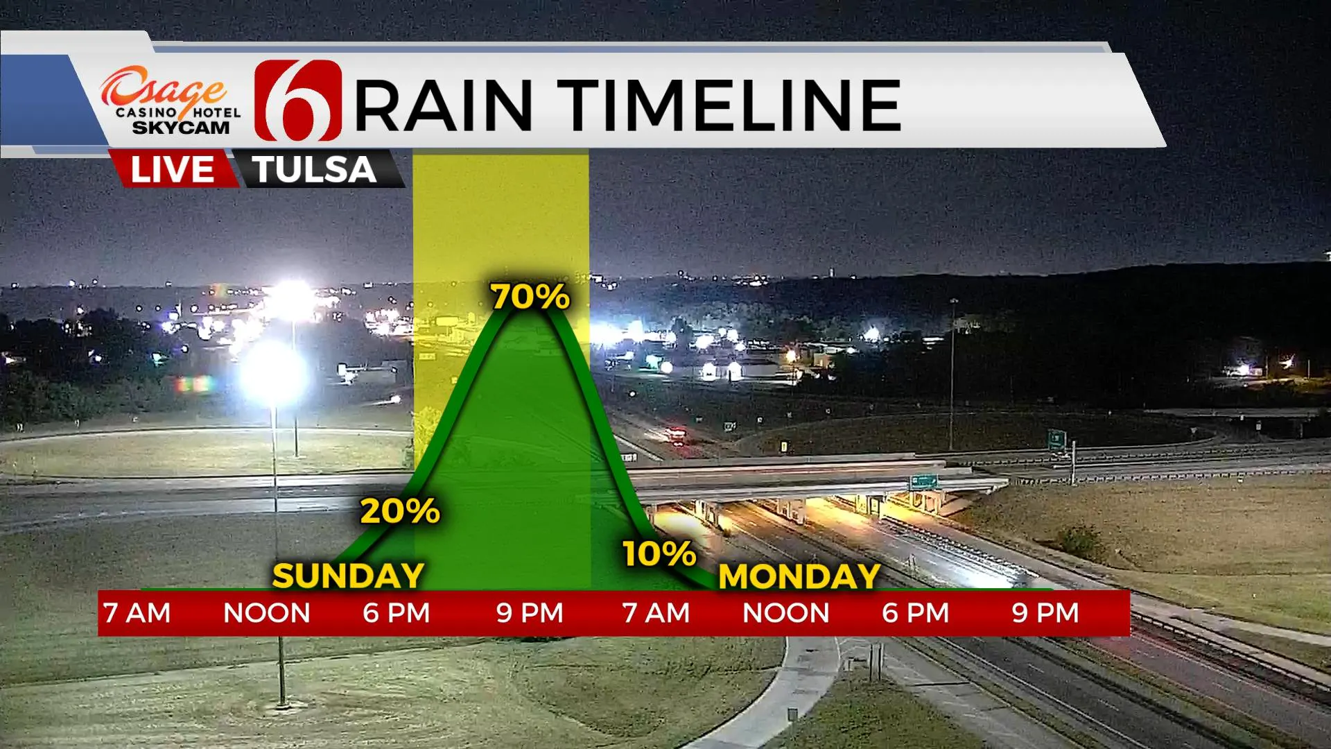
The upper air pattern will undergo some significant changes this weekend into early next week. A strong short-wave will scoot across the northern U.S. Saturday night into Sunday while shoving the first surface front southward into the central plains Sunday. By evening, this first boundary will cross northern OK and bring a chance of showers or storms near and behind the boundary. A few days ago, data suggested the front would stall or quickly become diffused. The models for the past two days have now trended stronger with the upper air flow and push this front across the state Sunday evening into Monday morning with a healthy area of rain and thunder, the consensus output nearing 1 inch of rain. A few strong to severe storms will also be possible. The result will be lowering the Monday afternoon highs into the upper 60s or lower 70s for some spots. A second and stronger upper level disturbance will also dive down the Prairie Provinces of Canada Monday and deepen in to a strong upper trough eventually positioned across the Midwest and northeastern U.S. early next week. The resulting upper air flow will be from the northwest Monday into most of next week for the southern plains and remain capable of transporting at least one additional front across the state for the middle of the week. This boundary appears to bring much drier air from Canada into our area. This means we’ll be in the running for chilly mornings and cool afternoons Thursday and Friday, including some 40s for Thursday and Friday morning lows. Daytime highs Wednesday and Thursday will stay in the lower 70s with north winds and sunshine.
 Image Provided By: Alan Crone
The rollercoaster of fall weather is underway. We typically go through several of these wild swings before the cooler weather begins to mostly dominate. This is also the time of year we typically enter our secondary severe weather season for a few weeks.
Thanks for reading the Friday morning weather discussion and blog.
Have a super great day!
Alan Crone
KOTV
More Like This
September 25th, 2020
April 24th, 2024
April 24th, 2024
April 24th, 2024
Top Headlines
April 24th, 2024
April 24th, 2024
April 24th, 2024


