Highs In The Lower 70s Today With Breezy Afternoon Winds
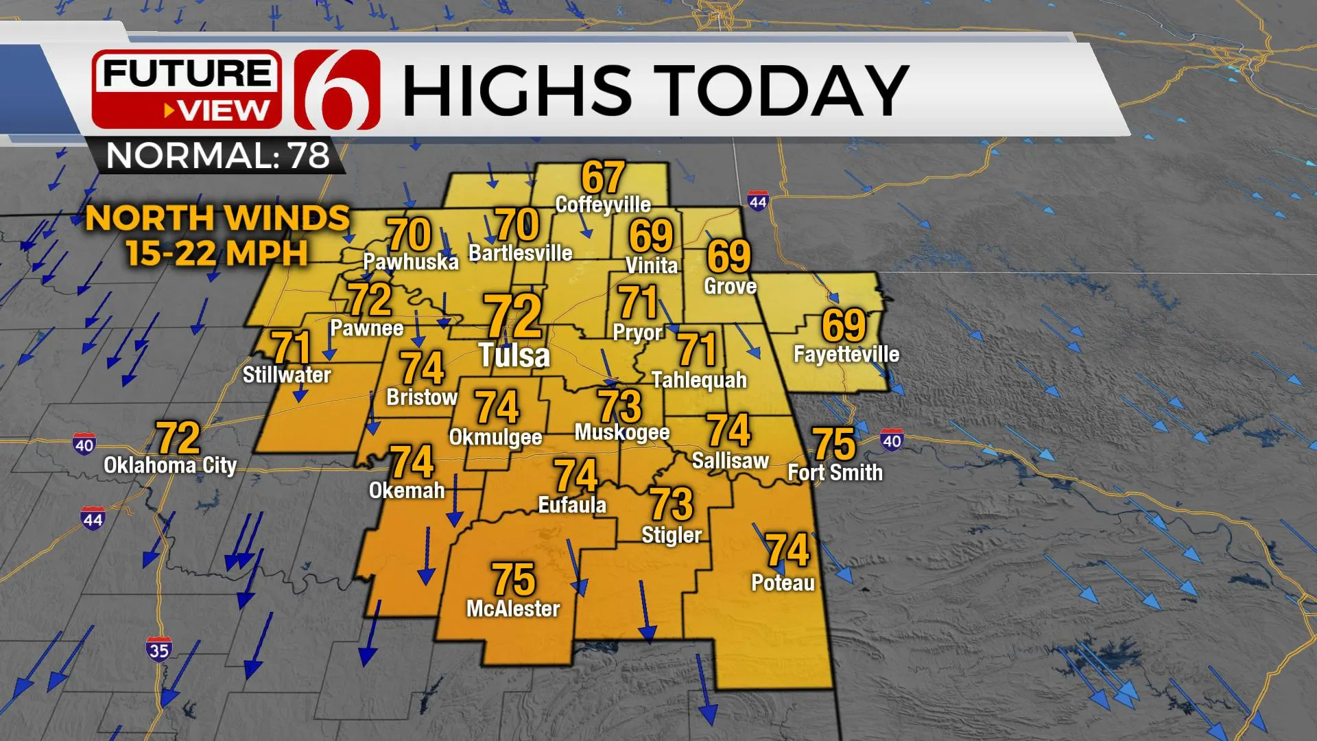
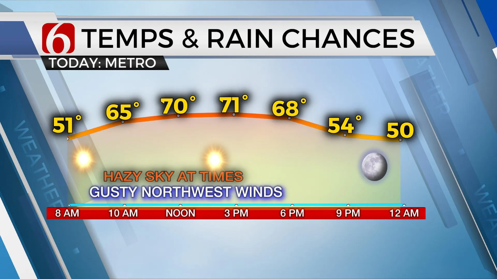
After a warm day yesterday, it is back to a nice autumnal pattern for the next few days. Highs today will reach the lower 70s near Tulsa with breezy north winds by midday to afternoon. Later tonight, our readings drop as many locations will experience Friday morning lows in the upper 30s and lower 40s. Highs Friday afternoon highs will reach the upper 60s.Thursday, October 1st 2020, 6:01 am
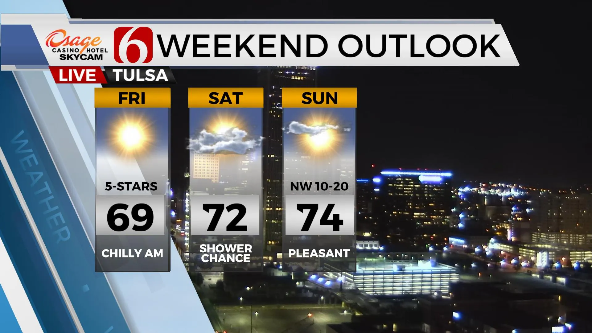
After a warm day yesterday, it is back to a nice autumnal pattern for the next few days. Highs today will reach the lower 70s near Tulsa with breezy north winds by midday to afternoon. Later tonight, our readings drop as many locations will experience Friday morning lows in the upper 30s and lower 40s. Highs Friday afternoon highs will reach the upper 60s. We are tracking a system nearing for Saturday bringing a mention for a few showers or storms even though the chances will remain low. Sunday into early next week currently appears pleasant with gradually warming weather and sunny and dry conditions.
 Image Provided By: Alan Crone
We’re starting this morning in the upper 40s and lower 50s and will reach the lower 70s north and the mid-70s south today. Winds may increase from 15 mph to 20 mph for the middle of the day. The upper air flow may bring a few clouds occasionally across the northern third of the state but we’re keeping abundant afternoon sunshine in the mix. Unfortunately, we may see the return of some hazy skies as the upper flow brings more high-level smoke from the western U.S. fires across the plains. Today looks very good from a temperature standpoint with highs around 17 to 20 degrees below Wednesdays readings. Friday morning will be a chilly morning as clear sky and light wind allow for temps dropping into the upper 30s and lower 40s. Light north winds tomorrow morning will quickly return from the south by afternoon with Friday afternoon highs only in the mid to upper 60s.
 Image Provided By: Alan Crone
A small yet robust short-wave will drop down the northwest flow into the central plains Saturday while shoving our next surface front southward into northern Oklahoma Saturday evening bringing a chance for a few showers or storms. The severe weather threats will be limited but we may experience a strong storm or two along or south of the I-40 corridor. The overall chances for northeastern Oklahoma will remain low, with slightly higher chances to the south. Before the front arrives, as south winds return low level moisture Friday night into Saturday morning, a few showers will be possible northeast of the Tulsa metro for a very small window Saturday morning. The majority of Saturday should be fine, but the window for showers and storms will develop by late afternoon into the evening. Sunday into early next week the upper pattern will change and should bring a gradual warming trend into the southern
plains.
 Image Provided By: Alan Crone
Thanks for reading the Thursday morning weather discussion and blog.
Have a super great day!
Alan Crone
KOTV
More Like This
October 1st, 2020
February 14th, 2022
January 26th, 2022
January 25th, 2022
Top Headlines
December 13th, 2024
December 13th, 2024
December 13th, 2024
December 13th, 2024


