Above Normal Temperatures Continue For The Week
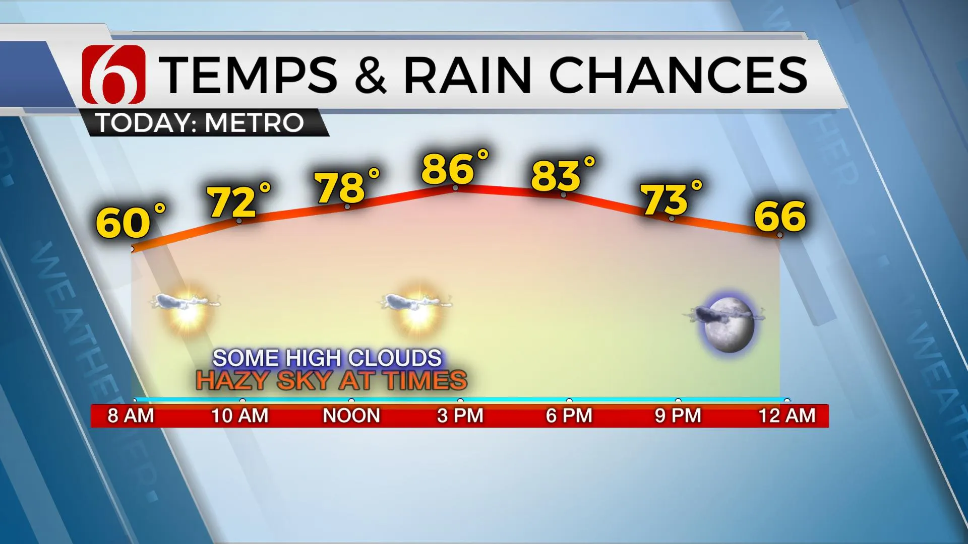
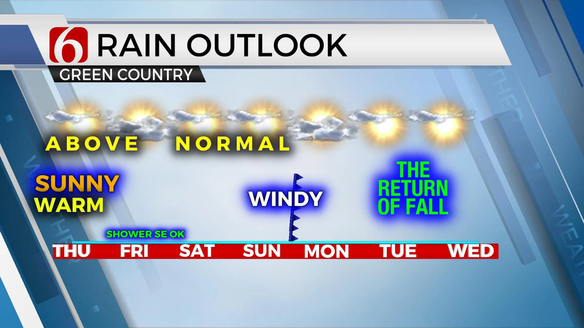
Our pattern will feature above normal temperatures for the rest of the week before our next front arrives Monday with cooler conditions. Our only issue currently will be gusty south winds Sunday along with increasing fire danger threats before the system arrives. We continue to watch Delta for any changes in the forecast for Friday.Thursday, October 8th 2020, 5:44 am
Our pattern will feature above normal temperatures for the rest of the week before our next front arrives Monday with cooler conditions. Our only issue currently will be gusty south winds Sunday along with increasing fire danger threats before the system arrives. We continue to watch Delta for any changes in the forecast for Friday.

Delta continues to slow-down some but will also continue to gain strength reaching major hurricane status later this afternoon or tonight before making landfall Friday afternoon across southern Louisiana. Based on today’s trajectory, we continue to keep our immediate area void of any direct impacts from the storm, yet far southeastern OK could experience a few outer bands of showers Friday morning to afternoon. A few clouds will be in the sunshine mix today, mostly high thin clouds approaching from the south and a few more broken clouds Friday. As the system pulls away from the region Friday evening into Saturday morning, northeast winds will develop on the backside of the storm and move across eastern Oklahoma for the first part of Saturday before returning from the south by evening. Sinking and compressing air should bring pleasant conditions Saturday afternoon.
Sunday into Monday our next upper level system will be approaching from the west. This system will eventually bring a pacific cold front across the state Monday morning with only a very low chance for a storm followed by a return to fall like weather. But as mentioned yesterday, the data continue to offer some varying solutions that could change the arrival time of the boundary. But for now, we’re sticking with Monday.
Gusty south winds will be likely Sunday ahead of the system, but also post frontal Monday with north winds at 20 to 30 mph. This front will bring a return to seasonal weather with highs Monday staying the mid-70s. Morning lows Tue and Wed of next week will range from the upper 40s to lower 50s with highs Tuesday into the upper 70s and lower 80s Wednesday. We should experience another surge of cooler air for the 2nd half of next week into the following weekend. Unfortunately, rain chances continue to appear rather bleak at this point.

Thanks for reading the Thursday morning weather discussion and blog.
Have a super great day!
Alan Crone
KOTV
More Like This
October 8th, 2020
February 14th, 2022
January 26th, 2022
January 25th, 2022
Top Headlines
December 11th, 2024
December 11th, 2024
December 11th, 2024
December 11th, 2024


