Warmer Weather Returning To The State
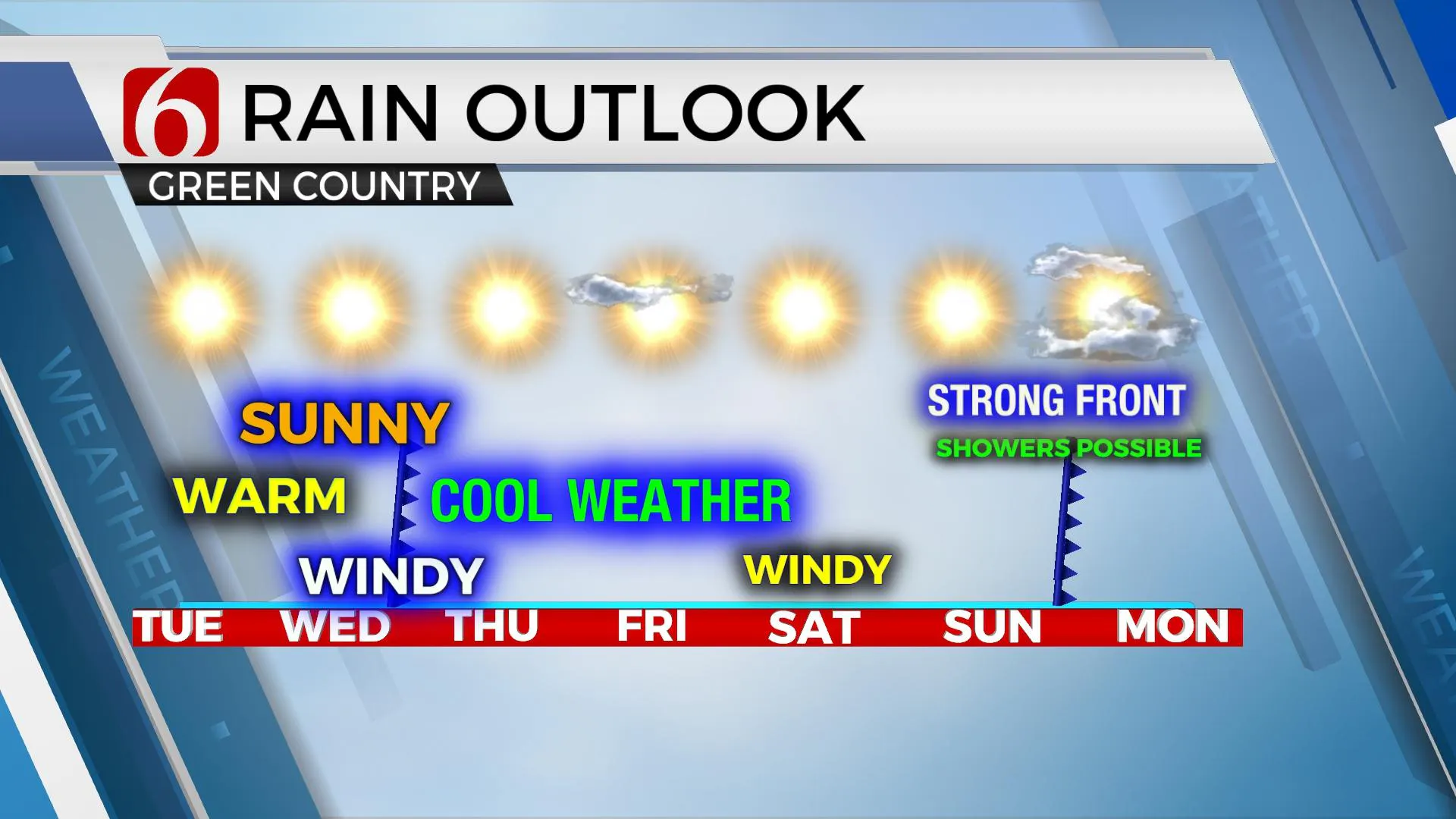
No major weather issues are expected for the next few days other than increasing fire spread rates across the state. Another roller-coaster ride of temperatures is underway with increasing daytime temps into midweek before chilly weather arrives for the remainder of the week. A potentially stronger front may arrive Sunday or early next week. Cool temperatures have settled into northeastern Oklahoma this morning with a surface ridge of high pressure centered near the area. South winds will returnTuesday, October 13th 2020, 9:00 am
No major weather issues are expected for the next few days other than increasing fire spread rates across the state. Another roller-coaster ride of temperatures is underway with increasing daytime temps into midweek before chilly weather arrives for the remainder of the week. A potentially stronger front may arrive Sunday or early next week. Cool temperatures have settled into northeastern Oklahoma this morning with a surface ridge of high pressure centered near the area. South winds will return today and slowly increase speeds as the ridge moves east and our next storm system approaches the area from the west and northwest.

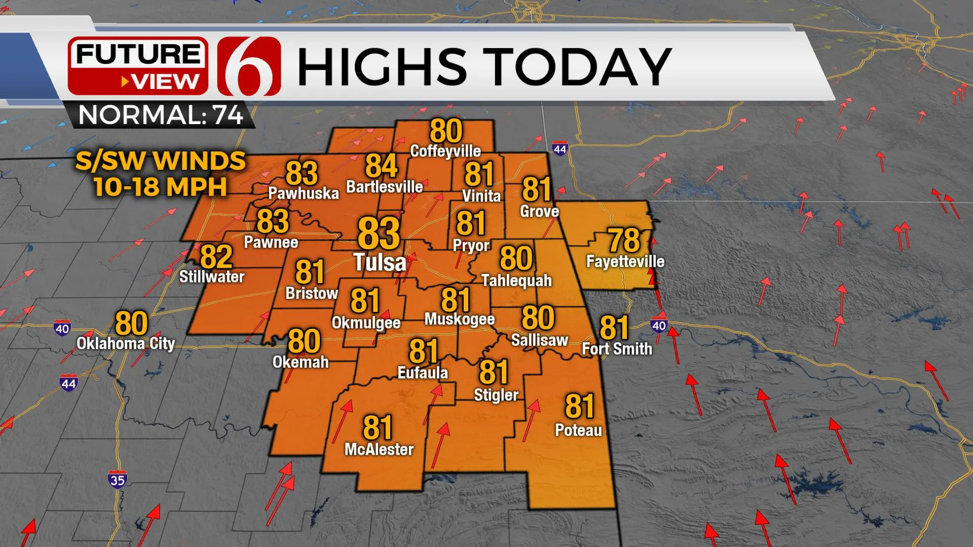
Temperatures will respond both today and especially Wednesday as warmer weather returns to the state, including the Tulsa metro with highs reaching the mid to upper 80s Wednesday along with gusty southwest winds from 25 to 30 mph. The fire spread rates will be increasing for the middle of the week, including both Wednesday and Thursday. Gusty northwest winds from 20 to 30 mph return Thursday behind the cold front that brings another surge of dry air across the state. Temperatures will drop with this midweek boundary allowing for chilly, fall like conditions for the end of the week. Highs will stay in the mid to upper 60s with morning lows Friday dripping into the mid-30s in the valleys and into the lower-40s near the metro. The weekend currently looks good, but we continue to have another front scheduled for either Sunday or Monday of next week that could bring another surge of chilly weather to the state. The data remain highly uncertain due to the lack of run to run consistency. More about this potentially strong front tomorrow.

We’ve had no significant rainfall across eastern OK since Sept 22, when the Tulsa metro recorded 1.30 inches at Tulsa International. Some light rain was also recorded Sept. 27th. The lack of rainfall combined with the continual drying of vegetation will support increasing fire danger threats for the next few weeks, if not longer.
The tropics remain quiet this morning, but we are tracking another disturbance about 500 miles east of the Windward island chains that’s moving slowly west. The nearby environment is not conducive for development in the short term but may prove increasing opportunities for strengthening during the next 6 to 8 days as it nears the southern Caribbean.
Thanks for reading the Tuesday morning discussion and blog.
Have a super great day!
Alan Crone
KOTV
If you’re into podcast, check out my daily “ Weather Out The Door” on your podcast provider. Just search for NewsOn6 and load the latest updated file. Or you can find it on SoundCloud here.
More Like This
October 13th, 2020
February 14th, 2022
January 26th, 2022
January 25th, 2022
Top Headlines
December 13th, 2024
December 13th, 2024
December 13th, 2024
December 13th, 2024


