Cold Weather Exiting The Region With A Warming Trend Here For The Weekend
Well, It's been an interesting 8 days, and I'm not just referring to the weather. I'll skip all the details, but I've been under the weather with some NON-COVID-19 issues. I feel much better and I'm back in the saddle ready to ride.Friday, October 30th 2020, 6:14 am
Tulsa -
Well, It's been an interesting 8 days, and I'm not just referring to the weather. I'll skip all the details, but I've been under the weather with some NON-COVID-19 issues. I feel much better and I'm back in the saddle ready to ride.
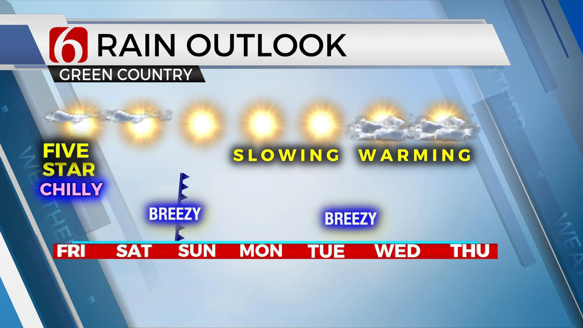
Our weather pattern also is finally changing. The powerful storm system and cold weather is exiting the region and a warming trend will slowly continue for the next few days. We'll track at least three systems for the next 10 days, but the first two should pass the area with little fanfare other than a wind shift. The last one, showing up about 10 days from now will be different. More about that system in the next few days. How about today's weather?

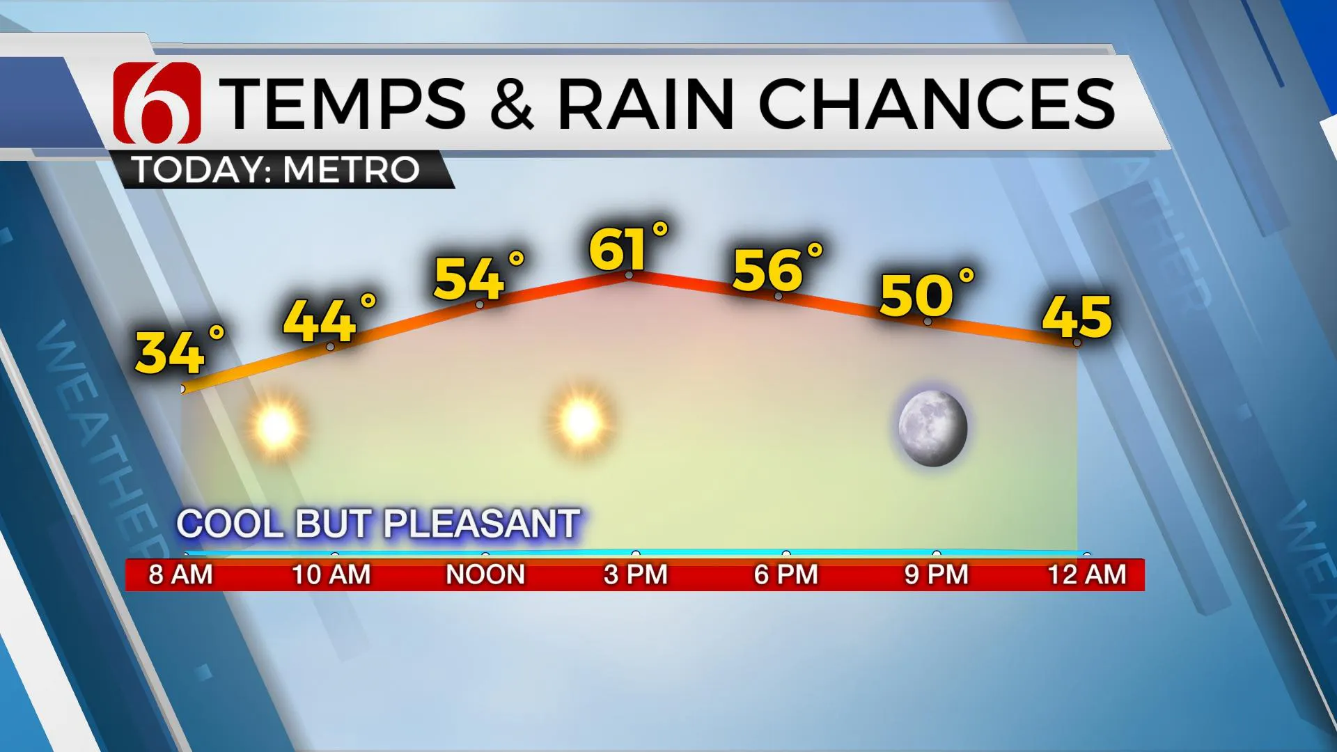
We're starting this morning with some locations near or below freezing across far northeastern OK and southern Kansas. Some patchy frost is likely, and unfortunately, we may also have some spots of freezing fog. Please remain highly aware that if you encounter fog this morning with temperature near or below freezing, slick spots on elevated surfaces will be possible. Temperatures will climb out of the freezer quickly this morning with plenty of sunshine and highs reaching the lower 60s. Wind will remain from the south around 10 to 15 mph for the day before diminishing this evening. This weekend looks pleasant with morning lows in the 40s and Saturday afternoon reaching the lower to mid-60s along with gusty south winds from 15 to 25 mph. But the first storm system moves across the northern high plains Sunday morning and shoves a surface cold front southward across the state with north winds and a minor reduction in temps. Highs Sunday will stay in the 50s, but abundant sunshine will keep us in pleasant conditions.

Early next week also looks good with lows in the 40s and highs in the 60s. Election Day has a system nearing the central plains by late evening but it also does not appear to have enough moisture to add any storm or rain chances for our immediate areas early next week. Highs Tuesday through the end of the week should be nearing 70 or slightly higher. At this point, all of next week will be pleasant.
Thanks for reading the Friday morning weather discussion and blog.
Have a super great day!
Alan Crone
KOTV
Check out my daily mini-podcast briefing. Search for it on Apple, TuneIn Radio, Spotify or you can Click Here to listen on SoundCloud.
More Like This
October 30th, 2020
February 14th, 2022
January 26th, 2022
January 25th, 2022
Top Headlines
December 12th, 2024
December 12th, 2024
December 12th, 2024


