Sunshine, Cloud Mix With Highs Reaching The Mid-70s
A weak short-wave trough scoots across the region today and will bring more mid and high-level clouds across part of northeastern Oklahoma this morning through midday before exiting the area later tonightWednesday, November 4th 2020, 5:31 am
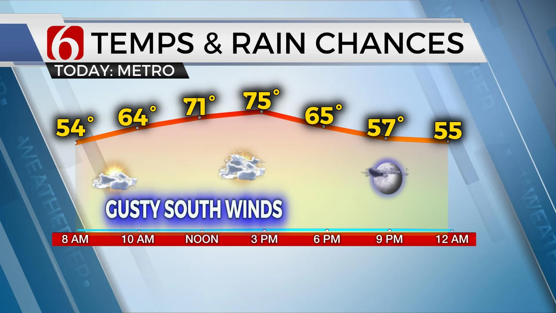
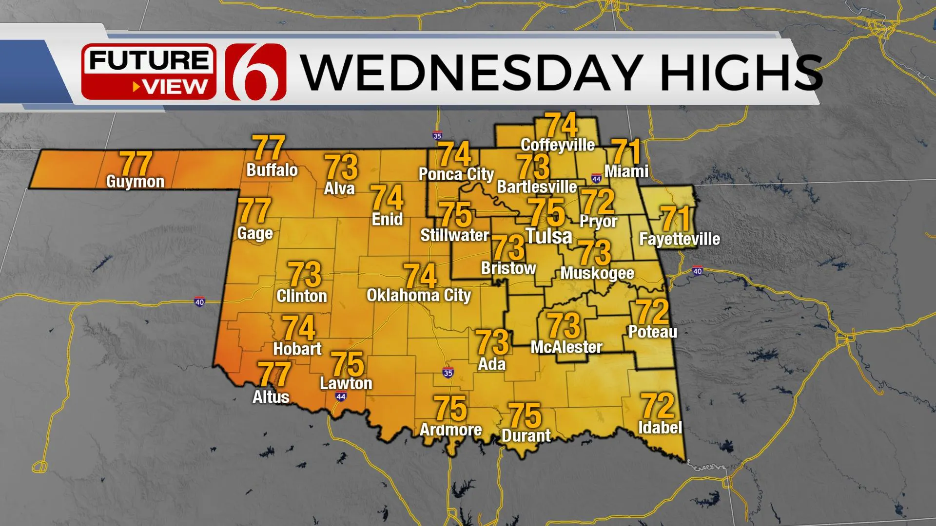
A weak short-wave trough scoots across the region today and will bring more mid and high-level clouds across part of northeastern Oklahoma this morning through midday before exiting the area later tonight. We’ll keep the mention of some clouds for the day but will also keep mentions of some sunshine in the mix with highs reaching the mid-70s. The pressure gradient will increase a few hours today and allow south winds from 15 to near 28 mph from midday to early afternoon. Despite the clouds and gusty winds, the weather continues to be pleasant with highs remaining above the seasonal average today and through the end of the week before a major pattern change occurs. The upper air flow will become from the southwest this weekend with a strong upper trough developing across the western U.S. A surface area of low pressure should develop somewhere along the Lee of the Rockies Friday or Saturday as the first wave ejects north into the northern plains and this will cause strong south winds to return across the state into the weekend.

Sunday into Monday the lead wave ejects around the base of the trough and brings a few showers or storms near the eastern third of the state Monday, but the main trough will remain to our west and not pass the area until either Monday evening or Tuesday. This is when a strong surface cold front will roll across the state bringing increasing thunderstorm chances followed by another shot of cooler weather Tuesday afternoon into the middle of next week. This system is a rather robust looking upper trough and would support deep layer wind shear for strong to severe storms, but many questions remain about the frontal boundary and timing of the system. No mentions for strong or severe storms will be included for this period of the forecast at this point, but it’s something I’ll be watching as the weekend trough nears the state. This same pattern is scheduled to bring several disturbances across the state for the next few weeks.

Thanks for reading the Wednesday morning weather discussion and blog.
Have a super great day!
Alan Crone
KOTV
More Like This
November 4th, 2020
February 14th, 2022
January 26th, 2022
January 25th, 2022
Top Headlines
December 14th, 2024
December 14th, 2024
December 14th, 2024
December 14th, 2024


