Above Normal Temperatures Continue Through The Weekend
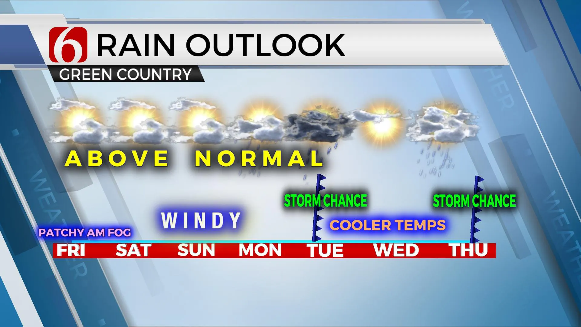
Above normal temperatures will continue through the weekend as a powerful storm system organizes across the western United States. This changing pattern will bring a cold front across Oklahoma Monday night into Tuesday morning. Before this arrives, gusty winds will become common into the weekend.Friday, November 6th 2020, 5:41 am
Above normal temperatures will continue through the weekend as a powerful storm system organizes across the western United States. This changing pattern will bring a cold front across Oklahoma Monday night into Tuesday morning. Before this arrives, gusty winds will become common into the weekend.

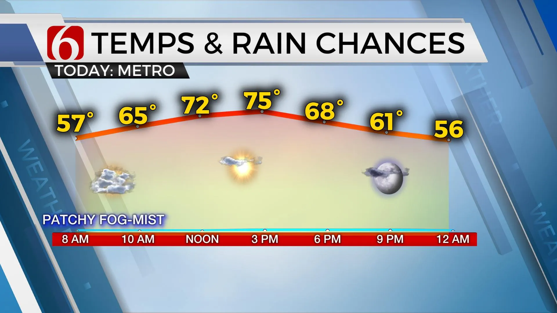
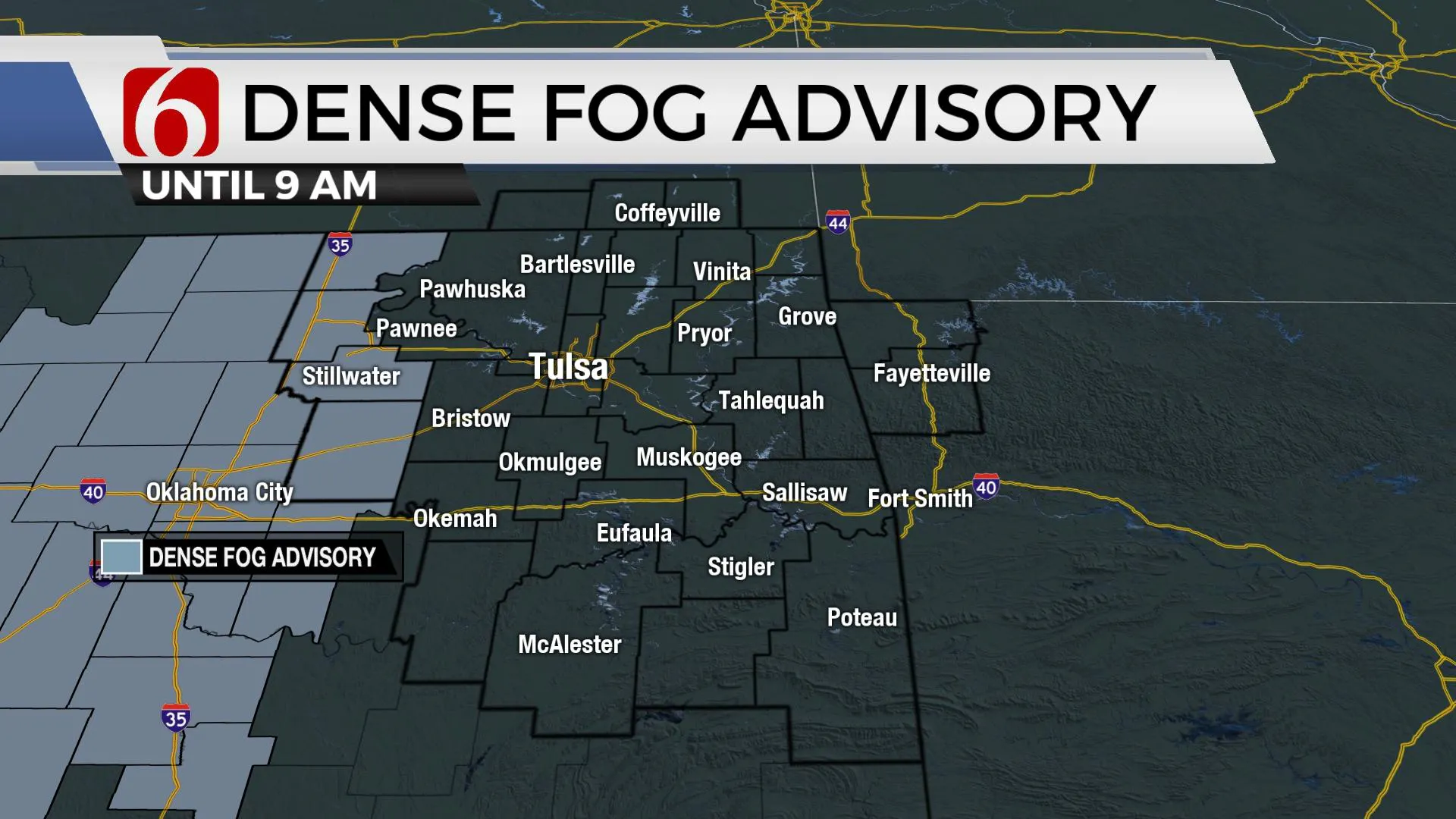
Soundings from certain model data yesterday suggested some stratus, fog and drizzle nearby this morning. It won’t be in every location, but there will be at least some patchy fog in valley locations for the morning hours. Temps are currently in the 50s and will move back into the lower to mid-70s later today. After some morning clouds, we should see increasing sunshine and south winds near 10 to 20 mph. Stronger wind speeds return into the weekend ahead of a pattern change that eventually brings storm chances into the area early next week.

The major pattern change is underway. A trough has developed across the Pacific and will enter the northwestern U.S. today while dropping southward across the intermountain region this weekend. A surface area of low pressure will form across eastern Colorado with strong south winds eventually sweeping up the plains with 15 to 25 mph Saturday and nearing 25 to 35 mph Sunday. This wind will also bring low-level moisture from Texas southward into Oklahoma, setting the stage for shower and storm chances when a strong cold front approaches our area late Monday night into Tuesday morning.
Our neighbors across the intermountain regions into southern Canada will prepare for a major winter storm that could bring blizzard-like conditions and heavy snow in some locations. Amounts in Montana could approach between 14 and 25 inches. We’ll be in the warm sector of this system and will need to watch for a few strong to severe storms late Monday evening into Tuesday morning. The upper air pattern appears strong enough to produce some deep layer shear needed for strong to severe storms, but most model data offer meager instability. At this point, severe weather threats will remain very low and limited.
The temps behind the front will drop. We’ll start in the upper 60s early Tuesday with north winds and falling temps in the 50s by afternoon. This is a stout cold front, but most of the deeper colder air will remain north of the state for the middle of the week as the upper airflow never buckles. This southwest flow will bring another system into the state by late next week.

Tropical depression Eta remains off the coast of Belize this morning but will be approaching the Florida Keys early next week as a strong tropical storm. Once again, we’ll track another tropical system nearing the southern U.S. coastal regions over the next few days.
Thanks for reading the Friday morning weather discussion and blog.
Have a super great day!
Alan Crone
KOTV
Be sure and check out my daily weather, mini podcast. Search for NewsOn6 and “Weather Out The Door” on Spotify, The Tune-In Radio app, Stitcher, Apple podcasts, and right here at SoundCloud.
More Like This
November 6th, 2020
February 14th, 2022
January 26th, 2022
January 25th, 2022
Top Headlines
December 14th, 2024
December 14th, 2024
December 14th, 2024
December 14th, 2024


