Scattered Tuesday Showers As Fall-Like Weather Returns Briefly
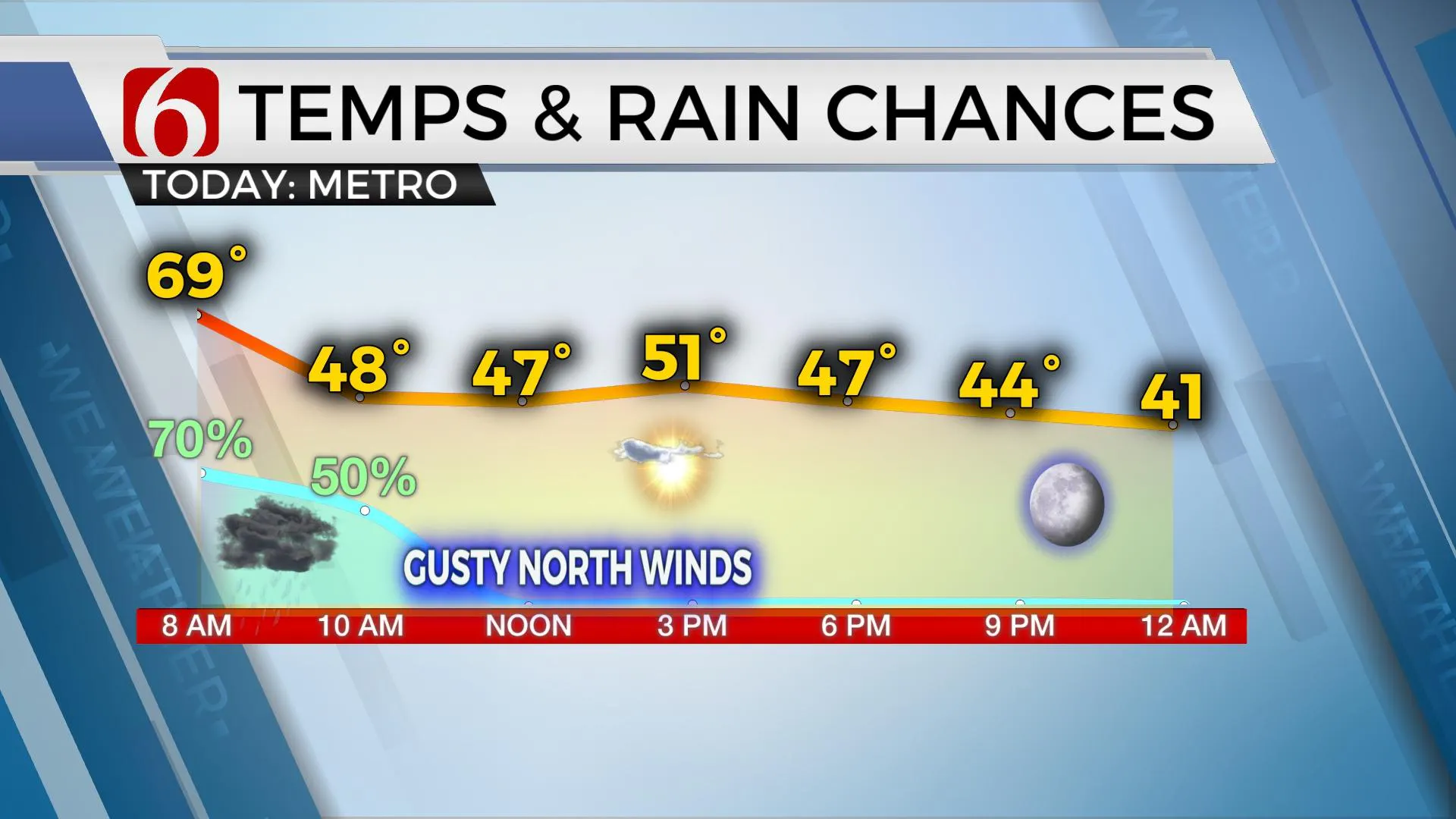
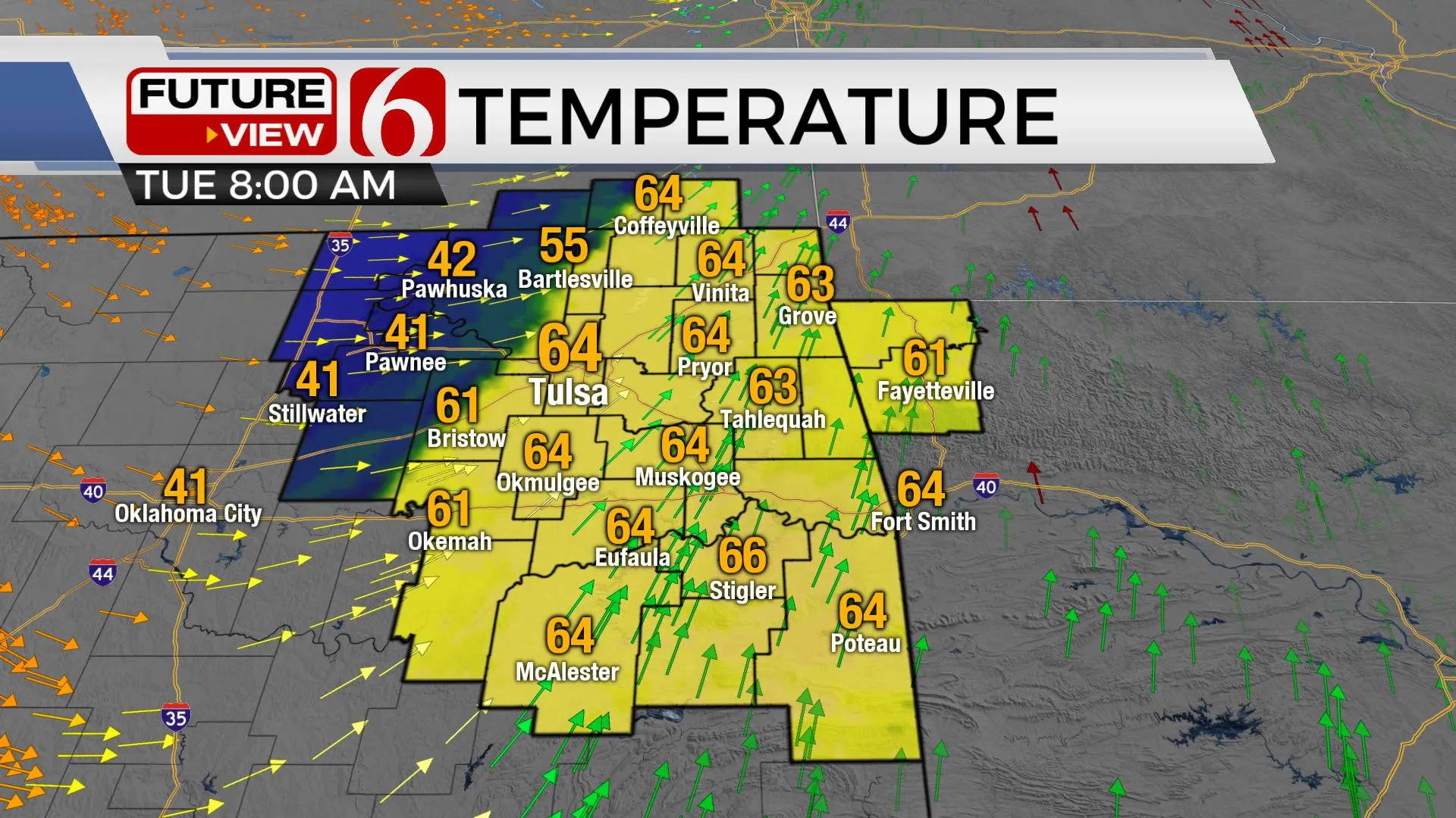
A strong front arrives this morning with some scattered showers and storms followed by a return of fall-like weather for a few days. Grab the jacket or the coat. Temps will be falling this morning from the upper 60s into the 40s near and west of the metro and rebounding into the lower to mid-50s this afternoon. Locations across far eastern and southeastern OK may not experience the falling temps until midday to shortly after noon.Tuesday, November 10th 2020, 5:10 am
A strong front arrives this morning with some scattered showers and storms followed by a return of fall-like weather for a few days. Grab the jacket or the coat. Temps will be falling this morning from the upper 60s into the 40s near and west of the metro and rebounding into the lower to mid-50s this afternoon. Locations across far eastern and southeastern OK may not experience the falling temps until midday to shortly after noon.

The cold front is making moderate progress across the area early this morning and should exit eastern OK around noon to 1 p.m. A few showers or storms will remain for the morning hours but some locations south of the metro will have a much lower chance compared to the northern region. Gusty northwest winds return today with decreasing clouds and afternoon sunshine. Temps will start this morning in the upper 60s near Tulsa but will quickly drop into the upper 40s around 10 a.m. through the afternoon and rebounding into the lower 50s by the evening commute. Clear sky and light winds will allow Wednesday morning lows in the lower to mid-30s with afternoon highs reaching the lower 60s with abundant sunshine and light winds. The 2nd half of the week also features another system nearing the region bringing additional rain and storm chances Friday into early Saturday. As of this morning, most of the weekend looks good after the early Saturday morning storm chances. Sunday features lows in the 40s with sunshine and highs in the lower 60s.
The main upper-level pattern will remain active for the next week to 10 days. A trough will be located across the western U.S. with a ridge mostly to the east. Today's trough will eject northeast rapidly into the central plains and Midwest today, but several waves will continue to move across the west and brush the central and southern plains for the next week to 10 days.

A weak surface front arrives Thursday afternoon with north winds but no significant change to sensible weather. This boundary will dive southward and reside near the Red River Valley area until the next upper-level disturbance nears the intermountain region early this weekend. This boundary will lift northward as a warm front and should bring some passing showers or storms occasionally Friday through this process. A slightly better chance will arrive early Saturday morning for a few hours before the boundary lifts north of the area with highs in the upper 60s to lower 70s. But the next front will quickly move across the area Sunday morning with northwest winds and a minor reduction in temps Sunday into Monday. This pattern of cool intrusions followed by returning south winds and low-level moisture should bring storm chances back to the plains sometime next week.
Thanks for reading the Tuesday morning weather discussion and blog.
Have a super great day!
Alan Crone
KOTV
More Like This
November 10th, 2020
February 14th, 2022
January 26th, 2022
January 25th, 2022
Top Headlines
December 13th, 2024
December 13th, 2024
December 13th, 2024
December 13th, 2024


