Windy Thursday With Sunshine, Highs In The Lower 70s
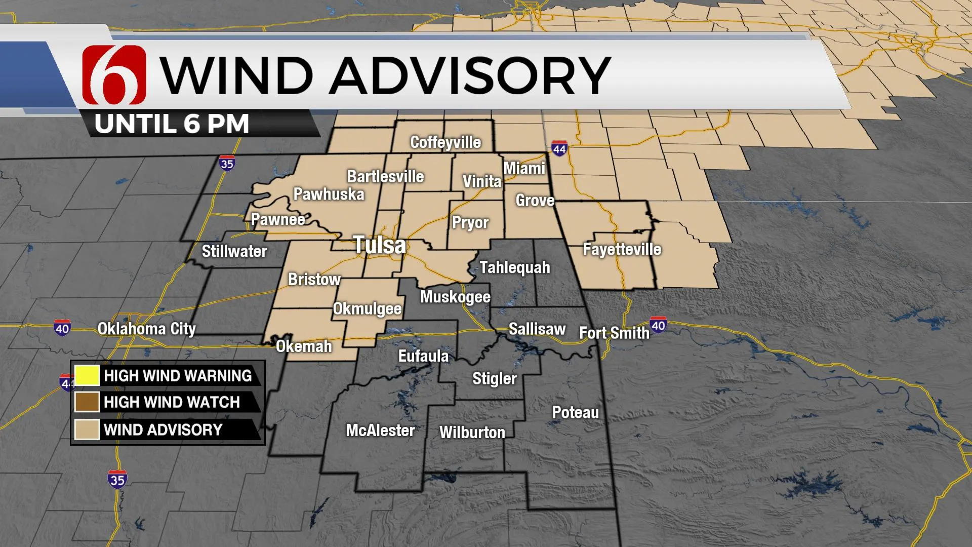
The windy weather remains today with south winds from 20 to 40 mph along with more sunshine and highs reaching the lower-mid-70s.Thursday, November 19th 2020, 5:43 am
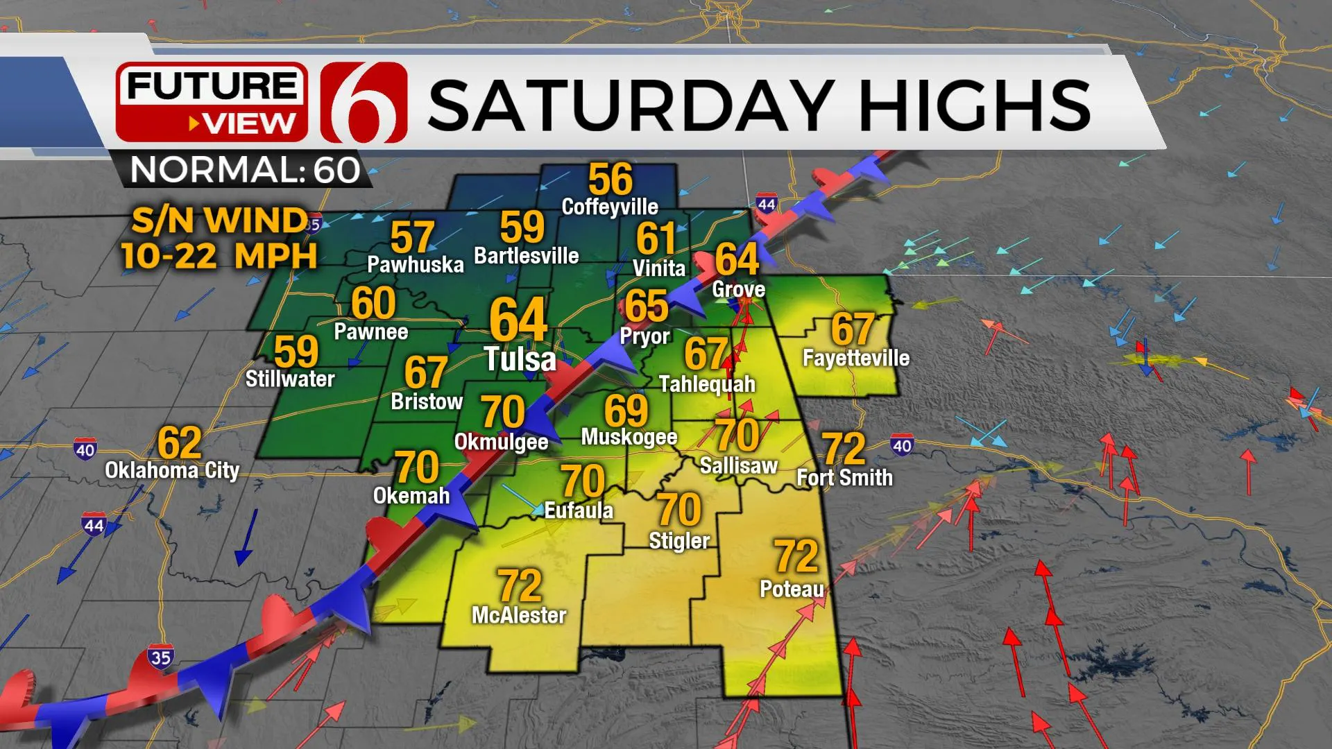
The windy weather remains today with south winds from 20 to 40 mph along with more sunshine and highs reaching the lower-mid-70s. This warm pattern continues for another day before our next storm system arrives bringing rain and chilly weather to northeastern Oklahoma for part of the weekend. The main impact from the system will be Sunday, but some impacts are possible Saturday as the front enters southern Kansas and possibly northwestern OK Friday evening before stalling near I-44 through the day Saturday. This makes the temp forecast quite tricky Saturday.

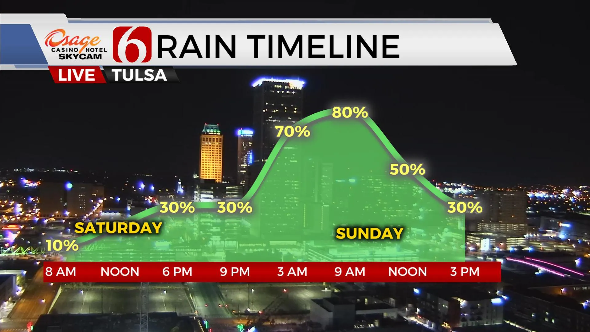
Saturday will feature a broad range of temperatures depending upon your exact location relative to the stalling front. Locations near and north of the front could stay in the upper 50s and lower 60s while locations south reach the lower 70s. A few showers or spots of drizzle may also occur Saturday along and north of the boundary. I’ve lowered the Tulsa temp Saturday to 64 with locations north in the upper 50s and increased the pops to 30% for some light precip. The front gets a shove Saturday evening and that should bring more rain with some thunder into part of the area late Saturday evening into the first part of Sunday. The dynamic energy is much lower for this weekend system compared to last weekend and instability will be greatly limited. Temps will start early Sunday morning in the 50s and should level-off in the upper 40s or lower 50s for the day with northwest winds at 15 to 25 mph. The data continues to slow the exit of the activity and we may still be dealing with some rain at midday Sunday before exiting southeastern sections Sunday afternoon.

Our next wave will quickly approach Monday night into Tuesday, but the data diverge regarding some important mid and upper levels. Our probability remains near 30% for Monday night, but I’ll increase this to a likely category for Tuesday based on this morning’s data. Higher dynamic energy and increasing instability should be nearby and a few strong to severe storms may be possible across far eastern Oklahoma Tuesday afternoon. The pattern also appears active for the rest of the week with another system nearing either Thanksgiving Day or Friday with another strong cold front. We’re still too early to pinpoint exact data for Thanksgiving, but we may be tracking a system nearby for this period.

Thanks for reading the Thursday morning weather discussion and blog.
Have a super great day!
Alan Crone
KOTV
More Like This
November 19th, 2020
February 14th, 2022
January 26th, 2022
January 25th, 2022
Top Headlines
December 13th, 2024
December 13th, 2024
December 13th, 2024
December 13th, 2024


