Cooler Temperatures, Weekend Rain Changes Return
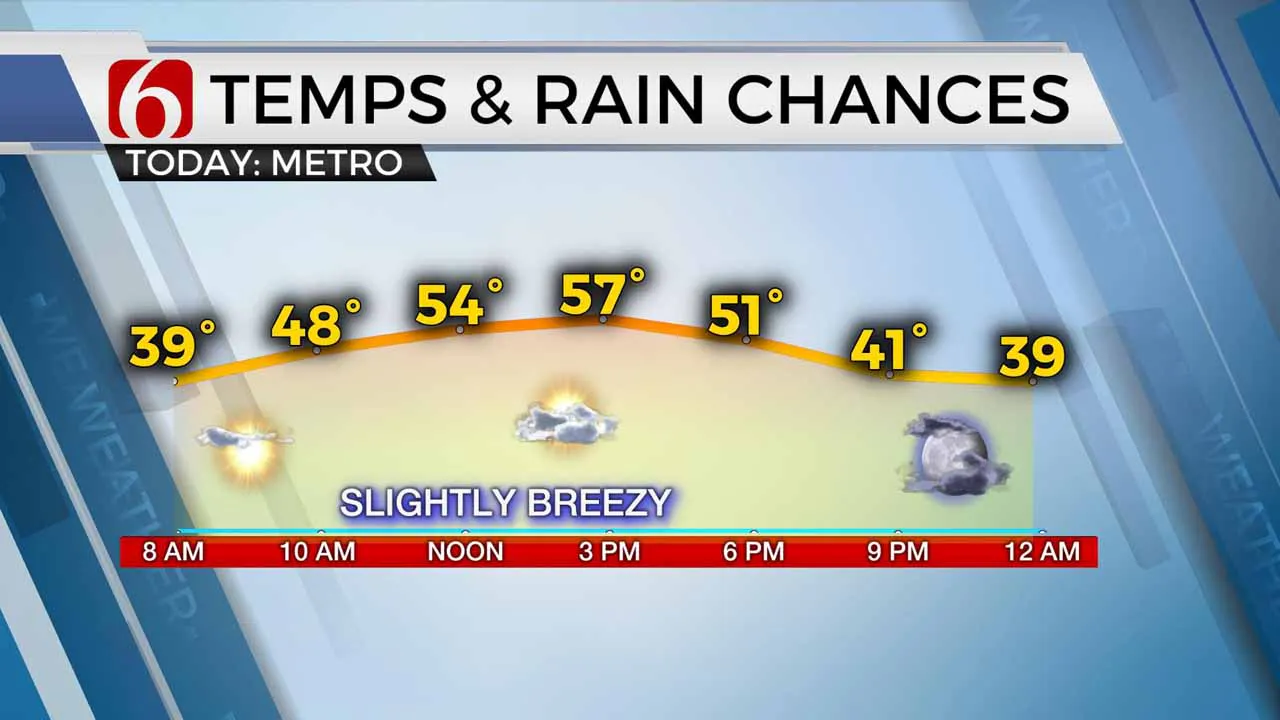
A weak front has passed the area early this morning and will bring cooler weather back to northeastern OK this afternoon with highs reaching the mid-50s along with north winds near 10 to 20 mph.Friday, November 27th 2020, 6:02 am
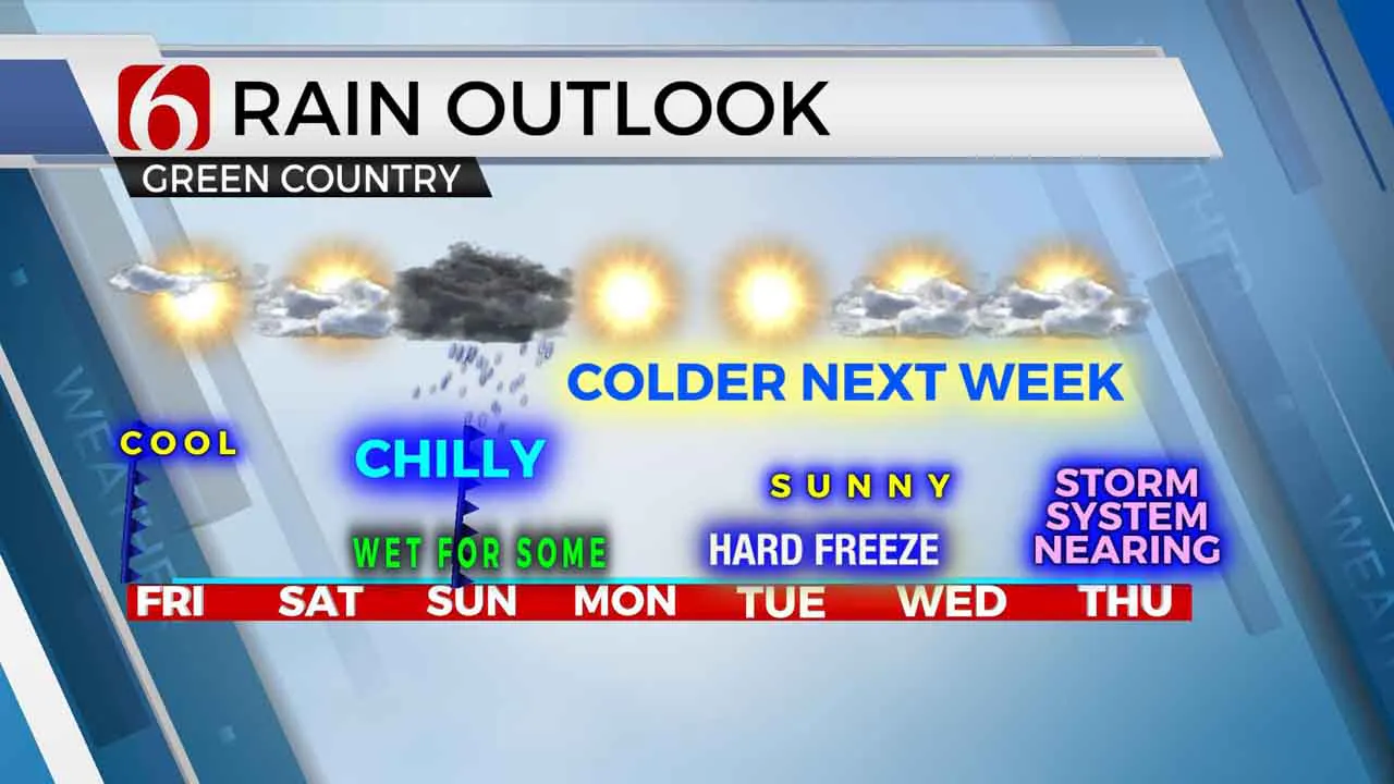
A weak front has passed the area early this morning and will bring cooler weather back to northeastern OK this afternoon with highs reaching the mid-50s along with north winds near 10 to 20 mph. The weekend also features the return of some rain chances for some, but not all locations by Saturday evening as a strong upper level system moves across the Red River Valley region. As this system passes, strong north winds return Sunday afternoon with much colder air returning across the Missouri valley into our area through early next week. This will signal some of the coldest air of the season, including hard freeze potential for many locations Tuesday and Wednesday. A second system will approach the area late next week bringing chance for additional showers across part of the state.

The first upper level system is closing off across the four-corners region this morning and should continue moving eastward, reaching western Oklahoma later tonight into early Saturday morning. We may start Saturday with some sunshine, but clouds will quickly arrive from the southwest as this closed low draws near the state. A surface area of low pressure will remain well to our south across Texas, but moisture will attempt to move northward through day bringing rain chances near the area by Saturday evening into early Sunday morning. Higher chances may stay slightly south of the metro, but I’ll continue with a moderate chance for Tulsa by Saturday evening through pre-dawn Sunday. Locations along and south of I-40 will be in the likely category for this activity. As the low moves east, the upper air flow quickly develops from the northwest with a significant low dropping across the Missouri Valley bringing much colder weather into our area Sunday evening and lasting for a few days next week. Mondays highs may stay in the lower to md 40s with morning lows Tuesday and Wednesday in the mid-20s.

Late next week the pattern is highly unsettled in the data with a pair of lows dropping southward in most data, but then diverging significantly for the outcome Thursday into the weekend. I’ll spare all the details for now in anticipation of even more changes between now and late next week.
Thanks for reading the Friday morning weather discussion and blog.
Have a super great day!
Alan Crone
More Like This
November 27th, 2020
August 8th, 2023
July 4th, 2023
May 8th, 2023
Top Headlines
December 13th, 2024
December 13th, 2024
December 13th, 2024
December 13th, 2024


