Partly Cloudy Skies With Highs In The Upper 30s
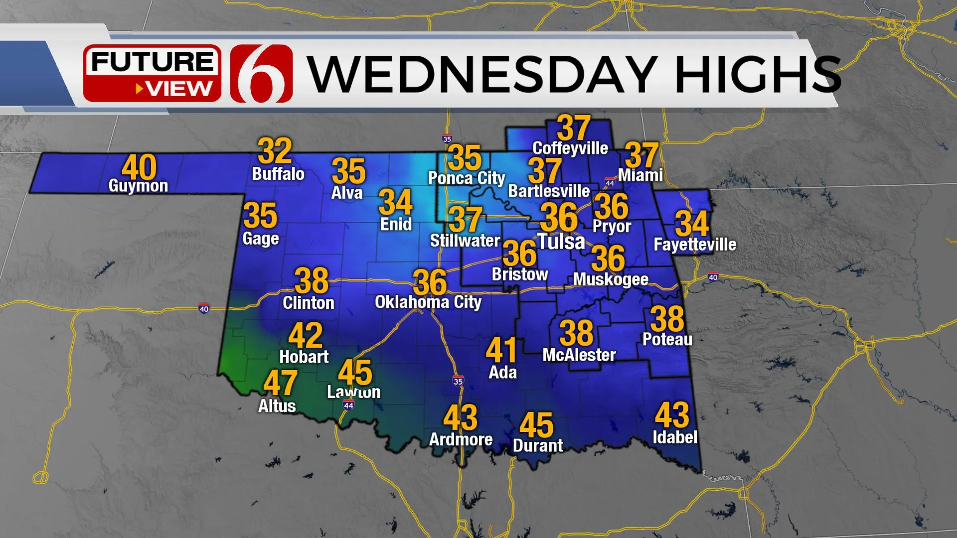
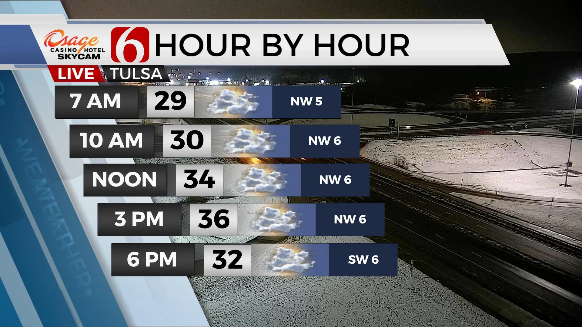
The system that brought the light snow to part but not all of Northeastern OK yesterday is now moving east this morning. We’re in good shape today with mostly to partly cloudy skies along with highs staying in the upper 30s. Our pattern brings one more system near the state late Friday night but this one will not be a wintry weather maker and only has a low chance for a few passing showers. The weekend looks fine for shopping with Saturday's highs in the upper 40s and Sunday in the mid-50s.Wednesday, December 16th 2020, 5:48 am
The system that brought the light snow to part but not all of Northeastern OK yesterday is now moving east this morning. We’re in good shape today with mostly to partly cloudy skies along with highs staying in the upper 30s. Our pattern brings one more system near the state late Friday night but this one will not be a wintry weather maker and only has a low chance for a few passing showers. The weekend looks fine for shopping with Saturday's highs in the upper 40s and Sunday in the mid-50s.

We basically dodged another big system yesterday. The main upper-level low lifted across northeastern OK and begin temporarily opening and weakening while the surface low took a scenic route southwest of the DFW region. This brought some rain and snow mix into the area last night, but the drier air quickly wrapped into the system north and shut down the light snow. Most locations near the metro reported minor snow with no major significant accumulations. NWS Tulsa received 0.20 at the office and Bixby had 0.50 while other locations northwest reported 1 to near 2 inches of fresh show. Of course, the higher totals were expected well west of I-35 and that’s where significant snow occurred from OKC into west-central and northwestern Oklahoma.

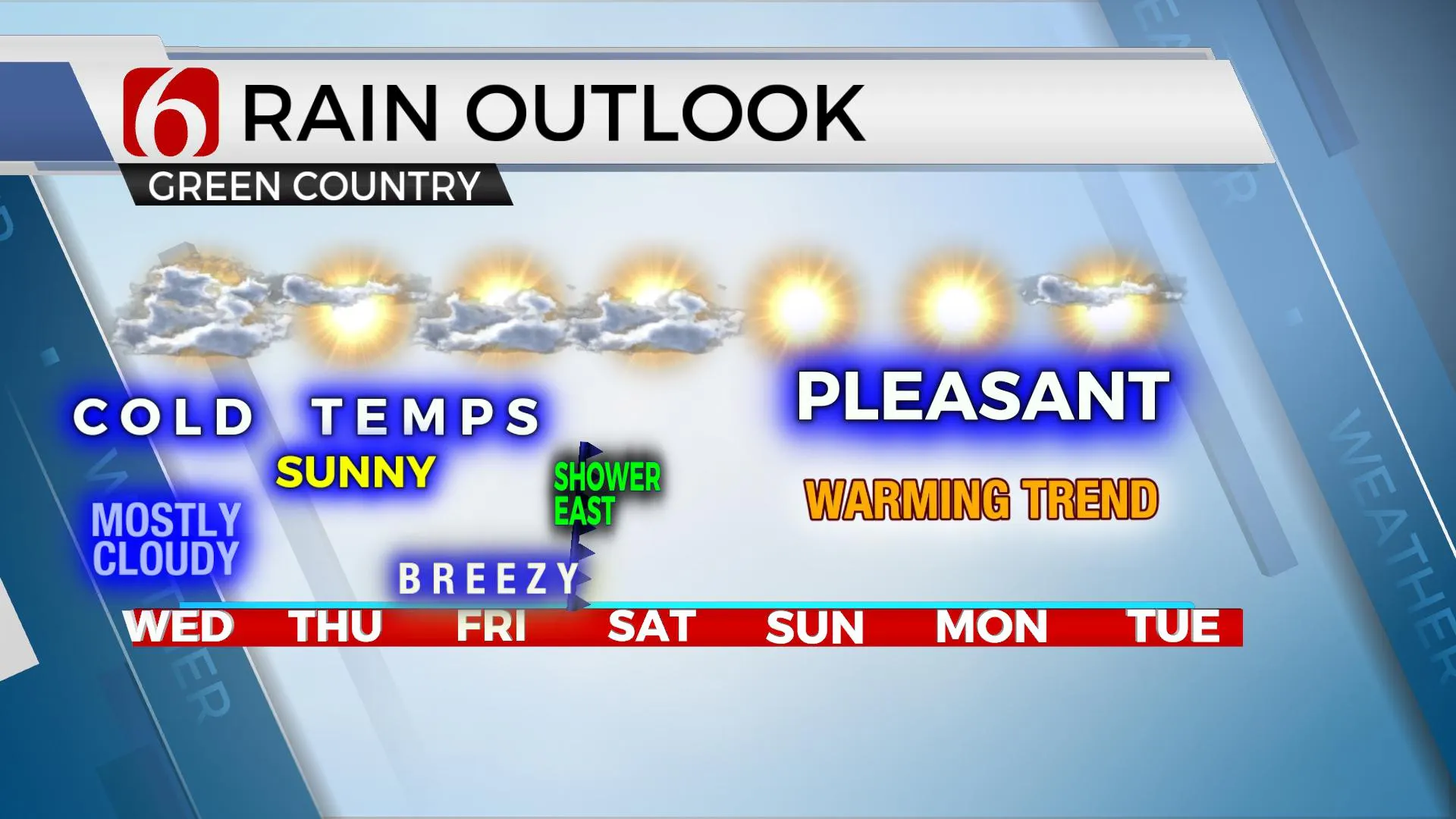
Cold weather remains today and even Thursday, but some minor improvements will be likely Thursday afternoon with highs reaching the upper 40s and lower 50s. The pressure gradient increases quickly Friday ahead of our next system and this means gusty southwest winds from 15 to 30 mph will be likely with highs reaching the mid-50s. The timeline for our next system will mention a few passing showers near or east of the Tulsa metro late Friday night and exiting eastern OK early Saturday morning. Unless this timing changes, there will be no precip impacts for the weekend.

We are tracking another system right before Christmas, but some big differences remain in the various data sets for these periods. The trend is toward colder air. Stay tuned.
Thanks for reading the Wednesday morning weather discussion and blog.
Have a super great day!
Alan Crone
KOTV
Check out my daily, mini-podcast and weather briefing.
Search for NewsOn6 and ‘ Weather Out The Door’ on most providers, including here on Apple podcast.
More Like This
December 16th, 2020
February 14th, 2022
January 26th, 2022
January 25th, 2022
Top Headlines
December 13th, 2024
December 13th, 2024
December 13th, 2024
December 13th, 2024


